Download

1 / 37
370 likes | 500 Views
Correction to Syllabus. My Office Hours: W2-3 & Th2-3 - Ellison 6844 If you’re interested in an honors section, meet here after class to talk about when/where/what. Honors Section. Natural disaster shaved millionths of a second off planet's day

E N D
Correction to Syllabus My Office Hours: W2-3 & Th2-3 - Ellison 6844 If you’re interested in an honors section, meet here after class to talk about when/where/what. Honors Section
Natural disaster shaved millionths of a second off planet's day The Earth has been rocked on its axis.The devastating earthquake that struck the Indian Ocean on 26 December was so powerful that it has accelerated the Earth's rotation, geophysicists have declared. They estimate that the shockwave shortened the period of our planet's rotation by some three microseconds.The change was caused by a shift of mass towards the planet's centre, as the Indian Ocean's heavy tectonic plate lurched underneath Indonesia's one, say researchers at NASA's Jet Propulsion Laboratory in Pasadena, California. This caused the globe to rotate faster, in the same way that a spinning figure-skater accelerates by tucking in her arms. news.nature.com
LONDON (AP) - A British schoolgirl who recognized the signs of a coming tsunami thanks to a recent geography lesson saved her family and some 100 other tourists at a Thai beach. Tilly Smith, 10, realized they were in danger when she saw the tide suddenly rush out -an indication earthquake-driven tidal waves are only minutes away -and told her mother, The Sun said in its Saturday edition. She explained that she had studied tsunamis only two weeks before at her school in Oxshott, just south of London. Her parents, Penny and Colin Smith, warned nearby vacationers and staff at their hotel in Phuket, and the hotel swiftly evacuated Maikhao beach, minutes before the devastating waves struck, the newspaper said. The Sun reported that the beach was one of only a few in Phuket where no one was killed or seriously hurt. Schoolgirl saved family and others by recognizing signs of coming tsunami
So, this course may save your life!!!
Last time - Chapter 1 • latitude, longitude • remote sensing • GIS
Chapter 1: continued Prime meridian and time zones Map projections
Time Zones First, the Earth revolves 360 degrees in one day or 15 degrees for each hour Each time zone (an hour of time!!) would span 15 degrees of longitude, with 7.5 degrees on either side of a central meridian - giving 24 time zones in total for the planet Then, local clock time could track local solar time fairly well
15o long and the time zones and meridians in the US
Greenwich Mean Time (GMT) was world time standard (now called Coordinated Universal Time or UTC) What is the time in California if the UTC is 5pm? Given this time difference, roughly how many degrees of longitude separate CA and the prime meridian (PM)? Given our latitude at UCSB, how many kilometers separate us from the PM? deg-lon(lat) = cos(lat)*deg-lat cos(34.5) = 0.824 deg-lon(34.5) = 0.824*111 km = 91.5 km deg-lat = 111 km distance ~ (91.5 km/deg)* (8 zones)*(15 deg/zone) = 10980 km (this is not a great circle)
Time Travel and the IDL the International Date Line (IDL) roughly follows the 180-degree meridian and officially marks the beginning of each day
Characteristics of Maps Scale Projection
Map Scale scale - the ratio of the area represented on a map to the real area the fraction gives the scale - the larger the second number (the denominator), the smaller the scale size
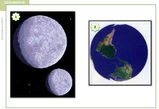
Map Projections a globe is the only faithful representation of the spherical Earth the act of reducing a globe to a flat, 2-D surface is called map projection during this process, distortion always occurs, and the degree of distortion depends on the scale of the projection the classic distortion is area
Mercator Projection Area of Greenland = 0.8 million square miles Area of Africa = 11.6 million square miles http://www.public.asu.edu/~aarios/resourcebank/maps/page10.html
Four (of many) map projections the standard line represents the area where the least distortion occurs
Robinson Projection this is the projection you will see most often in the text - it represents a compromise between equal areal and true shape
you will be exposed to these concepts and learn for yourself how projections work in Lab 1, “Getting a Grip on the Globe” you will also learn about why great circles form the shortest connection between two points on a globe
Chapter 2: Solar energy to earth and the seasons Earth’s orbit around the sun Solar energy: composition and amount reaching Earth Solar insolation and Earth’s radiation budget The reasons for seasons March of the seasons
Scientific Notation (see Appendix C in text) useful for expressing very large or very small numbers Nx10b where (1 <= N < 10) and b is the exponent to which 10 is raised (pos. or neg.) Examples… 35,000,000 = 3.5 x 10⁷ 0.000049 = 4.9 x 10⁻⁵
100,000 light years across First, some galactic geography… light year - the distance light travels in a year speed of light = 300,000 km/sec Milky way is 9.5x10¹⁷ km across
our solar system is 11 light hours wide (12 billion km across)
Earth’s Orbit Around the Sun -elliptical- 152 million km 147 million km aphelion NH summer perihelion SH summer Credit: http://www.physics.uwo.ca/everyday-physics/images/earth-orbit.gif => the southern hemisphere (SH) summer will be slightly more intense than the NH summer
The elliptical orbit varies on 100,000-year time scales this is one of the variations that contributes to glacial and interglacial periods the sun-earth distance varies by 17 million km over this cycle present-day Credit: http://www.env.leeds.ac.uk/envi2150/lecture5/eccentricity.gif
Credit: http://www.plasmas.org isotopes of hydrogen Credit: http://www.harmsy.freeuk.com/images/fusion.gif Solar activity thermonuclear fusion is occurring in the sun’s interior, releasing tremendous amounts of energy the difference in mass is converted to energy which radiated as light
The Sun captured by the extreme ultraviolet telescope on the SOHO satellite Courtesy of SOHO/[instrument] consortium. SOHO is a project of international cooperation between ESA and NASA.
The sun radiates 3.9x1026 W (390 billion billion million watts) which reach the Earth (after 8 minutes & 20 seconds) Earth intercepts only one two-billionths of this output (thankfully) At the top of the atmosphere (480 km up), the solar constant is 1370 W / m2 This relatively small output powers [nearly all] climate & weather dynamics and life on Earth
Electromagnetic Radiation red light frequency is # wavelengths per time green light blue/violet light
Wavelength increasing Frequency increasing Energy increasing electromagnetic spectrum ROY G BIV
all objects radiate energy in wavelengths related to their surface temperatures (the higher the T, the shorter the wavelength) the sun’s surface temperature is 6000 degrees C; Earth’s is about 15 degrees C
note the difference in area to equal the total radiation received < 90 degrees 90 degrees subsolar point = the point on Earth’s surface where the sun is 90 degrees overhead
note the difference in area to equal the total radiation received Relative Intensity = sin(90-latitude) recall that sin(90)=1 sin(45) = 0.71 (or 71% of the intensity when the sun is directly overhead) at the Arctic Circle (66.5 N) intensity = sin(90-66.5) = 0.4
at the Arctic Circle (66.5 N) intensity = sin(90-66.5) = 0.4 1/0.4 = 2.5
northern hemisphere winter would you expect higher summertime values in one of the hemispheres? northern hemisphere summer Credit: http://langley.atmos.colostate.edu/srb/toasw2dc.jpg
Reasons for the Seasons we will take this up on Friday…