Download

1 / 49
490 likes | 699 Views
Draft volcano primer: Mt. Pinatubo and Taal volcanoes, the Philippines. Mt. PINATUBO ERUPTIONS June 1991. Prior to eruption. Fumaroles on flanks, April 1991. June 12th, 1991 eruption. Giant pyroclastic flows, June 15th 1991 form off of collapsing eruption column.

E N D
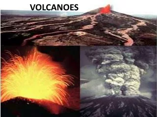
Draft volcano primer:Mt. Pinatubo and Taal volcanoes,the Philippines
Giant pyroclastic flows, June 15th 1991form off of collapsing eruption column
The view from space via theJapanese GMS-5 geostationary satellite
Major landscape changes: Pyroclastic flows in-filled pre-existing river valleys (the peaksin two views below are the same feature)
Summit caldera of Mt. Pinatubo, Nov. 1999.The low-point in the rim is a future hazardas the lake will eventually over-top here.
Sediment fills valley floor downslope on lower E. flank November 1999
Crossing the sediment-laden streams is a real challenge! So much sediment is in these streams that they easily knock you over.
Valley erosion can be extreme in places: Up to 20 m down-cutting during one typhoon! This mosaic shows the remains of the 1991 deposit (white unit) that has been cut by younger flash floods
Vegetation is starting to grow back on westernfan. Summit of Mt. Pinatubo in background
Major changes in valley floor elevation aftersingle lahar has formed after typhoon.
The impact on villages within the path of a lahar can be extreme
While old houses are buried, new homesare built on stilts to try to avoid the next lahar
An old church has been partially-buried sothat you now enter on the 2nd floor. RonnieTorres shows the church prior to the lahars.
Giant dikes made from old lahar and covered withconcrete now try to protect areas from new lahars
The contrast between areas protected by thedikes and unprotected is striking -- and it’sall an issue of insurance for redevelopment!
Some homes, once buried by lahar, andnow being exposed by recent erosion
RADARSAT radar backscatter imageof Mt. Pinatubo, February 1998
Comparison of NW Summitfrom SPOT dataobtained between1991 and 1998Red showsvegetation,the ash depositsare light blue Summit is atlower right
Changes in Mt. Pinatubo lahar deposits. Lower Pasig-Potrero River 1991 - 1996
RADARSATscansar beam 1(50 m/pixel)image of TaalVolcano andsurroundingarea
View of Lake Taal and Volcano Island from north rim, Nov. 1999
Over 4,000 people live without permission on the shores of Volcano Island
In the event of an eruption of Taal, all the population would have to leave Volcano Island via small boats
View of the volcanic lake in middle of Volcano Island (middle of Lake Taal)
In Fall 1999, this vent on Volcano Island was actively geysering.
Close-up viewof recently activevent on VolcanoIsland, in themiddle of Taal Volcano
Even around the rim of Lake Taal, people and their fish farms are at risk from tsunamis generated by eruptions.