Download

1 / 14
140 likes | 274 Views
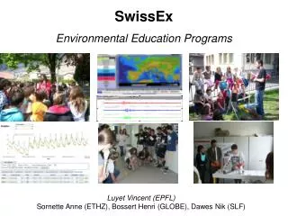
SwissEx WIKI. Motivation for WIKI. re-use of measurements collaborative effort semantics organization of measurements temporal and spatial reference systems. Overview Experiments. Ontolog y experiment set-up maintenance data access, processing & visualization overall coordination.

E N D
Motivation for WIKI • re-use of measurements • collaborative effort • semantics • organization of measurements • temporal and spatial reference systems
Overview Experiments • Ontology • experiment • set-up • maintenance • data access, processing & visualization • overall coordination
Meta Data Management • very different requirements per project • master schema will not work • does not even work in a single organization (SLF) • m eta data usage • important for data re-use and provenance • less important for searching • approach • capturing meta data in WIKI pages using a controlled vocabulary • make relevant parts accessible for search using semantic annotation using a controlled vocabulary
Ontology • sensorML http://vast.nsstc.uah.edu/SensorML/ • Ontology for Geographic Information - Metadata ( ISO 19115:2003 ) http://loki.cae.drexel.edu/%7Ewbs/ontology/iso-19115.htm • Open Geospatial Consortium, “GML – A Markup Language for Geography,” http://opengis.net/gml/ • Ontology for Geography Markup Language (GML3.0) of Open GIS Consortium (OGC) http://loki.cae.drexel.edu/~wbs/ontology/2004/09/ogc-gml.owl • sensor standard harmonization (ANSI N42.42, CAP, DoD CBRN Data Model, EDXL-DE, IEEE 1451.0, IEEE 1512.3-2002, OGC SAS 1.0, OGC SensorML, OGC SWE, OGC WFS 1.1) http://vkwiki.visualknowledge.com/wiki/sensors, http://colab.cim3.net/cgi-bin/wiki.pl?NetReadySensorsWorkshop_2006_08_0203 • sensor ontology of the NASA project http://sweet.jpl.nasa.gov/ontology/sensor.owl • Suggested Upper Merged Ontology (SUMO) http://www.ontologyportal.org/ • AmeriFlux ontology of measurment values http://public.ornl.gov/ameriflux/standards-core.shtml • American Meterological Society Glossary http://amsglossary.allenpress.com/glossary/browse
Ontology • DIN 4049 Part 1-3 (hydrologic terms quantitative, qualitative, ground water) • DIN 19711 Hydrogeologische Characters • ISO 19100 series of geographic information standards • supported by the World Meteorological Organization • main goal • define the basic semantics and structure of geographic information for data management and data interchange purposes, and • define geographic information service components and their behaviour for data processing purposes. • ISO/TC 211 DIS 19115 OpenGIS(tm) Metadata • around 400 elements where around 20 are mandatory • 19115-2 - Metadata - Part 2: Extensions for imagery and gridded data • World Meteorological Organization (WMO) No 182 "International meteorological vocabulary" • http://www.wmo.ch/pages/catalogue/New%20HTML/frame/engfil/182.html • http://doi.wiley.com/10.1002/qj.49709339524 • ISO/IEC 10746:1995 RM_ODP (Reference model for Open Distributed Processing).
Ontology • standards are community specific • SensorMap & SwissEx: interdisciplinary • ontology has to be discussed and decided by environmental scientists • scientists are not used to share data on a larger scale without personal interaction • scientist see the need for a controlled vocabulary in their work, but are busy right now with site selection and instrumentation • scientists are used to report a minimal set of meta data (geographical position, time, author, etc...)
Ontology • approach • definition of a glossary • have to provide information about • instruments being used • measurements done in an experiment using an instrument • position, situation, • maintenance and manual observations of stations • use this vocabulary to steer the ontology discussion • use formatting templates to structure meta data
Ontology / Glossary http://www.swiss-experiment.ch/SwissEx/index.php/Record:Glossary
Experiment set-up • assigning a name to a sensor station • when does a name change? • recording of meta data • using controlled vocabulary • persistence of data • publishing of data • e.g. SensorMap
Experiment maintenance • change over time of senor positions, names • maintenance and exchange of instruments • re-calibration or configuration of instruments
Data access, processing and visualization • find relevant sensors • e.g. based on spatial constraints • select relevant data • more information by environmental engineers • process or visualize derived data • existing code is based on applications (ArcGIS, MatLab) • document processing instructions and results • integrated UI • data provenance?
Overall coordination • tagging • personalized organization of content • calendar • temporal organization • map • spatial organization for knowledge management and project coordination