Download
1 / 107
1.07k likes | 1.09k Views
Learn the art of importing and visualizing arbitrary data in AVS/Express, with in-depth content on data understanding, import methods, visualization techniques, and practical examples. The course covers data classification, reading tables, and working with spatial relationships, providing a comprehensive overview of data manipulation in AVS/Express.

E N D
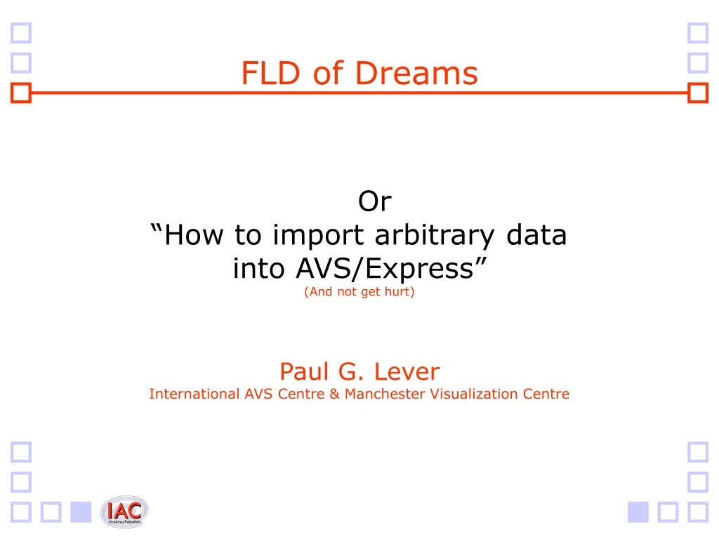
FLD of Dreams Or“How to import arbitrary datainto AVS/Express”(And not get hurt) Paul G. LeverInternational AVS Centre & Manchester Visualization Centre
Introduction • Overview of course • Understanding data • How to import data • What visualization tasks can be applied • Plenty of examples • Exercises to try out and take-away • Q&A Session this afternoon
Overview of Course • Data • What information it contains • What you already know about it • What you need to think about • Get the meta-data • Importing data • Method used depends on data • Picking the right approach • Information required by the “Reader” • How to provide that information
Overview of Course (2) • Working with data • How does AVS/Express manage it • How does it store it internally • What modules can work with your data • What modules can’t • Visualization of data • Using appropriate techniques • Using multiple techniques • Effects of the data and the meta-data
Overview of Course (3) • Content not presented in that order • Will try and introduce new concepts at the same time in the four key areas: • Understanding Data and Meta-Data • Importing Data • Working with Data • Visualizing Data
Data • The dream: • Import your data • Visualize your data • Understand your data • The nightmare: • ASCII, binary; single file, multiple files • Block, interleave; scalar, vector, multivariate • Grids, nodes, cells; 1D, 2D, 3D or 4D • Uniform, rectilinear, (un)structured • Data types; headers; offset, skip, stride • Computational & Coordinate space; extents; labels • Limitations; and more besides….
Data (2) • What is missing? • Understanding of the data • Before importing it • And before visualizing it • If you understand what goes in • You will have a better understanding of: • What comes out • What’s right • And what’s wrong
Data (3) • Knowledge of how to import it • Use the right approach • Provide the right meta-data • Minimum requirements • Support given by the “Reader” tool
Classification • Not all data is the same • Non-spatial data • Simple lists of items • No spatial relationship between items • Visualization techniques: • Bar charts • Histograms • Graphs • Pie Charts • Or spatial relationship not important • May be ignored • Not necessary for visualization task
Classification (2) • Spatial Data • Is a spatial relationship between items • Each item has a location (coordinates) • Within a given coordinate system • E.g., Cartesian or Polar • May have more than one location • E.g., Position in file; array; 3D space • Data may be associated with each location • Location coordinates are also data!
Classification (3) • Spatial Data (2) • Items have a relationship with other items • A connectivity between a set of items • Data may be associated with each relationship • A set of items have data assigned to them as a unit • Items may be in more than one relationship • Items may be organized • An underlying structure • E.g., a grid
Classification (4) • Spatial Data (3) • Organization and Relationships affect: • The coordinates • The data at each coordinate • The connectivity • The data for each connectivity set • More specifically it affects: • The data that has to be provided • What data is implicit because of the given organization and relationships • What data must be explicitly provided because of the given organization and relationships
Tables and Fields • All this can become very complex • The classification could be taken further • E.g., complexity of relational databases • We are interested in AVS/Express • And importing “simpler” data • Not going to look at Database support • More specifically we want to look at: • Reading tables (column data) • Reading fields (of types AVS/Express provides support for)
Tables • Look at some simple column data • Describe it • Look at it, i.e., the contents of the file • Extrapolate what we know about it • Or what we should know about it • Look at the Read_Column_File tool • Examine what it requires • Match our meta-data and its parameters • Think about the visualization tasks • Try some visualization techniques • And see the results
Exercise: Population Data • We have some population data • The description of the data is: • It lists a bunch of towns on the Isle of Wight • And gives the population count for each town • Broken down into counts for males and females • And it includes the total count • The data is given in the file “town.txt”
Exercise: Population Data (2) • Let’s take a look at the data The following figures for the Isle of Wight population are based on the official Government Census conducted in 1991. Area Males Females Total Cowes_Castle 1715 1923 3638 Cowes_Central 1233 1281 2514 Cowes_Medina 1554 1642 3196 Cowes_Northwood 1777 1903 3680 East_Cowes 1901 1996 3897 Newport_Carisbrooke 2475 2689 5164 Newport_Central 814 925 1739 Newport_Mountjoy 1491 1732 3223 Newport_Pan 2067 2323 4390 Newport_Parkhurst 2562 1757 4319 Newport_Wootton_&_Fairlee 2939 3259 6198 Osborne 1394 1600 2994 Ryde_St_Johns 2340 2701 5041 Ryde_St_Helens 1860 2130 3990 Ryde_East 2654 3046 5700 Ryde_Ashey_&_Binstead 2782 2975 5757 Ryde_West 2657 3007 5664 Arreton_&_Newchurch 1728 1812 3540 Bembridge 1628 1939 3567 Brading 970 1107 2077 Brighstone_&_Shorwell 1132 1292 2424 Calbourne_&_Shalfleet 1178 1181 2359 Chale_&_Niton 1316 1449 2765 Freshwater 2438 2829 5267 Gatcombe_&_Godshill 1253 1286 2539 Lake 1997 2408 4405 Sandown 2477 2822 5299 Shanklin_North 1925 2246 4171 Shanklin_South 1831 2053 3884 Totland 1208 1449 2657 Ventnor 2770 3208 5978 Wroxall 801 855 1656 Yarmouth 410 475 885
Exercise: Population Data (3) • What can we extrapolate? • It has two lines at the top that should be ignored as they are not part of the data • It then has a header line • Giving the column titles • They are [Area][Male][Female][Total] • It’s on one line • Each title is separated by a TAB character • Then, on each subsequent line it gives: • A string for the town name • An integer number for the male population • An integer number for the female population • An integer number for the total population
Exercise: Population Data (4) • More yet: • Those entries on each line are too separated by a TAB character • There are <N> lines, meaning <N> towns • Minus one for the header! • Therefore: • Town name is in the 1st column • Male Population is in the 2nd column • Female population is in the 3rd column • And the total is in the 4th column • Hence we have four columns per line!
Exercise: Population Data (5) • The Read_Column_File tool • Standard module in AVS/Express • Drag & Drop into network • Comes with its own User Interface • What does it want from you? • A filename where the data can be found • How many lines should it skip? • Is there a header line it should read? • How many columns (can work it out itself)? • What is in each column (automatic)?
Exercise: Population Data (6) • Matching meta-data to the parameters • It wants filename: “town.txt” • It wants the separator character: “TAB” • It wants number of lines to skip: “2” • Should it read a header line: “YES” (tick) • At this stage it will automatically look at the file and try to work things out for itself • It gets it right! • Should say there a 4 columns and you should be able to examine the settings for each column • It should have set the type for each column correctly
Exercise: Population Data (7) • Visualization Techniques • View as a graph • Use the Annotation and Graphing Kit • Will need to extract the arrays from Read_Column_File • Example network includes this for you to try • Exercise • Very simple: just load the example application • Then set the Read_Column_File settings and press “Read File” • Look at the settings it has automatically derived from examining the data and play with settings to see what happens • Look at the graph generated by the application
Exercise • Exercise 3 in the workbook
Fields • AVS/Express Field Terms • Each item is known as a “Node” • It has a “Coordinate” • All the coordinates together form a “Grid” • Data on that node is known as “Node Data” • A relationship/connectivity is a “Cell” • Data for that cell is “Cell Data” • A collection of cells (of one cell type) is a “Cell Set” • All the Cells Sets together and the Grid constitute a “Mesh”
Field Hierarchy FIELD MESH DATA GRID CELLS NODE_DATA CELL_DATA
Field Hierarchy (2) • Field Definitions • Mesh • “A geometric description that specifies where and how the data is located and organized in space” • Data • “Scalar or vector values defined at specific domain locations” • Mesh Definitions • Grid • “Defines the location of nodes in space” • Cells • “Specify node (grid) connectivity”
Field Hierarchy (3) • Data Definitions • Node_Data • “Data located on the nodes” • Cell_Data • “Data associated with the cells”
Field Types • Grid & Mesh Organization • The “Grid” can be “Unstructured” • A collection of nodes with no obvious pattern • The “Grid” can be “Structured” • The nodes are arrayed in 1D, 2D or 3D grids • The “Mesh” can be “Unstructured” • Collection of of higher-order cells (e.g., triangles) • The “Mesh” can be “Structured” • Nodes are arrayed in 1D, 2D or 3D grids • If the mesh is structured the grid must be too • But if the grid is structured is doesn’t mean that the mesh has to be too
Field Types (2) • Data Organization • Node Data is mapped to the Grid • Data is assigned to the nodes themselves on the provided coordinates • If the Grid is Unstructured, so is the Node Data • If the Grid is Structured, so is the Node Data • Cell Data is mapped to the Mesh • Data is assigned to each defined cell • If the Mesh is Unstructured, Cell Data is assigned to each cell that has been defined • If the Mesh is Structured, Cell Data is assigned to the implicit cells of the grid structure
Field Types (3) • AVS/Express defines four Base Types • Based on the type of “Mesh” • And on the “computational to physical space” mapping that is used • Computational Space • How the nodes (and the data) are organized • Data is computationally N-dimensional array • Coordinate (Physical) Space • The physical space in which the field exists • The dimensionality of the coordinates • 1D (x), 2D (x,y) or 3D (x,y,z) per node
Field Types (4) • The four Base Types are: • Unstructured • Structured: Irregular • Nodes are arrayed as 1D, 2D or 3D grid • There is no alignment of the nodes on the grid • Connectivity is implied as Lines, Quads or Hexahedrons respectively • Structured: Rectilinear • Nodes are arrayed as Irregular • There is some alignment of nodes • Structured: Uniform • Same but with more rigid alignment of nodes
Field Types (5) • Computational to Coordinate Mapping • Unstructured Grid is just a list of nodes • Is technically 1D but there is no connectivity implied • Structured means data is in an array • 1D array has implied connectivity • Each subsequent node is connected to the previous • 2D and 3D arrays have implied connectivity • E.g., an image is a 2D array of pixels • You would not normally treat an image as a 1D list of values as that removes their inherent structure • E.g., a volume is a 3D array of voxels
Field Types (6) • Computational to Coordinate Mapping • Do not have to match • Coordinate space is independent of computational • it is common for computational space to be less than or equal to coordinate space • It is unusual to have 3D computationally arrayed data which is only mapped to a 2D coordinate world for example but it is possible • Example • Latitude and Longitude are 2D coordinates (lat,long) • Mapped to a sphere (exists in a 3D world) requires 3D coordinates (x,y,z) • This is a 2D to 3D mapping
3 6 5 9 11 8 4 2 1 12 7 10 Unstructured Grid Unstructured Grid Just a list of nodes No implicit connectivitybetween the nodes Must be explicitly given
3 6 5 9 11 8 4 2 1 12 7 10 Unstructured Grid & Mesh Unstructured Grid Unstructured Mesh(2 Cell Types: Tri and Quad)
Structured Fields • Unstructured Fields • Have the most complex requirements • Will return to definition later • Structured Fields • Much simpler • Will examine them now • Show how to import those with the AVS “Read Field” tool • Show how to visualize them
25 26 27 28 29 30 19 20 21 22 23 24 13 14 15 16 17 18 7 8 9 10 11 12 1 2 3 4 5 6 2D Computational & Uniform Grid Structured Computational Grid2D: (6 x 5 nodes)The structure implies theconnectivity between the nodes Structured Uniform Grid2D: (6 x 5 nodes) 25 26 27 28 29 30 19 20 21 22 23 24 13 14 15 16 17 18 7 8 9 10 11 12 1 2 3 4 5 6 NB. This computational 2D grid is the samefor all 2D structured Grids & MeshesNB. 3D computational grids continue this in the next plane
2D Uniform Grid & Mesh Uniform (Structured) Mesh2D: (4 x 4 Quads) Uniform (Structured) Grid2D: (5 x 5 nodes) Quadrilateral(2D) Cell NB. Even spacing butmay be different per axis
3D Uniform Grid & Mesh Uniform (Structured) Mesh3D: (4 x 4 x 3 Hex’s) Uniform (Structured) Grid3D: (5 x 5 x 4 nodes) Hexahedral(3D) Cell
Meta-Data for Uniform Field • Uniform Grid & Mesh implies: • All nodes on a grid, uniformly spaced • No missing nodes and no extra nodes • 2D grid must have A x B nodes • 3D grid must have A x B x C nodes • We have N nodes, the product of A and B (and C) • We need N coordinates • 2D connectivity forms a “Quadrilateral Mesh” • 3D connectivity forms a “Hexahedral Mesh” • May be data on each node • May need N data values • May be data for each cell • May need (A-1) x (B-1) x (C-1) data values
Meta-Data for Uniform Field (2) • What information do we need? • What is the computational space? • Need to know if it’s 1D, 2D or 3D arrayed data • What are the array dimensions? • What is the coordinate space? • Need to know if the physical coordinates are positioned in 1D, 2D or 3D space • What are the coordinates? • Need N (product of array dimensions) n-space coordinates
Meta-Data for Uniform Field (3) • What information do we need? • What data do we have? • Need to know if there is Node Data and/or Cell Data • NB. AVS/Express “Read Field” tool does not support Cell Data • How many data components are there? • Are they scalar or vector? • What primitive type are they? • Single- or Double- Precision Floating Point, Integers, Shorts, or Bytes • Any labels or units defined for each data component?
Meta-Data for Uniform Field (4) • Could this be simplified? • Not all the coordinates are needed • There is “uniform” spacing • We know how many grid points there are in each axis, A and B (and C) • We only need to specify two coordinates • Two diagonally opposite coordinates • The minimum and maximum extents coordinates • Both n-D coordinates for the n-D space • All other coordinates can be derived • It is common to not even specify the extents • By default the extents will be set to the array dimensions, e.g, 5 x 5 grid {0,0} to {4,4}
2D Uniform Mesh Simplified {1,1.8} • Meta-Data: • Type: Uniform • Comp: 2D • Dims: [A][B] • Space: 2D • Min = {0,0} • Max = {1,1.8} • Data[A][B] = {…..} B • Derived: • N = A x B • Mesh = “2D Quad” • Coords[A][B][2] = {{0.0,0.0}, {0.2,0.0}, {0.4,0.0}, {0.6,0.0}, {0.8,0.0}, {1.0,0.0}, {0.0,0.3}, {0.2,0.3}, {0.4,0.3}, {0.6,0.3}, …. {1.0, 1.8}} {0,0} A
Uniform Field Data • What data do we have? • How many components? • And are they scalar or vector? • Data must be organized on the same grid as the coordinates • Order of the data must follow the order that the nodes are defined in the computational array • I.e., Node[1] has Data[1]
Read Field Tool • AVS/Express has a Field reader • Meta-Data is given in a FLD file • It is an ASCII header file that defines a field • It has strict requirements about the information or meta-data it needs • Information is given on a line-by-line basis • Each line has a keyword and a value • Some keywords are mandatory • Some are optional • Some are required depending on other keyword values • Some keywords have sub-keywords and values • This description should match your data
Field File Keywords # AVS field file ndim = [1|2|3|…] dim1 = [A] dim2 = [B] nspace = [1|2|3] veclen = [1-N] data = [byte|float|integer] field = [uniform|rectilinear|irregular] {labels = Name Name Name …} {units = Name Name Name …} variable 1 file=[filename] filetype=[binary|ascii] {skip=[?]} \{offset=[?]} {stride=[?]} {variable 2 …} {variable [VECLEN] …} {coord 1 file=[filename] filetype=[binary|ascii] {skip=[?]} \{offset=[?]} {stride=[?]} {coord [NSPACE] …}
Field File Keywords (2) • [] denote where values have to be given • The [] themselves are not required • {} denote optional or dependent keywords • Following list will detail which • \ denotes continuation of line • All keywords, sub-keywords and values must be on a single line • The \ character is for display purposes only and should not be present in the Field File itself • First line mandatory • Comment tells AVS it’s a Field File
Field File Keywords (3) • ndim • Computational Space • Matches the dimensionality of the array • Usually 1,2 or 3 • dim1, dim2 … dimN • Array dimensions • Must be one entry for each Computational Space defined in ndim • nspace • Coordinate Space • The physical space that the coordinates exist in • Usually 1,2 or 3
Field File Keywords (4) • veclen • Number of data elements • This is the total of all elements for all components • E.g., two scalar and a 3 element vector will result in a total of 5 elements • Components, i.e., the two scalar and the one vector component can be extracted later inside AVS/Express • data • The type of the data elements • Can be “float”, “integer”, “double”, “byte” • All data components must be the same type
Field File Keywords (5) • field • Denotes the structure of the field • AVS Field File only supports structured meshes • Can be either “uniform”, “rectilinear” or “irregular” • label • Optional label names for the elements • Must be same number of labels as elements • White-space separates each label • Vector component has a label for each element • E.g., wind_u wind_v wind_w