Download
1 / 41
410 likes | 521 Views
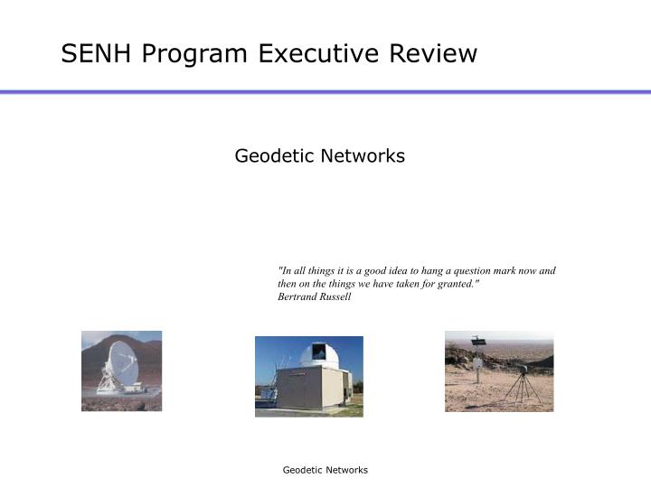
SENH Program Executive Review. Geodetic Networks. "In all things it is a good idea to hang a question mark now and then on the things we have taken for granted." Bertrand Russell. NASA ESE Needs for Geodetic Networks.

E N D
SENH Program Executive Review Geodetic Networks "In all things it is a good idea to hang a question mark now and then on the things we have taken for granted." Bertrand Russell Geodetic Networks
NASA ESE Needs for Geodetic Networks • Long term, systematic measurements of the Earth system require the availability of a terrestrial reference frame (TRF) that is stable over decades and independent of the technology used to define it. • The space geodetic networks are intended to provide the critical infrastructure to develop and maintain the TRF and the needed technology, both terrestrial and space borne, to support the Earth Science Enterprise goals and missions. • This infrastructure is composed of the:- Physical networks,- Technologies that compose them, and- Scientific models and model development that define a TRF. Geodetic Networks
Geodetic Networks: • A stable and accurate Terrestrial Reference Frame (TRF) is required by NASA Earth Science missions, research, and applications. • Geodetic networks • ‘Critical Infrastructure’ for defining the TRF • Fundamental component of all ESE roadmaps • One of SESWG’s seven observation strategies to address the fundamental solid Earth questions. • Maintenance of the global geodetic network, the Terrestrial Reference Frame, and Earth Orientation Parameters is the “supporting framework”: an element of the fully realized solid Earth program. Geodetic Networks
Geodetic Networks: Realization of TRF • TRF is a set of station positions and velocities. • Networks of SLR, VLBI, and GPS ground systems • Techniques have unique yet complementary capabilities. • Techniques are interdependent for TRF definition • Data and products are provided to the research community via international services of the IAG: IGS, ILRS, IVS. • Current consistency and accuracy of space geodetic systems • 1-3 cm positions, mm/yr velocities • 0.1 mas/day pole position • 3 µs UT1 • Sub-nanosecond timing distribution Geodetic Networks
Geodetic Networks: 5-year outcome • TRF realized by coordinated multi-technique networks and analysis • Consistency and accuracy sub-centimeter globally • Vertical component improvement • Consistent and robust access to the improved TRF in real-time for all users • Improvement in network and sub-network distributions and characteristics and efficiencies • Real-time GPS global subnetwork, GNSS, GPS3 • eVLBI • SLR2000 • Analysis development and validation to optimize multi-technique methods • Improved data and product access interfaces • Implement SEEDS philosophies at data and information systems (CDDIS - GSFC/CBIS - JPL) Geodetic Networks
Geodetic Networks: NASA’s role among global collaborators • Networks, though the TRF, provide critical infrastructure to support flight projects • This support is assumed by current and future missions to be there when needed • NASA leverages its resources by cooperating with international partners • NASA supports and coordinates the geodetic services through central offices at JPL (IGS) and GSFC (ILRS&IVS) • This NASA coordination is a highly successful international activity endorsed by international agencies such as the IAG. • And results in access to greater and enhanced data sets and products. Geodetic Networks
Geodetic Networks: Issues and Challenges • Maintaining and upgrading aging equipment and hardware • Transitioning new technology into the definition of the TRF • Developing new analysis techniques to address new requirements and opportunities • Exploiting opportunities in data and analysis • Responding to evolving requirements • Identifying a mechanism by which the support for these vital resources can be shared by all users within NASA Geodetic Networks
TRF System Issues affecting Long Term Availability and Stability Current and pending issues (0-3 years): • Aging equipment • Ownership of the network • Integration of new techniques, e. g. GALILEO • Communications infrastructure • Geophysical model development • International partnering Future issues (2-10 years): • System redundancy • Verification and Validation of TRF stability • Technology independence • Integrated operation of the different techniques • Co-location • Infusion of new technology Geodetic Networks
Geodetic Networks: GPS Geodetic Networks
Geodetic Networks: GPS Stations Map Geodetic Networks
Geodetic Network: GPS Strengths • Low cost • Hardware • Stations operations • Analysis • Dense ground networks • Supports the objectives and goals of many users and agencies • Solid Earth Science ( e. g., NASA, NSF, USGS) • Climate Science (e. g., NASA, NSF, NOAA, USGS) • Flight projects • POD (e. g., TOPEX, Jason, GRACE) • Opportunities for new and novel applications • Ocean reflections • Atmospheric occultations Geodetic Networks
Geodetic Networks: GPS Technology Development TRF realization as a System Ground and flight hardware capabilities with analysis software • Ground stations • Continuous GPS Networks • Receiver tracking technology • Communications • Real-time Internet (RTNT) • Flight segment • Receiver development • Hardware deliveries to flight projects • Analysis • Computational efficiency ~ (Number of stations)3 • Optimal combinations • Modern, low cost/high performance computers Geodetic Networks
NASA’s Global Differential GPS System JPL processing center running IGDG NASA’s global real time network Internet Broadcast Internet Broadcast Revolutionary new capability: decimeter real time positioning, anywhere, anytime Remote user Running IGDG For more info see: http://gipsy.jpl.nasa.gov/igdg Geodetic Networks
Special Value to NASA and Society • Autonomous operations in Earth orbit to enable smart sensor webs and reduce operational costs and communications bandwidth • Prototype GDGPS flight receiver being developed • Precise time transfer for interferometric SAR • Safe operations for NASA missions • RLV navigation payload based on GDGPS • Timely monitoring and • response to natural hazards • NRT sea surface height • Aviation safety and efficiency • Dryden plans to offer GDGPS services on all platforms • Many national security applications • GPS integrity monitoring • GPS enhancements • GPS capabilities to exceed Galileo’s Many commercial applications Geodetic Networks
optional 1553 Interface Board CPU & Memory Board Digital Signal Processing Board Host I/O Board Single Antenna RF Sampler Board, Diplexer & Amp Modules BlackJack is a Software Radio single antenna version (eg, Jason) • software-driven allows • mission-independent hardware • post-launch reconfigurability • mission-specific functionality • software-driven requires • mission-specific configuration & testing Geodetic Networks
Geodetic Networks: IGS Structure Geodetic Networks
Geodetic Networks: GPS Analysis • Geophysical models • Required to maintain TRF • Support mission enabling Precise Orbit Determination • Repeat Orbit Interferometry for InSAR • GRACE • TOPEX, Jason, other LEO’s • Formation Flying • Collateral science support • Solid Earth, such as - SCIGN (NASA, WM Keck, NSF, USGS) - Plate Boundary Observatory (NSF, USGS) - Post Glacial Rebound Studies • Atmospheric occultations Geodetic Networks
Current Missions with BlackJack Receivers CHAMP (Jul 2000) GRACE (Mar 2002) • precise orbit • atmospheric remote sensing • gravity • ionospheric remote sensing • ocean surface reflections • precise orbit • atmospheric remote sensing • gravity • ionospheric remote sensing SAC-C (Nov 2000) FEDSat (Dec 2002) • precise orbit (on-board, real-time) • atmospheric remote sensing • ionospheric remote sensing • ocean surface reflections • precise orbit • ionospheric remote sensing ICESat (Jan 2003) JASON-1 (Dec 2001) • precise orbit • precise orbit LEGEND • solid full functionality • shaded limited functionality Geodetic Networks
Upcoming Missions with BlackJack Receivers C/NOFS (2003) OSTM (2007) • ionospheric remote sensing • precise orbit • precise orbit • atmospheric remote sensing • ionospheric remote sensing PARCS (2009) COSMIC (2005) • precise orbit and time Geodetic Networks
How is the surface of the Earth changing? Geodetic Networks
Geodetic Networks: GPS Issues and Challenges Geodetic Networks
Geodetic Networks: GPS 5-year Plan • New GPS signals • L2C (June 2004) • L5 (June 2005) • New GPS satellites • GPS III (2005) • New GNSS systems • Galileo (2004) • Network hardware • Replace aging and obsolete equipment (2003-2004) • Track new signals and satellites (2004-2007) • Increase number of real-time stations • Upgrade analysis capability to support new signals Geodetic Networks
Transition to SLR slides Geodetic Networks
Geodetic Networks: SLR Unique Capabilities Geodetic Networks
Geodetic Networks: SLR Site Map Geodetic Networks
Geodetic Networks: SLR Current Challenges Geodetic Networks
Geodetic Networks: SLR Next Generation System Geodetic Networks
Geodetic Networks: SLR Products Geodetic Networks
Geodetic Networks: ILRS Structure Geodetic Networks
Transition to VLBI slides Geodetic Networks
Geodetic Networks: VLBI Station Map Geodetic Networks
Geodetic Networks: IVS Structure IVS has 73 Permanent Components, representing 37 institutions in 17 countries. NASA supports the IVS Coordinating Center, Network Coordinator, and 7 Permanent Components Geodetic Networks
Geodetic Networks: VLBI Unique Capabilities • CRF • Celestial pole • UT1-UTC Geodetic Networks
Geodetic Networks: VLBI Issues and Challenges • Temporal coverage only 3.5 days/week • Time delay from data acquisition to products is 15 days • Global configuration lacks southern hemisphere stations • RFI at S/X • Aging antennas • Aging data acquisition equipment • Currently need to ship media (tapes, disks) from stations to correlator Geodetic Networks
Geodetic Networks: VLBI Technology Advances • Mark 5 disk-based recording system (photo) • Less expensive media than magnetic tapes • Greater capacity for higher bandwidth • Enables automated and unattended operation • Allows electronic data transfer and near real time processing • e-VLBI for data transfer (map) • Phase 1: develop e-VLBI compatible data system (Mark 5) • Phase 2: demonstrate Gb/s data transfer. Done on 700 km Westford-GGAO baseline, achieved ~788 Mb/s transfer rate. • Phase 3: demonstrate transfer in global experiments such as the Westford-Kashima (Japan) experiment. • Phase 4: establish new adaptive IP protocol. Tailored to operate in shared-network background mode. Most networks are lightly loaded but have bursty high data requirements. Geodetic Networks
Geodetic Networks: VLBI 5-year Plan • 2004 • Deploy and use Mark 5 at all correlators and stations • Establish e-VLBI for daily UT1 measurements • 2005 • Begin replacement of Fairbanks antenna • Begin development of K/Q receivers • Study K/Q and small antenna options • 2006 • Establish e-VLBI network of NASA stations with international partner stations • Begin replacement of data acquisition hardware with digital interfaces • 2007 • Fairbanks antenna complete • 2008 • e-VLBI networks in use for 3-4 days/week EOP and TRF measurements • Initial K/Q test installations Geodetic Networks
Transition to integration slides Geodetic Networks
Geodetic Networks: Map of NASA Stations Geodetic Networks
Geodetic Networks: Integration Elements • Proposed activities • NGO proposal • National Geodetic Observatory proposed in response to NASA solicitation • Focus US efforts in space geodesy to optimally integrate techniques, attract new funding • INDIGO proposal • Inter-Service Data Integration for Geodetic Operations proposed in response to NASA solicitation • Goal: to enable improved performance, accuracy, and efficiency in support of NASA’s Earth science and international user community by developing and providing uniform access to heterogeneous space geodetic data systems. • International organizations • IERS • International Earth rotation and Reference systems Service. • Compiles and distributes ITRF, ICRF, EOP time series • Pilot project on rigorous combination of data from all techniques • IAG • IGS, ILRS, IVS are all services of IAG, will all contribute to IGGOS: Integrated Global Geodetic Observing System • IGGOS is the flagship project under new IAG structure, is expected to play a major role in geodesy community • Integration of techniques at a very high level Geodetic Networks
Geodetic Networks: Co-location Strategy • Local ties are essential for combination of data from different techniques • Local ties are the limiting factor in closure of the networks • Improvements are needed, due to suspect or discrepant ties at the few cm level at some stations • Best local ties agree at the few mm level Geodetic Networks
Geodetic Networks: Next Steps towards integration • Global networks are NASA ‘critical infrastructure’ and strategic US assets • Cross technique coordination • Appropriate balance of measurements, scientific needs and resources in the mix of VLBI, GPS and SLR • Appropriate balance of resources for scientific research and applications with the demanding requirements of Reference Frame infrastructure • Meeting challenges together for mutual strength • Oriented to the goal of having the most stable and accurate reference frame and tracking capabilities • Assess the structure and budget for the NASA networks and recommend an approach for integration Geodetic Networks