Download
1 / 16
160 likes | 372 Views
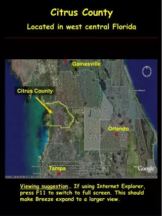
Soils in West Central Florida. Playing in the sandbox. Mary Barnwell SOS 5716 Environmental Pedology April 1, 2010. Watershed Map – Coastal Rivers Basin. Site 2 – Hernando County. Gulf Of Mexico. Site 1 – Pasco County. Physiographic Region. Site 2 – Hernando County. Gulf Of

E N D
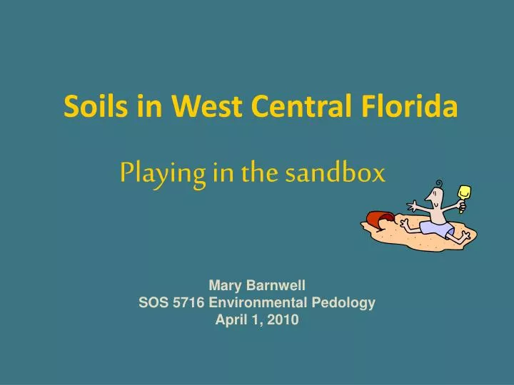
Soils in West Central Florida Playing in the sandbox Mary Barnwell SOS 5716 Environmental Pedology April 1, 2010
Watershed Map – Coastal Rivers Basin Site 2 – Hernando County Gulf Of Mexico Site 1 – Pasco County
Physiographic Region Site 2 – Hernando County Gulf Of Mexico Site 1 – Pasco County
Pasco County Conner Preserve Brooksville Ridge Coastal Rivers Basin Soil Order - Spodosol Spodic Horizon OchricEpipedon Study Site 1
SITE 1 Flat terrain in uplands Elevation 75 feet NVGD Former pine flatwoods Logged, plowed, converted to pasture Also heavily limed prior to 2006
.. . • Adamsville fine sand • Smyrna fine sand • Basinger fine sand depressional • Cassia fine sand, 0-5% slope • 52 Samsula muck
Ap 2.5YR 2.5/1 Sand 4” E1 7.5YR 5/1 Sand 14” E2 10YR 5/2 Sand 24” Bh1 2.5 YR 2.5/1 Sand 28” Bh2 10YR 5/4 Sand 45” Btg 10YR 7/3 Loam Sand >63” SOIL PROPERTIES Infiltration Rate High Available Water Very low Hydraulic Conductivity High SHWT 50 - <100 cm SOIL INTERPRETATIONS Dwellings w/Basements 3 Septic Tank Ab. Fields 3 Local Roads 3 SITE CHARACTERISTICS Position of Site Uplands Parent Material Marine Soil Slope Nearly level Surface Runoff Very slow Erosion Potential Very low
Proximity to Cypress Creek Wellfield Influenced by drawdown of water table Tampa Bay Water – Permitted to withdrawal 90,000,000 mgd
Redoximorphic Features concentrations/depletions Pore linings Gleyed soils - 10YR 7/3 Water table observed at 67 inches
Study Site 2 Hernando County Annutteliga Hammock Northern Gulf Coastal Lowlands Coastal Rivers Basin Soil Order –Entisol Ochric Epipedon
SITE 2 Gently sloping Sandhill Elevation 60 NGDV (USGS 7.5’ Quads) Logged, ATV Disturbance
Candlerfine sand/5-8% slope • 14 Candler fine sand/0-5% slope
Ap 2.5 YR 4/2 Sand 8” E1 10 YR 5/4 Sand 8 – 34” E2 10 YR 6/6 Sand 34 – 48” E3 10 YR 7/4 Sand 48 – 80+” SOIL PROPERTIES Infiltration Rate High Available Water Low Hydraulic Conductivity High SHWT >150 cm SOIL INTERPRETATIONS Dwellings w/Basements 1 Septic Tank Absorption Fields 2 Local Roads 1 SITE CHARACTERISTICS Position of Site Uplands Parent Material Marine Soil Slope Gently sloping Surface Runoff Slow Erosion Potential Low
Lamellae are present at about 70-72 inches and greater. Color 10YR 5/8 (yellowish brown). Bands are 1-4 inches in length and very narrow. This feature is consistent with Candler fine sand (5-8% slope) soil description: “between depths of 72-80+ inches is pale brown fine sand that has lamellae of strong brown loamy sands about 1/16 to 1/8 inch wide and 1-4 inches long.” Soil Survey of Hernando County (1977)
Other Features of Interest • Fossorial Burrowing Animals • Tortoises • Pocket gophers & mice • Snakes • Beetles & Ants Several chunks of charcoal found at about 57 – 63 inches; Legacy of long fire history. Krotovina? • Soil Surface Disturbance Evident • ATV trails and mounding of soils • Turpentining & harvesting