Download
1 / 26
260 likes | 484 Views
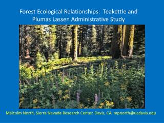
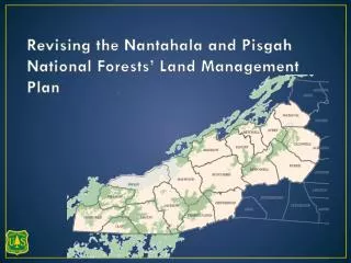
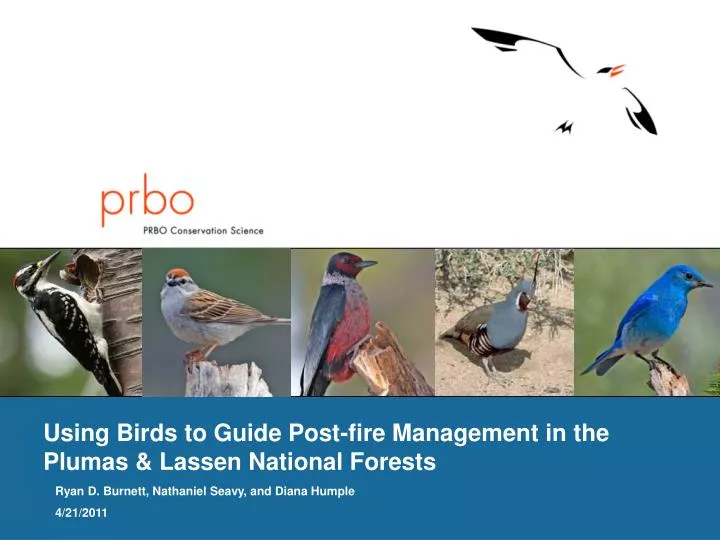
Using Birds to Guide Post-fire Management in the Plumas & Lassen National Forests. Ryan D. Burnett, Nathaniel Seavy, and Diana Humple 4/21/2011. Study Objectives. Assess the influence of post-fire conditions on spatial and temporal variation in landbird populations

E N D
Using Birds to Guide Post-fire Management in the Plumas & Lassen National Forests Ryan D. Burnett, Nathaniel Seavy, and Diana Humple 4/21/2011
Study Objectives • Assess the influence of post-fire conditions on spatial and temporal variation in landbird populations - diversity and abundance of a suite of landbird species - woodpecker cavity use - linking avian metrics with habitat conditions at multiple spatial scales • Inform forest management decisions to promote diverse and resilient forest ecosystems across multiple spatial scales
Fire Age, Size, Patch Size, and Severity Varies Moonlight ~ 66,000 acres Summer 2007 56.5% high severity Cub ~15,000 acres – Summer 2008 12% High Severity Storrie ~”52,000” acres – Fall 2000 28% high severity
Site Selection • Random Stratified sample (public land, slope<40 percent, 1km from road or trail, 1500m between starting points) • Sample size per fire based on accessible area • 17 Storrie Fire Transects (4 private) • 32 Moonlight Fire Transects (6 private) • 13 Cub Fire Transects (0 private)
Sampling Transect Five exact distance point count surveys per transect 2-4 hour cavity nest search of 20ha plot
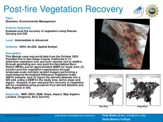
Habitat Surveys • 50m radius vegetation surveys at each point count station • 11.3m radius snag plot at each nest, point count station, and 5 random locations –DBH, decay class, tree species, scorch height, etc. • Classified Severity Using Composite Burn Index Point Count Stations & Random Snag Plot - example
Black-backed Woodpecker Nest Sites = High Snag Densities ~277/ha (111/acre)
Black-backed Woodpecker Use = Very High Snag Densities beyond the micro-nest site Mean Snag Density across 20ha plots with BBWO Nests Mean Snag Density within 11.3m of BBWO nests
Early Successional - Disturbance Dependent Species left out in the rain ← Decrease in Owl Habitat Increase in Owl Habitat → Regression Coefficient
Early Seral & Habitat Mosaics R2=0.21, p<0.0001
Conclusions • Post-fire habitat – including areas that burned at high severity – are an important component of the ecosystem necessary for maintaining biological diversity in the Sierra Nevada • Time since fire & fire severity both appear to influence avian community • Post-fire salvaged areas on private land support significantly less diverse and abundant avian community • Existing snags on the landscape (prior to fire) are important resource for cavity nesting birds the first 3 to 5 years post-fire • Black-backed Woodpecker are nesting in areas with very high snag densities (100 – 300 per acre)
Future Direction • Temporal & spatial effects of fire severity on bird diversity, abundance, and cavity use • Spatially explicit habitat suitability models to help guide future post-fire management • Compare bird assemblages between green forest and post-fire habitat with and without treatments
Bird Response to Commercial DFPZ Harvest • 122 points treated with DFPZs (only) 2005 – 2009 • Lassen and Plumas National Forests • 122 reference points selected using cladogram to determine most appropriate reference for each treated sites
Analysis • Dependent variables: abundance of 15 focal species, total bird abundance, & species richness • Data from 2004-2010 • Generalized linear mixed models (GLMMs) with Poisson distributions • Controlled for random effects (point, year, transect) • Compared: -reference to pre-treatment -year-since-treatment to reference sites -year-since-treatment to pre-treatment sites
Sierra Nevada Avian Monitoring Information Network Four main uses of the website: 1) view project results through ‘packaged’ analyses 2) view study locations and presence/absence on a map 3) download raw data (survey results and locations) 4) Access reports, publications, and other literature
Thank You! Plumas & Lassen National Forests H.F. Quincy Library Group Monitoring Program PSW SNRC – Peter Stine Resources Legacy Fund Field Crew: Paul Taillie, Mel Preston, Tiffany Russell, Brendan McGarry, Jason St. Pierre, Meghan Horne-Brine, Alicia Arcidiacono, Simone Cook, Joe Michael, Doug Zimmerman