Download
1 / 124
1.24k likes | 1.44k Views
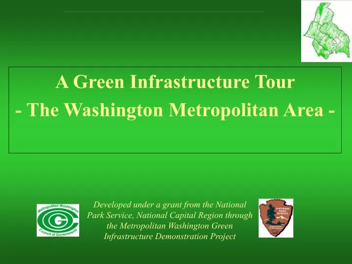
A Green Infrastructure Tour - The Washington Metropolitan Area -. Developed under a grant from the National Park Service, National Capital Region through the Metropolitan Washington Green Infrastructure Demonstration Project.

E N D
A Green Infrastructure Tour- The Washington Metropolitan Area - Developed under a grant from the National Park Service, National Capital Region through the Metropolitan Washington Green Infrastructure Demonstration Project
Purpose – To Provide Visitors and Residents of the Washington Metropolitan Area (WMA) (click to see map) with various examples of existing Best Management Practices (BMP’s) that are helping to sustain our local green infrastructure (e.g., agricultural and forested areas, stream valley parks, green roofs, low impact development techniques, stream valley restoration projects, etc.) and protect and restore our natural resources. TourIntroduction
The Anacostia was selected as the featured watershed because the breadth of related and representative practices present. We have also included two recently completed projects outside this watershed in the District of Columbia and Arlington County, Virginia. In addition to provide greater regional context and representation, we invite other submissions for green infrastructure sites to broaden the scope of this dynamic virtual tour. TourIntroduction – cont.
This tour has been intentionally designed so that all sites (click to see map) may be physically visited via automobile in one day. The sites in the Anacostia watershed are numbered in a logical line of travel via automobile. Alternatively, this presentation provides representative site information for those that may only have time for a virtual regional tour. There are also two other sites that lie outside the Anacostia watershed. These sites may be combined to modify the Anacostia Tour with those sites in the lower Anacostia Watershed in order to maintain a one-day tour. Tour Logistics
Many sites are only accessible via automobile due to their remote locations. However, a few sites are accessible via Metro-Rail. Site accessibility is noted with each destination. When planning to conduct a tour of the sites in this presentation, please be sure to contact the landowners prior to your visit. Tour Logistics – Cont.
The 176 sq-mi. Anacostia River watershed, which encompasses portions of suburban Maryland and the District of Columbia (click to see map) is a green infrastructure microcosm of the larger 3,020 sq-mi Washington Metro Area. Anacostia Watershed Geographic Scope
The Green Infrastructure Demonstration Project is a partnership between the National Park Service and the Metropolitan Washington Council of Governments to move parks, open space and recreation areas to the forefront -- these areas are the green infrastructure of the Metropolitan Washington. Through the use of geographical information; technical forums and workshops; improved communication; and targeted technical assistance, this project has worked to build a lasting public constituency and create a model public and private partnership for parks and open space. The Project’s ultimate goal is to impart a metropolitan region that continually strives to achieve a balance between the built environment and green space, sustained by natural processes and able to support and enhance the quality of life for its people and communities. The Metropolitan Washington Green Infrastructure Demonstration Project
Green Infrastructure is“Green Infrastructure is a network of open space, airsheds, watersheds, woodlands, wildlife habitat, parks, and other natural areas, which provide many vital services that sustain life and enrich quality of life”. President’s Council on Sustainable Development Report - 1999 What is Green Infrastructure?
“I think there’s an opportunity to look at how we regenerate communities and ecologies by looking at green space as a form of infrastructure like roads, water lines, and sewers. When we talk about green infrastructure in the Washington [D.C.] area, we talk about everything from window boxes, to Rock Creek Park and in between: it’s urban gardens, residential landscaping, pocket parks, landscaped portions of a development parcel, linear parks, riparian buffers, street trees, parkways, farms and large parks and reserves.” Green Infrastructure / Gray Infrastructure J. Glenn Eugster, National Park Service - OMG Open Space Roundtable -Philadelphia, 2001
Green Infrastructure Tour Sites: Visit The Anacostia Watershed (next slide) Visit The Arlington County Government Center Visit The National Park Service Center for Urban Ecology
Address: 2000 Half Street, SW Washington, DC 20024 Phone: 202-479-6710 Fax: 202-479-9509 Email: info@ecc1 Ground Transportation Recommended Metro Rail Stop: Navy Yard (8 block walk) Tour Stop No. 1Earth Conservation CorpsMatthew Henson Earth Conservation Center
Green roofs are an alternative to traditional asphalt-based roofs constructed of waterproofing, soil and plants. They are an innovative stormwater management solution especially in intensely developed urban areas where open land is scarce. Green roofs have been used extensively in Europe for many years to improve water and air quality, mitigate the urban heat island effect, and improve the energy performance of buildings. Green Roofs
Green Roof Green Kiosk Rain Garden Site Features
Green Roof Looking north toward the Anacostia River and the Whitney Young Bridge
Green Roof Looking south toward the Matthew Henson second floor meeting room
Green Roof Multi-level green roof area
Green Roof Close up view of Sedum sp. and other plant materials
Green Roofed Kiosk View of Kiosk at ECC withminiature greenroof
Rain Garden Recently constructed rain garden immediately following a 0.5 inch rain fall event
Address: Anacostia Ave. & Douglas St., N.E.Washington, D.C. 20019 Phone: 202-426-6905 Ground Transportation Recommended Metro Rail Stop: Closest is Minnesota Ave (several blocks) Tour Stop No. 2 National Park Service Kenilworth Park and Aquatic Gardens/Marsh
Historic Aquatic Gardens (dating from the 1860’s) 32-acre freshwater tidal river marsh restoration project (constructed 1993) River trail and boardwalk (constructed 2002) Interpretative signage Site Features
Aquatic Gardens Looking west from visitor’s center
KenilworthMarsh Restoration 1993 At the time of its completion, this 32 acre tidal-fresh water restoration project was the largest of its kind in the U.S. It involved the raising of the marsh bed elevations through the addition of approximately 130,000 cubic yards of clean Anacostia River dredge spoilmaterial and the planting of 300,000 native emergent aquatic plants Project partners included: National Park Service, U.S. Army Corps of Engineers, the District of Columbia and COG
Kenilworth Marsh – Before Restoration Kenilworth Marsh mud flats pre-restoration (circa 1989) Anacostia River in foreground
Kenilworth Marsh – Before Restoration Marsh at low tide Close up of extensive mud flat area where pre-restoration water depths were generally too deep to support emergent aquatic plants
Kenilworth Marsh - After Restoration Tidal gut at low tide
Kenilworth Marsh - After Restoration Tidal gut at high tide
Address: 555 Crescent Road Greenbelt, Md. 20770 Phone: City of Greenbelt: 301-474-8000 Buddy Attick Lake Park: 301- 397-2200 Ground Transportation Recommended Tour Stop No. 3City of Greenbelt /Buddy Attick Lake Park
Historic Green Town with planned wooded open space areas and trail systems Greenbelt Museum (fully restored and furnished 1930’s house) 23-acre Greenbelt Lake and recreation area Site Features
Background/History of City of Greenbelt • Greenbelt is one of three "green towns" built during President Franklin D. Roosevelt's Administration (The other two being Greenhills, OH and Greendale, WI). The primary purpose of these projects was to provide employment during the Great Depression, the green towns were innovative planned communities, designed to provide economical housing in a pleasant, healthy surrounding. • In 1935, the U.S. Government assembled parcels of overworked farmland to become the site of a new community to be called Greenbelt. Groundbreaking was in October 1935 and the first residents arrived two years later. The government created a community of mixed housing types, a school, town center with shops and theater, underpasses, walkways, parks, playgrounds, swimming pool, and a 23 acre lake. • For additional information see: http://www.ci.greenbelt.md.us/About_Greenbelt/history.htm
Planned Green Space Typical community open space area
Address: National Visitor Center Building 302 (Log Lodge)Powder Mill RoadBeltsville, Maryland 20705 Phone: 301-504-9403 Scheduled Tours Available (301-504-8483) Ground Transportation Recommended Tour Stop No. 4U.S. Department of Agriculture Beltsville Agricultural Research Center (BARC)
Largest remaining green space in the Anacostia Watershed (7,200 acres) Working research farm National Visitor Center Site Features
The 7,200-acre Beltsville Agricultural Research Center is the largest and most prominent of USDA’s Agricultural Research Services 100-plus sites. It is a dynamic, highly diversified research facility featuring large expanses of forest and farm fields. The facility’s origins date back to livestock experiments in 1910. At its maximum size during the 1940’s, the facility encompassed over 14,000 acres of land. A trip to the ARS Visitor Center will provide guests a broad picture of agricultural research in America, as well as a glimpse back at the Washington Metro Area’s agricultural roots. Background
Aerial Photo of BARC, 2000 Visitor Center (Log Lodge) BARC property is outlined in red
National Visitor’s Center1930’s Civilian Conservation Corps (CCC)Log Cabin Building
Address: 13950 Old Gunpowder Rd Laurel, Maryland 20707 Phone: 301-504-9595 www.pgparks.com/places/parks/fairland.html Ground Transportation Recommended Tour Stop No. 5 M-NCPPC Fairland Regional Park- Fairland Sports and Aquatics Complex
Stormwater management demonstration area featuring parking lot sand filter, artificial wetlands, infiltration trench, grass swale and check dam system, and stormwater management wet pond Stormwater management pavilion and self-guided walking tour with interpretive signage Multi-recreational facilities including aquatic swim center, open and covered tennis courts, baseball and soccer fields and a hiker-biker trail system Site Features
150 acre regional park (Prince George’s County, Maryland portion) Stormwater management pavilion and best management practices (BMP’s) demonstration area. Constructed in 1994 in partnership with Maryland Department of the Environment as a BMP demonstration site for both the public and building industry BMP demonstration area features parking lot sand filter, artificial wetlands, infiltration trench, grass swale and check dam system, and stormwater management wet pond Background