Download
1 / 37
370 likes | 670 Views
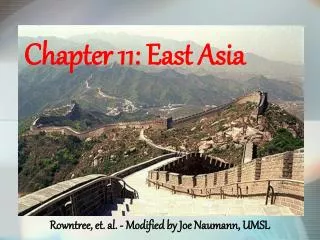
Chp 24: Physical Geography of South Asia. Landforms and Resources. South Asia = subcontinent Peninsulas surrounded by mountains and oceans ½ the size of the U.S. More than 1 billion inhabitants. Take Five…. Look at the graphic on pg 551. How do scientists believe the Himalayas were formed?.

E N D
Landforms and Resources • South Asia = subcontinent • Peninsulas surrounded by mountains and oceans • ½ the size of the U.S. • More than 1 billion inhabitants
Take Five… • Look at the graphic on pg 551. • How do scientists believe the Himalayas were formed?
Mountains and Plateaus • Himalayas are located in 5 countries: India, Pakistan, Bangladesh, Bhutan, Nepal • Serve as a natural barrier between South Asia and the rest of Asia
Wally Points… • How many people have successfully climbed Mt. Everest? • How old was the oldest person to successfully climb the mountain? • How young was the youngest person to successfully climb the mountain? • How many corpses remain on the mountain?
Answers… • How many people have successfully climbed Mt. Everest? At the end of the 2004 climbing season, 1,400 different climbers from twenty different countries had completed a total of over 2,000 climbs. • How old was the oldest person to successfully climb the mountain? Yuichiro Miura age 70 • How young was the youngest person to successfully climb the mountain? Temba Tsheri 15 • How many corpses remain on the mountain? To date, 189 people have died trying to reach the summit, which sets the fatality rate at around nine percent. Most of these fatalities happened before 1990. In the last ten years, advances in climbing equipment and more experienced guides have resulted in a steep drop in fatality statistics: from 37% in 1990 to 4.4% in 2004.
Mountain ranges as natural barriers • Hindu Kush—west of the Himalayas cut off Pakistan from Afghanistan • Khyber Pass
Rivers, Deltas & Plains • Indus, Ganges & Brahmaputra Rivers • Meet and form one large delta before Bay of Bengal • Provide irrigation for agriculture • Carry alluvial soil to alluvial plains (deposits of fertile soil) • Indo-Gangetic Plain one of most fertile region in the world • 3/5’s population of South Asia located here
Offshore Islands • Sri Lanka • Teardrop island in the Indian Ocean • The Maldives • Archipelago—island group of 1,200 islands • Atoll—tops of submerged volcanoes • Only 200 of the islands are inhabitable • 115 square miles
Take Five… • Complete the Skill Builder questions on pg 554
Natural Resources • Water resources • Alluvial plains (for fertile agriculture) • Irrigation for agriculture • Hydroelectricity • Transportation and trade • Fishing • Timber • Rainforests—teak, sal, bamboo & sandalwood • Highlands & Nepal—pine, fir etc • Deforestation & soil erosion are problems • Minerals • Coal production (India=4th largest in the world) • Natural gas production—India, Pakistan & Bangladesh • Uranium, mica, diamonds & iron-ore—India • Diamonds & other precious gemstones—Sri Lanka
Take Five… • Complete the Skill Builder questions on pg 557
Sec 2: Climate and Vegetation • 6 main climate zones (see skill builder map) • Tropical wet • Tropical wet/dry • Desert—only 10 inches per year ave. • Semiarid—high temps & light rainfall • Humid subtropical • Highland—coldest climate
Monsoons • Seasonal winds • Oct-Feb dry winds from northeast • June-Sept moist winds from southeast • Provides rainfall for region • Unpredictable • Flooding or drought…
Cyclones • Hurricanes/tornadoes—devastating storms with heavy rains and winds • Bangladesh most prone to cyclones
Vegetation of South Asia • Lush Rainforest of Bangladesh • Deserts like Thar Desert with little vegetation
Sec 3: Human-Environment Interaction • The significance of the Ganges River • Hinduism religious rituals • Drinking water • Effects of pollution • Raw sewage • Industrial waste • Corpses of animals & humans • Plethora of bacteria • Illness, disease and death
Take Five… • Complete the Skill Builder question on pg 561
The process of building a dam • Employing a Dutch engineering firm • Unskilled labor force of Bangladesh • Bamboo mats to prevent erosion • Boulders to weight down the mats • Clay filled bags on top of the boulders • Feb. 28, 1985—filling in the closure (completing the dam)—low tide • 600,000 bags followed by clay to 30 ft then concrete, brick with a road built over the top