Download
1 / 33
330 likes | 416 Views
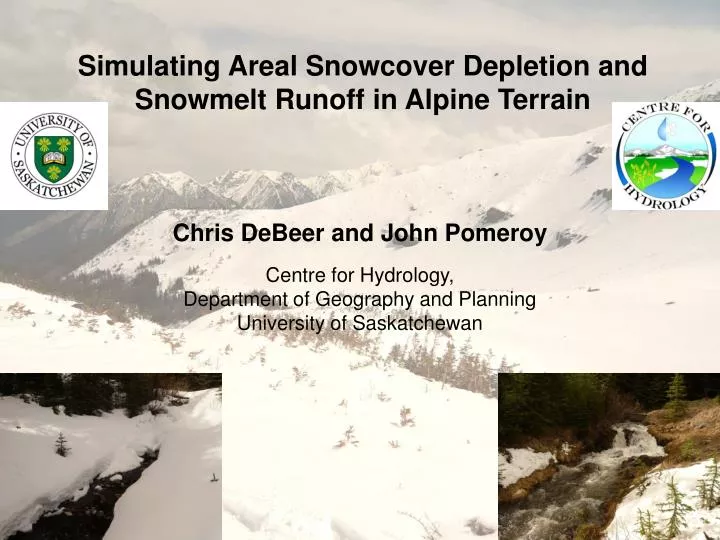
Simulating Areal Snowcover Depletion and Snowmelt Runoff in Alpine Terrain. Chris DeBeer and John Pomeroy Centre for Hydrology, Department of Geography and Planning University of Saskatchewan. Background. Snowmelt runoff from Rocky Mountains is an important water resource

E N D
Simulating Areal Snowcover Depletion and Snowmelt Runoff in Alpine Terrain Chris DeBeer and John PomeroyCentre for Hydrology,Department of Geography and Planning University of Saskatchewan
Background • Snowmelt runoff from Rocky Mountains is an important water resource • High uncertainty in the future hydrological response to climate and/or landcover change • Important to be able to better understand and predict likely changes for future water management • Requires robust and physically based models for simulating snow processes
Variability of Alpine Snow Processes • Complexities in terrain and vegetation affect snow accumulation, redistribution, and melt • High spatial variability in snow water equivalent (SWE) • Large variation in energy for snowmelt during the spring • Leads to a patchy snowcover as the spring progresses • Significantly affects timing, rate, and magnitude of meltwater generation
Areal Snowcover Depletion (SCD) • Melt rate computations applied to a distribution of SWE yield snowcovered area (SCA) over time (SCD curve) Frequency distribution of SWE Derived SCD curve SCA = 0.92 Ma 100 mm Ma 100 mm SCA = 0.45 Ma 200 mm Ma 200 mm Ma 350 mm Ma 350 mm SCA = 0.05
Problems with SCD Approach in Alpine Terrain The approach assumes uniform melt rate over the SWE distribution Energy balance melt rate computations depend on snowpack state (e.g. depth, density, SWE, temperature, etc.) Melt rates are not uniform in alpine terrain Further problems with new snowfall part way through melt
Study Objectives Develop new theoretical framework for areal snowcover depletion (SCD) and meltwater generation Test framework using observations in alpine basin Determine how variability of SWE and snowmelt energy affect areal SCD and meltwater generation Incorporate framework within hydrological model and examine influence of variability on hydrograph
Development of Theoretical Framework • Framework for areal SCD based on lognormal distribution SCD curve from uniform 30 mm/day applied snowmelt
Development of Theoretical Framework • Framework handles other important aspects of spatial snowmelt and new snowfall during spring Line representing the distribution can be discretized Initial distribution New snow added uniformly over remaining distribution Melt depth for 100 mm initial SWE Following melt 200 SWE (mm) 150 Melt depth for 50 mm initial SWE 100 1 3 2 Snowmelt 50 SWE Foot Kmin, iKmin, ii 0 Subsequent accumulation Frequency factor, K Kmin, 1Kmin, 2 0
Field Study Site • Marmot Creek Research Basin, Kananaskis Country, Alberta
Field Study Site • Focused data collection at Fisera Ridge and Upper Middle Creek Mt. Allan Fisera Ridge
Field Methods and Observations • Data collection over three years (2007-09) involved: • Meteorological observation • Snow surveys • Daily terrestrial photos • Lidar snowcover mapping • Streamflow measurement North Facing Station Ridgetop Station Southeast Facing Station
Field Methods and Observations • 100’s of snow surveys over 3 years • Setup and maintenance of many instruments and met stations • Dozen’s of manual stream discharge measurements
Terrestrial Oblique Photo Correction 1) Viewshed mask created from camera perspective 2) DEM projection in camera coordinate system 3) Correspondence established between DEM cells and image pixels 4) Image reprojection in DEM coordinates 1 4 2 & 3
Areal Snowcover Observations Time lapse digital photography used to monitor areal SCD May 10, 2007 May 14, 2007 May 17, 2007 May 19, 2007 May 22, 2007 May 26, 2007 May 29, 2007 May 31, 2007 June 2, 2007 June 7, 2007 June 10, 2007 June 13, 2007 June 18, 2007 June 21, 2007 June 24, 2007 June 27, 2007 July 1, 2007 July 4, 2007 July 9, 2007 July 13, 2007 June 4, 2007 May 7, 2007
Snowmelt Modelling and Validation • Snowpack evolution simulated using the Snobal energy balance model within Cold Regions Hydrological Model (CRHM) platform • Shortwave and longwave radiation inputs corrected for slope, aspect, skyview fraction using algorithms in CRHM • (Qm = LVE + H - K↑ + K↓ + L↓ - L↑ + G - dU/dt) LvE H K↑ K↓ L↓ L↑ P E Active layer U U Lower layer G R Soil layer
Snowmelt Modelling and Validation • Model performs well for depth, SWE, internal energy 2008 2009
Effects of Snow Mass and Internal Energy • Differences in initial state have large influence on computation of snowmelt timing and rate Cold Content: Energy required to bring snowpack to 0 °C and satisfy liquid water holding capacity
Spatial – Temporal Snowmelt Variability SE-facing slope • Differences in melt energy and SWE lead to large differences in snowmelt that change over time N-facing slope
Landscape Disaggregation for SCD Simulation S-facing slope • SWE values on different slopes fit theoretical lognormal distribution N-facing slope
Simulation of Areal SCD over Landscape Overall basin • Framework applied to predict areal SCD • Results were improved by considering separate distributions and melt rates on each slope North facing South facing East facing NS = 0.92 RMSE = 0.09
Influence of “Inhomogeneous” Snowmelt • Earlier and more rapid melt of shallow snow on some slopes led to an initial acceleration of SCD
Spatial Variability of Meltwater Generation • Variability in melt over landscape and SWE dist’s. affects location, extent, and timing of meltwater generating area April 26 April 29 May 5 May 2 0 – 5 mm/day 5 – 10 mm/day 10 – 20 mm/day exposed ground forested areas cliffs
Hydrological Model Development • Process-based and conceptual model with spatial structure based on topography, land cover, and SWE distributions
Model Evaluation for Snowmelt Hydrograph • Model is capable of producing reasonable hydrographs with correct volume of runoff Total Discharge Component Hydrographs
Hydrograph Sensitivity Analysis • Various simulation approaches were used to examine influence on the basin hydrograph NS = 0.62 RMSE = 0.03 NS = 0.53 RMSE = 0.03 NS = 0.39 RMSE = 0.04 NS = 0.23 RMSE = 0.04
Hydrograph Sensitivity Analysis • Other approaches were used to examine effects of forest canopy and soil depth, and inhomogeneous melt NS = -0.28 RMSE = 0.06 Homogeneous Inhomogeneous NS = 0.47 RMSE = 0.04 NS = 0.62 RMSE = 0.03
Key Conclusions, Significance • Novel framework that allows for physical, yet spatially simple snowmelt and SCD simulation • Incorporation of sub-grid distributions of internal energy for melt computation • Application of the framework, together with a hydrological model showed the influence of the spatial variability of both SWE and snowmelt energy on areal SCD and snowmelt runoff in an alpine environment
Important to take inhomogeneous melt into account for areal SCD simulations Implications for remote sensing, climate models and modelling applications using depletion curves Effects are not as important for snowmelt runoff and hydrograph simulation, as other processes tend to overwhelm the response Still important to account for spatial variability of snowmelt energy on the slope, and land cover scale Key Conclusions, Significance
Thank You • NSERC • CFCAS • Canada Research Chairs Programme • University of Calgary Biogeosciences Institute • Nakiska Ski Resort • Applied Geomatics Research Group • Students and Staff of Centre for Hydrology