Download
1 / 17
170 likes | 331 Views
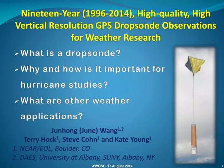
Nineteen-Year (1996-2014), High-quality, High Vertical Resolution GPS Dropsonde Observations for Weather Research. What is a dropsonde? Why and how is it important for hurricane studies? What are other weather applications?. Junhong (June) Wang 1,2

E N D
Nineteen-Year (1996-2014), High-quality, High Vertical Resolution GPS Dropsonde Observations for Weather Research • What is a dropsonde? • Why and how is it important for hurricane studies? • What are other weather applications? Junhong (June) Wang1,2 Terry Hock1, Steve Cohn1 and Kate Young1 1. NCAR/EOL, Boulder, CO 2. DAES, University at Albany, SUNY, Albany, NY WWOSC, 17 August 2014
What is a dropsonde? Complete end to end solution • Precision Atmospheric Profiling • Research quality sensors for pressure, temperature, humidity and winds • From surface to the stratosphere • Over remote areas • Fast sample rate- high vertical resolution • Capability of rapid launch, up to 8 sondes in the air simultaneously. • Multiple Launch Platforms Dropsondes ASPEN Software Data Quality and Temp Drop message Automatic launcher Data Systems WWOSC, 17 August 2014
Multiple Platforms & Capabilites Radiosonde Driftsonde: Long duration Balloon based Full automated Global Hawk: Automated High altitude Large sonde capacity Remotely controlled G-5 C-130 Aircraft: ~21 research aircrafts ~3000 dropsondes/year Operational & research Targeted observations P-3 WWOSC, 17 August 2014
Global Operations & Longer Duration 1990-2012: 41 Field projects >8000 soundings T-PARC: 2008 DLR-Falcon DOTSTAR Driftsonde NRL-P3 AF-C130 Concordiasi (2010) Pre-Concordiasi (2010) WWOSC, 17 August 2014
Hurricane and Dropsonde Hurricane Observations: Satellites Ships and Buoys Land-based Observations Aircraft Reconnaissance Eyewall drops WC-130/WP-3D 10,000 feet Synoptic Surveillance G-IV: 45,000 feet WWOSC, 17 August 2014
Hurricane Reconnaissance Dropsondes From 1996-2012, > 22,000 dropsondes dropped into hurricanes for 125 storms. 1998 1996/1997 1999 2000 2001 2003 2004 2002 2008 2007 2006 2005 2010 2012 2010 2009 Wang et al. (2014, BAMS)
Why do we need dropsondes? Upper-level cloud winds • The air currents surrounding the hurricane eyewall determine the storm motion. • Information throughout the depth of the troposphere is required to specify the environmental flow. Water vapor winds Lower-level cloud winds Scatterometer winds WWOSC, 17 August 2014 Courtesy of James Franklin
UKMET MODEL WITH SONDES WITHOUT SONDES Final track James Franklin Courtesy Julian Heming, UKMO
Composite wind profiles (2,300 P3) • Significant shear in BL • Low-level wind maxima in 500-1000 m and linear increase with storm categories • Significant weakening above 3-4 km & secondary maxima at ~ 4 km in Cat. 3 & 4 4 3 5 2 1 Jeff Halverson
HS3: Leslie’s outflow 15 Global Hawk: Outflow Satellite 10 Height (km) Air Force WC-130J: 5 Radar SFMR Model 0 300 600 100 radius (nm) Courtesy of Pete Black WWOSC, 17 August 2014
Other Applications Severe weather forecasting and research (winter storm, typhoon, …) Atmospheric research Improving numerical weather prediction Calibration and validation of satellite-based and airborne techniques WWOSC, 17 August 2014
Driftsonde Concept Large Zero-pressure or Super-pressure Balloon, aloft for days to months Iridium Satellite Gondola capacity of 54 dropsondes Float altitude ~18 to 30 km Driftsonde Gondola • Sonde measures • Pressure • Temperature • Relative humidity • Wind Ground station for communication and control (web based remote operation) Sondes dropped on command or a pre-programmed schedule • Cost-effective dropsonde observations to fill critical gaps in coverage over oceanic and remote regions over days to months
Concordiasi(Antarctica, Sept.-Nov. 2010) To combine innovative measurements and modeling components for a better analysis and prediction of weather over Antarctica. Total 13 flights (43-94 days) Total 648 soundings Flight level altitude: 14-18 km Surface elevation: 0-4 km
MSD11: 10/19-12/29/2010 Gravity Waves Surface-based Inversion Complicated, variable T structures Elevation changes
Impact per Observation NWP Verification and Assimilation T diff. near surface (Dropsonde - Model) Courtesy of Rolf Langlund (NRL) Courtesy of F. Rabier WWOSC, 17 August 2014
Summary NCAR GPS dropsonde provides measurements of atmospheric profiles from the stratosphere to the surface over remote areas with high accuracy and high vertical resolution. Since its debut in 1997, the dropsonde has served both the operational and research community. It improved the hurricane forecasting, played important role in various science discovery and had huge society benefits. Latest developments in Global-Hawk dropsonde, GV dropsonde and driftsonde system extend its vertical dimension to the UT/LS regions, lengthen its deployment duration and increase its spatial coverage, and thus expand to new scientific areas. WWOSC, 17 August 2014