Download
1 / 13
130 likes | 199 Views
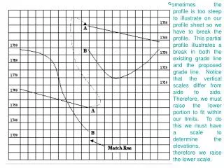
This tool allows you to label points as Hills, Valleys, and Streams on a topographic map, and determine their elevations. Input specific point numbers, and the tool will provide the elevation data you need. Enhance your mapping skills with this convenient labeling feature.

E N D