Download
1 / 13
130 likes | 253 Views
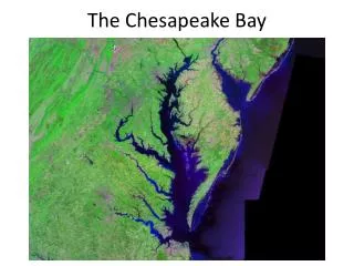
The Chesapeake Commons. What is the Chesapeake Commons. A ground-breaking data tool that allows users to store, map, publish, and share any type of information pertaining to the Chesapeake Bay. Centralized Database that is used to locate reliable peer-rated datasets.

E N D
What is the Chesapeake Commons • A ground-breaking data tool that allows users to store, map, publish, and share any type of information pertaining to the Chesapeake Bay. • Centralized Database that is used to locate reliable peer-rated datasets. • Data can be searched by geography, keyword, source, ratings, latest additions, and more. • Policy Makers with limited GIS background can: create dynamic maps and make data tell a locally relevant story. • Chesapeake Commons is a system that thrives based on YOUR participation.
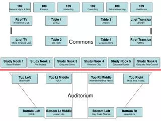
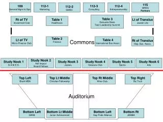
Current System Status • 43 data sets available for mapping and download. • 34 live snapshots. • 44 registered users. • With current data available three system uses have already been developed. • Smart phone data collection app is in final phase of testing. • We have entered into the soft release phase.
System Uses: Conservation Targeting • Track and inventory ecological assets in the Chesapeake Bay. • Isolate high value corridors and their composite risk of development. • Prioritize which corridors are a “code red” for conservation. • Over 20 attributes can be visualized from this single data set! Click Picture for live map.
System Uses: Erosion Targeting • Soil Type and Erosion Dataset: Delineates all soil types in the Chesapeake Bay Watershed. • Provides information on soil content (sand, silt, and clay). • Easily demonstrates areas susceptible to erosion via Kf values. • Example Use: Soils exhibiting high erosion potential=potentially bad location for conservation tillage. Click Picture for live map.
System Use: Crucial Nutrient Reduction Targeting and Need for BMP Locations • Nutrient Effectiveness Model is available on a HUC 8 and County Level. • Model indicates where nutrients have the greatest impact upon delivery to the Bay. • Users can target high priority areas with need for BMPs. Click Picture for live map.
Who Can Use the System? • Any one who registers! • Currently there are registered users from non profits, government (CBP), and local stake holders. • NFWF Data Collection Form: interactive form feature that is a living data set. • Soon to be launched smart phone app! Click Picture for live form.
System Training Status • In order to grow the Chesapeake Commons and its number of users, full system trainings are available and must continue. • Burke Environmental Associates, Waterkeeper Alliance, and the Heinz Center have received a system training. • System trainings are being scheduled with the Chesapeake Bay Program Modeling group and Chesapeake Stat.
Soft release Progress • Government training and presentations are being scheduled. • Targeting Chesapeake Bay Program and state agencies for a full letter of endorsement. • Building on the number data sets and users within the Chesapeake Commons. • Final quality assurance checks will continually be run within system. • Mobile data collection app must be tested and implemented.