Download
1 / 31
310 likes | 444 Views
By: David G. Lautenschleger, P.S., GISP Surveying and Facilities GIS Coordinator Advisor: Joseph A. Bishop, PhD.

E N D
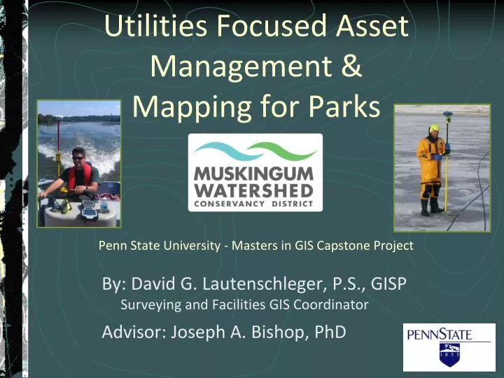
By: David G. Lautenschleger, P.S., GISP Surveying and Facilities GIS Coordinator Advisor: Joseph A. Bishop, PhD Utilities Focused Asset Management & Mapping for ParksPenn State University - Masters in GIS Capstone Project
Muskingum Watershed Conservancy District (MWCD) Background Largest watershed in Ohio (8,000 sq. miles / 20% of state) Established in 1933 for flood control after the Great Flood of 1913, Ohio's greatest natural disaster with nearly 500 deaths System of 16 dams and reservoirs Provided Public's Works projects during depression $8 Billion in flood damage prevented Park system started in 1960's
Atwood Lake Park • Charles Mill Lake Park • Pleasant Hill Lake Park • Seneca Lake Park • Tappan Lake Park
What is the problem? Parks are over 50 years old and have endured a variety of modifications Unknown utility locations Excavations can lead to “surprises” Poor record keeping - Information in variety of formats and locations Interruption of utility service Unhappy campers Unsafe conditions to construction crews NEW SYSTEM NEEDED!
Avoid Expensive ExcavationSimple projects turn into BIG problems! Lack of utility knowledge creates additional expenses for future projects
Employee safety and Utility interruption http://blog.level3.com/wp-content/uploads/2011/08/landownerfibercut.jpg http://hamptonroads.com/2011/04/incidents-gas-line-power-pole-tangle-va-beach-traffic http://www.nbcnewyork.com/news/local/Bayonne-Water-Main-Break-Avenue-E-52-Street-208420521.html
Goals • Develop a system in which multiple departments can easily access utility data • Maintain data in one location and make available to all staff via the Internet • Increase the amount of sharing of data district-wide • Once the advantages of GIS are realized, a more sharing and open philosophy will be adopted • Increase efficiency for Utilities and Construction Crews • Make the information not typically available to field staff by implementing tablets/handheld GPS units, allowing problems to be resolved faster and generating a self- sufficient environment
Current Location Methods Utility Locator (metal only) Utility Camera Ohio Utilities Protection Service (OUPS) Not for private utilities Walk project – compare and measure to existing structures
Existing Data Historical data: hand drawings on linens and mylar (1960's-1980's) CAD design files from expansions (1980's- present) Misc. field survey data from in-house survey (2001) Existing in-house CAD engineering drawings Institutional knowledge - MEMORY
Where is the data? MWCD Engineering Department has majority of plans at Main Office in New Philadelphia, Ohio Conservation Department has limited amount of plans from easements and projects not directly affecting parks Parks keep miscellaneous maps and notes in Maintenance buildings Additional data stored in off-site location http://www.newsgroupdirect.com/blog/2011/01/20/binary-retention-reaches-810-days/raiders_of_the_lost_ark_government_warehouse_new/
How to get into GIS? Scan historical drawings and aerials Georeference & digitize historical data Georeference past projects and surveys created during construction projects NEW SURVEY!
Field survey of the current conditions Locate ALL utility components Manholes Culverts Water valves/boxes Electrical boxes Power Poles Structures
Field survey environment 4 Day work week: 10 hr. days: Monday-Thursday to minimize disruption to visitors Signage and safety gear (vests, cones) Communication with Park Manager & Park Rangers
Field survey - QC/QA Walk-through of entire project by surveyor with field collected data Walk-through of first set of deliverables by MWCD staff Video of area provided for additional checks from office
Horizontal and Vertical Survey Control A CORDINATE SYSTEM IS NECCESSARY!! Use standardized local system Ohio State Plane System – North Zone (NAD83 US Survey Feet-FIPS 3401) Elevation Datum (NGVD29) Well monumented for future use
Permanent Monumentation All future surveys to utilize new control monuments on Ohio State Plane Coordinate System 10” Diameter by 42” deep with aluminum cap and witness post. 12 placed throughout campground
Develop Database Standards and SchemaReview with end-users • Engineering • Water/Waste-water maintenance • Park Managers • Park Maintenance staff • Recreation Management
Database Standards and domains for consistency Database also to include method of data collection for each entity to determine level of “trust” for each actual location. i.e. Survey Grade, Aerial, CAD, Handheld GPS, Scanned Document, etc.
End Users - Office Staff ArcGIS Desktop for Survey / GIS staff for updates and maintenance ArcGIS ONLINE for non-technical staff in Recreation and Conservation Departments Embed in MWCD website for construction updates Create web applications for MWCD staff as needed
End Users - Field Staff Smart Phone (Android or iOS) Mobile options for quick reference of utility locations Handheld GPS (Trimble GeoExplorer or Juno) with ArcPAD IMAGE: http://www.trimble.com/mappingGIS/geo-7-series.aspx Survey crew to stake-out locations prior to excavation similar to Ohio Utilities Protection Service (OUPS)
Future Maintenance Future projects and utility installs documented Work-flow document be created Utility planning (Project Engineer) Construction (Const. & Utility Crews) As-built survey (Survey Technician) GIS updates (GIS Specialist) MWCD Engineering Dept. consists of Survey and GIS staff to fulfill this need
Benefits of GIS in Park Management Limit duplication of data capture and maintenance Consistency with multiple parks Education/transfer of knowledge Managing Facilities with current information
Lessons Learned Consultant Communication: Survey staff needs to have understanding of final product Internal Communication: Maintain constant communication with end-users (primarily park staff) Project Schedule: Perform fieldwork in off season with less traffic and obstructions
Presentation Information 2014 Ohio Parks and Recreation Association (OPRA) Conference and Trade Show Kalahari Conference Center Sandusky, Ohio February 2-5, 2014 www.opraonline.org
References Publications Buckley, A. (2012 Summer) Designing Great Web Maps. ArcUser, vol. 15, p.50 Jenkins, H. (1976) A Valley Renewed, The History of the Muskingum Watershed Conservancy District. The Kent State University Press Saine, A. (2012, Fall)Town Sharpens Proactive Sewer System Management.ArcNews, vol. 34, p. 37 Internal MWCD documents Burke, T. (2000) Needs Assessment and Feasibility Study for Muskingum Watershed Conservancy District, Peak Geo-Design, Inc. Schreiner, B. 1997-2004 GIS Group files, former Docks and Marinas Coordinator – MWCD, Retired 2011. Websites Diethorn, B. (2005) Coordinating National Park Management with GIS. Retrieved Sept. 2, 2013 from http://www.nps.gov/gis/odyssey/2006/thursday.html Turner, T. (2008-9) Mapping and Managing Potable Water Infrastructure Assets.ArcNews Retrieved Oct. 15, 2013 from http://www.esri.com/news/arcnews/winter0809articles/mapping-and-managing.html Minami, M. (2011) ARCGIS ONLINES VS ARCGIS EXPLORER ONLINE, ArcGIS Resources Retrieved Nov. 18, 2013 from http://forums.arcgis.com/threads/36353-ARCGIS-ONLINES-VS-ARCGIS-EXPLORER-ONLINE Mayo, M. (n.d.) Enhancing Water Department Efficiency - Using GIS and GPS to produce quality maps of rural water system features. ArcUser Retrieved Oct. 15, 2013 from http://www.esri.com/news/arcuser/0408/bamah2o.html Hamil, D. (n.d.) Your Mission, Should You Choose To Accept It: Project Management Excellence.GeoCommunity Retrieved Oct. 15, 2013 from http://spatialnews.geocomm.com/features/mesa1/ Projects 2009 - GPS/GIS Asset InventoryChippewa Subdistrict – Muskingum Watershed Conservancy District Retrieved Oct. 10, 2013 from http://chippewa.mwcd.org/html/at_work/2009_cap_inv_GIS.htm GIS Program – Role & Function. National Park Service – U.S. Department of the Interior. Retrieved Oct. 10, 2013 from http://www.nps.gov/gis/gis_program/role.html
Acknowledgements Joseph Bishop, PhD, PSU Advisor Beth King, PSU Assistant Program Manager Boris Slogar, P.E., M.P.M., MWCD Chief Engineer Doug Little, P.E., Project Engineer Michael Kobilarcsik, MWCD Survey Technician Jeremy Hoffer, MWCD Tappan Lake Park Manager Mary Burley, MWCD Human Resources Bodo & Associates, Inc., Surveying & Mapping and of course, an extremely patient family