Download
1 / 28
480 likes | 1.88k Views
Desk Study and Site Investigation. EOSC316 Engineering Geoscience. Sequence of stages. Initial stage: Desk Study Desk study of available data Site visit and visual assessment Preliminary report and fieldwork plan Main stage: Site Investigation Fieldwork Geological mapping if necessary

E N D
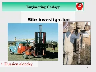
Desk Study and Site Investigation EOSC316 Engineering Geoscience
Sequence of stages • Initial stage: Desk Study • Desk study of available data • Site visit and visual assessment • Preliminary report and fieldwork plan • Main stage: Site Investigation • Fieldwork • Geological mapping if necessary • Trial pits, trenches and boreholes • Geophysical survey if appropriate • Lab testing, mainly of soils • Geophysical survey • Final Report • Review stage • Monitoring during excavation and construction
Aims and benefits of a desk study: • To collect, understand and interpret data • To limit costs • Aid in the Design Process • Highlights problems early • Low cost & cost effective • Provides information which would otherwise be difficult to obtain
Sources of information • Maps • Geological maps & Memoirs • Current OS Maps • Old Maps / Aerial Photos • Archive • Historical Geotechnical Info. • Engineering Drawings • Construction Records • Libraries • Specialist Surveys • Enviro Check, Landfill etc. • Mining Records • Ecological Survey • Observational • Site Visit / Walkover survey • People (UU Ops, Construction Staff, Local Residents)
Walkover survey • Checklist • Ground truth air photos • Land use • Physical features • Geology • Drift • Groundwater conditions
Desk study • Collect the information • Highlight potential problems • Design site investigation
Site investigation • SITE INVESTIGATION is the exercise of undertaking a planned sequence of exploratory holes, with associated field and laboratory testing, in order to bring our understanding of the ground at a site, to an acceptable level of confidence for a particular project. • SCOPE of investigation is developed from the Desk Study review.
Site investigation boreholes • Percussion drilling • soils/soft clay rocks • core recovery • Rotary coring • soil or rock >100m deep • core recovery • Rock probing • rotary percussion rig • soil or rock • no core recovery
How many boreholes, how deep? • Spacing: • buildings 10 – 30 m apart • road lines 30 – 300 m apart • landslides at least 5 in line for profile • Depth: • 1.5 x foundation width + 10 m control hole • 3 m below rockhead
Trial pits/trenches • Services - hand dug to 1.2m • Geotechnical - machine dug to 3.0m • Penetrometer test • Photographs
Field testing • SPT : Standard Penetration Test • no. of blows/300mm penetration • Permeability Test • Vane tests • Cone Penetration Tests ( Dutch Cone Soundings ) • In-Situ Density Test
Geophysical surveys • Ground probing radar • Seismic surveys • Magnetic surveys • Gravity surveys • Electromagnetic surveys
Geophysical surveys • Ground probing radar • uses electromagnetic microwave radar signals to map ground contrasts • main restriction: depth • 10-20 m in dry sand • 1 – 3 m in wet clay
Geophysical surveys • Seismic surveys • greater penetration, typically 20 m (with sledge hammer) • rockhead ususally easy to detect owing to velocity contrast • Typical seismic velocities (Vp):
Geophysical surveys • Magnetic surveys • Utilizes dipole anomalies arising from vertical linear features • Particularly useful for identifying buried mine shafts
Geophysical surveys • Gravity surveys • underground voids or low density rock/soil show up as negative anomalies • usual to drill all negative anomalies
Geophysical surveys - summary • Search for cavities • GPR < 10 m; gravity if size > depth • Mineshaft location • magnetic survey • Rockhead profiling • seismic survey, GPR • Rock quality ahead of tunnel • seismic survey