Download
1 / 2
20 likes | 159 Views
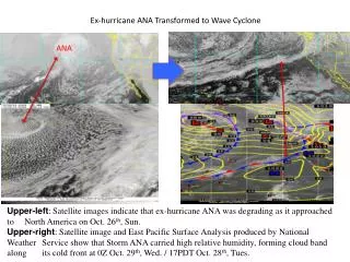
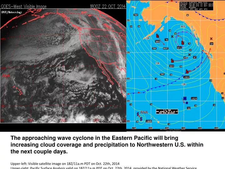
ANA. ANA. The approaching wave cyclone in the Eastern Pacific will bring increasing cloud coverage and precipitation to Northwestern U.S. within the next couple days. Upper-left: Visible satellite image on 18Z/11a.m PDT on Oct. 22th, 2014

E N D
ANA ANA The approaching wave cyclone in the Eastern Pacific will bring increasing cloud coverage and precipitation to Northwestern U.S. within the next couple days. Upper-left: Visible satellite image on 18Z/11a.m PDT on Oct. 22th, 2014 Upper-right: Pacific Surface Analysis valid on 18Z/11a.m PDT on Oct. 22th, 2014, provided by the National Weather Service
The left image shows the clouds associated with possibilities of precipitation in Contiguous U.S. on 11a.m. PDT Oct. 22th, Wednesday. The images below depict forecasted “pressure patterns, circulation centers and fronts, and extent of precipitation” at 0Z Oct. 23th/5p.m. PDT Oct 22th, Wed (left); 12Z/5a.m. PDT Oct 23th,Thurs. (middle); and 24-hr quantitative precipitation forecasts since 0Z Oct. 23th to 0Z Oct. 24th (5p.m. PDT Oct 22th to 5p.m. PDT Oct 23th)(right). The images are provided by National Weather Service – Weather Prediction Center.