Download
1 / 11
120 likes | 257 Views
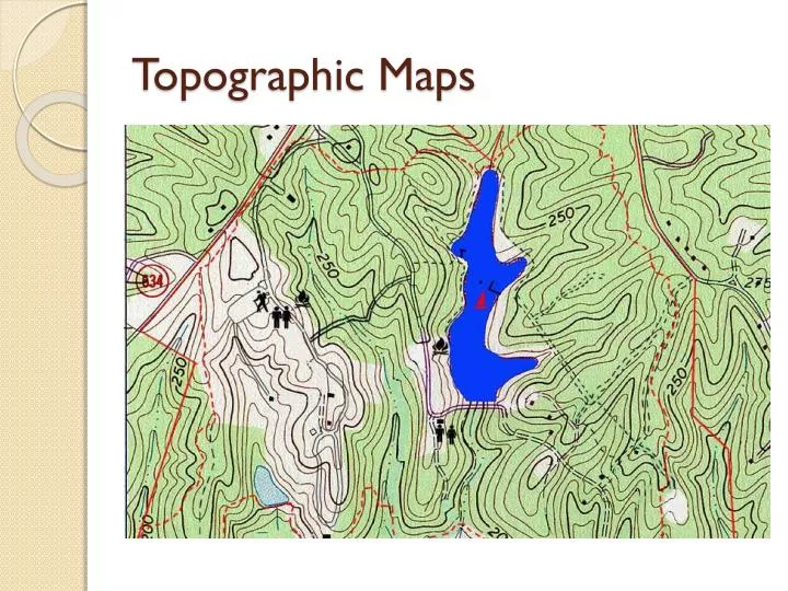
Topographic Maps. Terms and Definitions. Topographic Maps: Show the shape of the land Elevation: Height above or below sea level Relief: Difference in elevation between two points. Contour Lines: Lines that connect points of equal elevation.

E N D
Terms and Definitions • Topographic Maps: Show the shape of the land • Elevation: Height above or below sea level • Relief: Difference in elevation between two points. • Contour Lines: Lines that connect points of equal elevation. • Contour Interval: Distance between two contour lines.
What is the contour interval of this topographic map? • Answer: 20 • What is the elevation of point W? • Answer: 40 • What is the elevation of point Y? • Answer: About 50
Visible Geology • Visible Geology Demo: http://visible-geology.appspot.com/#page/program
Topographic Map Features • What feature is this? • A hill/mountain • *The closer the contour lines are together, the steeper the hill.
Topographic Map Features • What feature is this? • A depression (Sink hole, volcanic opening, pit)
Topographic Map Features • What feature is being shown where it says 0-80? • A cliff
Topographic Map Features • The blue line is a river. What do the contour lines do when they cross the river? • Point upstream • What direction is the river flowing? • Southeast and then southwest.