Download

1 / 40
400 likes | 514 Views
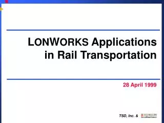
Application of Intelligent Transportation Systems (ITS) for Statewide Traffic and Evacuation Monitoring and Management in Louisiana. April 16, 1999. Who Are We?. Louisiana State University. Department of Civil and Environmental Engineering Dr. Marc Levitan, Structural Engineering

E N D
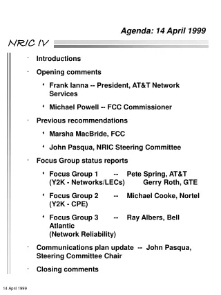
Application of Intelligent Transportation Systems (ITS) for Statewide Traffic and Evacuation Monitoring and Management in Louisiana April 16, 1999
Who Are We? Louisiana State University • Department of Civil and Environmental Engineering • Dr. Marc Levitan, Structural Engineering • Dr. Brian Wolshon, Transportation Engineering • Remote Sensing and Image Processing Laboratory • Chris Schwehm, Digital Processing
What is ITS? Application of Advanced Information and Communication Technologies for Transportation • ATMS - Video Surveillance, Incident Detection and Response, Adaptive Traffic Signal Systems • ATIS - Changeable Message Signs, HA, In-vehicle Information, Dynamic Route Guidance • CVO - Safety Assurance, Automated Credential Administration, Weigh-in-Motion • AVCS - Collision Avoidance, Road Condition Sensing, Advanced Guidance
Limitations of Current Systems Used in Louisiana • Limited Statewide Traffic Data Collection • Limited to Hourly Volume and Average Speed • Not “Real-Time” • Not Easily Accessible and Usable • No Roadway Specific Weather Data • Road Icing, Fog Conditions, Wind Speed • Limited Coordination Between OEP & DOTD • Evacuation for Natural and Technological Hazards
What Do We Suggest? • Collect Data Statewide • Traffic, Weather, Road Surface Conditions • Process this Information in Real-Time • Automatic and Immediate Updates • Make it Available • Use the World Wide Web • Decision Makers and the Public • Present information in a Clear and Useable Format • Graphical Interface (point and click)
What Will It Do? If such data were available in an easily accessible form, it could have a tremendous positive impact on • Hurricane Evacuations • Incident Detection and Management • Traffic Management • Air quality attainment? • + many others
System Requirements • Provide data on • Traffic • Road surface conditions • Weather conditions • Regional or statewide coverage of key routes • Provide data in real-time or near real-time
System Requirements, cont’d. • Allow simultaneous access to all officials in need of the data • DOTD, OEP, State Police • Local counterparts • Provide feedback (management) capabilities • Allow public access to selected portions
TRICOMM Total Roadway Integrated Condition Monitoring & Management
System Overview Traffic, Weather Road Surface Data Users Internet Central Processor Internet Phone modem Cellular modem Satellite Paging Other
Traffic Management System Overview Traffic, Weather Road Surface Data Users Internet Central Processor Internet Phone modem cell modem satellite paging other
Traffic Flow # of vehicles speed type Road Surface temperature water depth Weather temperature relative humidity wind speed and direction visibility rain System Overview- Basic Conditions Monitored
System Overview- Optional Conditions Monitored • Water Depth/Rate of rise in adjacent floodprone areas • HAZMAT • chemicals • radiation • Other
W W H
Highway Advisory Radio Station 3 Location: I-12 at Oneal Lane Frequency: 1670 am Status: Operational Flash Status:No Flash Current Message: Enter New Message: Flash URGENT Interstate reconstruction project completed. All traffic lanes are open Interstate 12 westbound reduced to one lane at Airline Highway due to an accident in the right lane. Please expect delays.
47,665 15, 037 2,745 18,873 2,364 11,008 5,805 12,445 5,339 4,123
Clearance Area Enter Clearance Area
Round Table Discussion • Will this type of system be useful (and used)? • Weaknesses? • Changes? • Improvements?