Download
1 / 25
250 likes | 359 Views
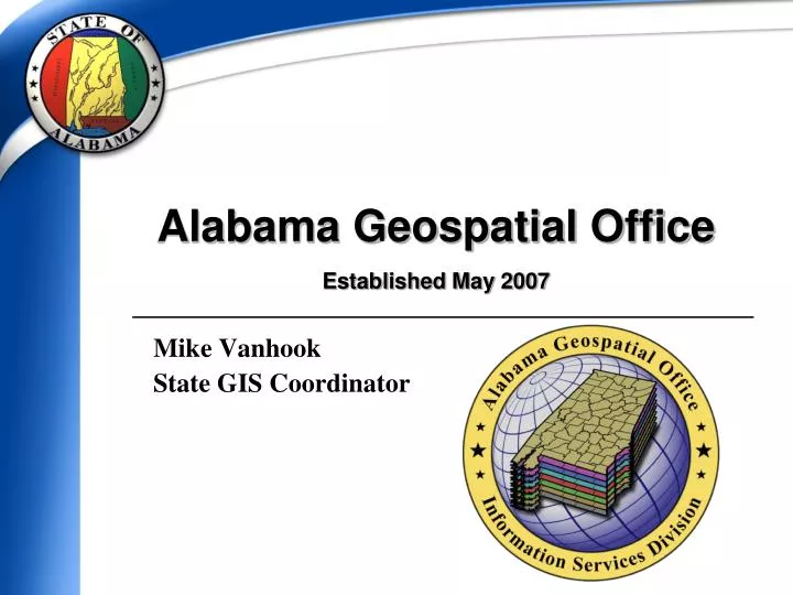
Alabama Geospatial Office Established May 2007. Mike Vanhook State GIS Coordinator. Vision. To become a trusted leader, providing high value information technology services to the state of Alabama. (ISD Vision) To build a comprehensive GIS program that facilitates growth and development

E N D
Alabama Geospatial OfficeEstablished May 2007 Mike Vanhook State GIS Coordinator
Vision • To become a trusted leader, providing high value information technology services to the state of Alabama. (ISD Vision) • To build a comprehensive GIS program that facilitates growth and development • Sever-based architecture and services • Unified spatial data infrastructure • Shared data and services
Goals • Support, facilitate, and promote geospatial programs and technology for the State • Develop statewide initiatives • Develop geospatial infrastructure for the enterprise • ASDI – Alabama Spatial Data Infrastructure • Avoid duplication of expense • Provide scalable solutions • Promote reuse of spatial data • Promote collaboration and cooperation
ISD Services(Self-Funding, Revolving Fund Agency) • IT Standards & Planning • Data Center and TechSupport • Application Development & Support (MF, C/S, Web) • Statewide Telecom System (Wired and Wireless) • WAN and Internet Access • Video Conferencing • E-mail and Messaging • IT Project Consulting • Desktop Services • Web Development Services • e-Government Services • Data and Network Security • Geospatial Services
Alabama Geospatial OfficeBuilding Upon Success • Geospatial Infrastructure • Build upon the existing IT and Network Infrastructures • Providing services over the Statewide Data Network • Statewide Authentication and Security
Expanded Infrastructure • Consolidated Data Centers • SAN with DR in Huntsville • Mainframe Storage • Metro Ethernet,MPLS Deployment • Backup Internet POP (Birmingham) • Policies and Standards • New GIS Server Deployment for web services • Develop Geospatial Policies and Standards
Enterprise Geospatial Infrastructure • Geospatial data provides LOCATION of entities to the enterprise; with minimal attribution • Connecting services and systems through Service Oriented Architecture (SOA) • Plumbing/Networking data and services • Building network applications
Geospatial Services • Potential Programs and Services: • Enterprise GIS solutions and web map services • Server and Service Oriented Architecture (SOA) • Alabama Spatial Data Infrastructure (ASDI) • Geospatial coordination and shared services • Data storage, integrity, replication, and security • Cost effective and high quality systems • Integrated technology • State negotiated contract pricing for hardware and software • Support for federal geospatial standards and guidelines • Training and Support
Statewide Contracts • Established state-wide purchasing contracts for computers and monitors. • GIS Developer Workstations (in process) • ESRI Enterprise License Agreement • Will save over $200k upon deployment • ISD - Microsoft Enterprise Agreement (SHI, Inc) • Other contract consideration in support of geospatial technology
State Enterprise License Agreement (ELA) Between the State of Alabama and Environmental Systems Research Institute (ESRI)
Purpose of the Agreement • We are coordinating a single contract with ESRI to: • Reduce the overall cost of license ownership • Improve support for Geospatial Programs • Coordinate and facilitate statewide GIS • Improve available training and capabilities
Participating Agencies • All State Agencies as identified in the ELA are eligible to receive benefits • There are over 90 State agencies listed • The State shall provide Tier 1 Technical Support • Primary state agencies will Provide local/in-house Tier 1 Support
AgreementLicensedSoftware • Including:ArcGIS Server Extensions
Price Benefit Participating State agencies will pay 80% of their annual maintenance costs
Supporting Geospatial Programs • NSGIC • National States Geographic Information Council • Serving as a State Representative • Ramona (GIS Inventory) State Administration • Imagery for the Nation • GIS for the Nation • Fifty States Initiative • USGS Agreement • Supporting the national Geospatial Line of Business • National Geospatial Programs Office • FGDC/NSDI standards and best practices • Shared data and services • HIFLD • Homeland Security Foundation Level Data Working Group • Served as NSGIC Representative for HSIP Feedback session
Supporting Geospatial Programs • HIFLD • Homeland Security Infrastructure Foundation Level Data Working Group • Served as NSGIC Representative for HSIP Feedback session • HSIP Freedom • Homeland Security Infrastructure Program • State partnership to provide and update data • Ownership/stewardship of State data • 2 way transaction of data • Communication and exchange of information
Ramona State Summary • Annually, NSGIC collects and publishes summary information about the GIS Coordination activities of each state. • Provide background for State geospatial programs • Describe accomplishments, goals, challenges, cooperative programs, data development • Collect links to standards, policy, and program documentation • State score card rating the (9) NSGIC Coordination Criteriaand key objectives of the Fifty States Initiative
Fifty States Initiative Coordination Criteria • 1. A full-time, paid coordinator position is designated and has the authority to implement the state's business and strategic plans. • 2. A clearly defined authority exists for statewide coordination of geospatial information technologies and data production. • 3. The statewide coordination office has a formal relationship with the state's Chief Information Officer (or similar office). • 4. A champion (politician or executive decision-maker) is aware and involved in the process of coordination.
Fifty States Initiative Coordination Criteria • 5. Responsibilities for developing the National Spatial Data Infrastructure and a State Clearinghouse are assigned. • 6. The ability exists to work and coordinate with local governments, academia, and the private sector. • 7. Sustainable funding sources exist to meet projected needs. • 8. Coordinators have the authority to enter into contracts and become capable of receiving and expending funds. • 9. The Federal government works through the statewide coordinating authority.
ALGO Website geospatial.alabama.gov
Alabama Geospatial OfficeEstablished May 2007 Mike Vanhook State GIS Coordinator Direct: (334) 242-4799 mike.vanhook@isd.alabama.gov geospatial.alabama.gov