Download
1 / 15
150 likes | 169 Views
This study aims to prepare for future scenarios of climate and land use change by spatially predicting and simulating the influence of potential mitigation and adaptation actions. The goal is to incorporate land use and climate change predictions into ecosystem process models to better understand and mitigate the impacts on ecosystems.

E N D
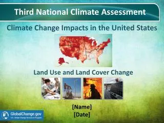
Modeling Strategies for Adaptation to Coupled Climate and Land Use Change in the United States Cristina Milesi Ecological Forecasting Lab CSU Monterey Bay / NASA Ames Research Center Co-Is: Forrest Melton and Weile Wang, CSU Monterey Bay / NASA Ames Research Center Rama Nemani, NASA Ames Research Center David Theobald Colorado State University PI: Scott Goetz, Woods Hole Center NASA LCLUC Science Team Meeting March 29, 2011
Motivation • IPCC Fourth Assessment Report (AR4) projects warming of 4-12 C over the United States by 2100 • Urban land cover and associated impervious surface are forecasted to increase by 50% over the next few decades across substantial portions of the U.S. • Coupled effects of changes in climate and land use and land cover are expected to intensify impacts on ecosystems (changes in productivity, disturbance and hydrological properties) • Low impact development (LID) and Best management practices (BMPs) for land use planning and design can mitigate impacts resulting from changes in climate and LU (e.g. reducing impervious surface cover)
Goal and Objectives • Prepare for next generation regionally focused IPCC scenarios that better incorporate the influences of land use change by: • Spatially predict future land use changes • Incorporate land use and climate change predictions under different SRES scenarios into ecosystem process models • Simulate the influence of potential mitigation and adaptation actions by predicting land use change scenarios that incorporate a range of best management practices (BMPs) associated with land cover and land use change.
Methods: SERGoM Housing Density Impervious Area covered by impervious surface over time for all five scenarios. (A) actual housing density in 2000; (B) modeled housing density in 2100 for base case; (C) for scenario A2; and (D) for scenario B1. Bierwagen et al. PNAS 2010;107:20887-20892
Methods: TOPS Generated 1km monthly Tave, Precip, VPD and solar radiation surfaces from downscaled WCRP CMIP3 scenarios (Maurer et al., 2007)
Model Calibration: Land Cover Change Impacts Forecast LC (2030) Baseline LC (2000) Current and Projected Impervious cover SERGoM on top of NLCD 2001 Chesapeake Bay and Delaware River watersheds
TOPS Results: Impact of Land Use Change on Runoff Baseline (2000) Forecast (2030) Change (2030-2000) Average annual total runoff for the baseline (2000) and forecast (2030) scenarios, and the projected increase in average annual runoff
TOPS Results: Impact of Land Use Change on Vegetation Productivity Baseline (2000) Forecast (2030) Change 2030-2000
Projected Impervious Surface under IPCC SRES A1B2010 to 2100
Projected Climate under IPPCC SRES A1B1km Downscaled GFDL CM2.0 Precipitation Tave VPD 1950 2000 2100
TOPS Results: Coupled Climate and Land Use Change SRES A1 vs A2 over US urban areas Impervious Area (km2) Total Runoff (mm) Loss in GPP (kg C) Coupled climate and land use change impacts over urban areas 2100 Runoff +110% +54% +90% +60% 2100 GPP -25% -40%
Next Steps • TOPS runs with other ecosystem and climate models (i.e., GISS-ER, CCSM3.0) and SRES B1 and B2 • Regional analysis of impacts of land use changes versus climate • Assess the effects on runoff and vegetation productivity of realistic Best Management Practices / Low Impact Development techniques by simulating: • increases of pervious surfaces • green roofs • urban afforestation programs https://c3.ndc.nasa.gov/nex/
Data Sharing on NASA Earth Exchange • Collaborative computing environment for sharing of data, code and science results https://c3.ndc.nasa.gov/nex/