Download
1 / 26
330 likes | 514 Views
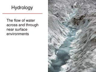
Hydrology. Step 1: Assess Riparian Resource Function Using PFC. 1d. Complete PFC assessment 17 questions about attributes and processes Reminder – PFC based on: Water (hydrology), Vegetation, and Soil & landform (erosion/deposition) Checklist answers: Yes, No, or N/A (sometimes)

E N D
Step 1: Assess Riparian Resource Function Using PFC • 1d. Complete PFC assessment • 17 questions about attributes and processes • Reminder – PFC based on: • Water (hydrology), • Vegetation, and • Soil & landform (erosion/deposition) • Checklist answers: Yes, No, or N/A (sometimes) • Not “Liner” • Notes for “No’s”, Many (all?) “Yes’s”, e g. species list
Floodplain Level area near a stream channel Constructed by the stream In the present climate Flooded during moderate & high flow events Should not be confused with terraces (abandoned floodplains)(adapted from Leopold 1994) Floodplain Valley flat Abandoned floodplain or terrace Hill slope Floodplain Channel Item #1: Floodplain inundation
Floodplain – Geologic feature being formed by the river in its present condition and climate
Bankfull Concept Information Forest Service Stream Systems Technology Center (Stream Team) website for on-line training videos, can order CDs and DVDs: www.stream.fs.fed.us • Western U.S. • Northeastern U.S. (4 CDs) • Forested Streams Eastern U.S. http://www.stream.fs.fed.us/publications/bankfull_west.html
Field Observations Bankfull Indicators (Moody et al. 2003, Odem and Moody 1999) • Build a case based on physical evidence • Series of depositional features at consistent elevations with similar substrate and veg components • Point bars at inside of meander bends, • Point bars often not well developed with low sinuosity, • Discontinuous alternating longitudinal bars parallel to the channel often most dependable indicator • Broad valley floors are almost always above bankfull
Terrace flooding? Break in stage-discharge Indicates floodplain or terrace access at 1,900 cfs
Item 1: Floodplain inundated frequently • Floodplain inundated in “relatively frequent events” Purpose: To determine whether frequent flood flows are capable of spreading out on low-lying areas adjacent to the stream and thus provide for: • energy dissipation • sediment deposition • periodic flooding of vegetation, and • periodic infiltration of flood water to replenish base flows • Floodplain • Bankfull
Item 1: Floodplain is inundated in “relatively frequent” events • Flat, depositional surface adjacent to channel on: • Low gradient, meandering (“C” and “E” channels) • Moderate gradient “B” channels • Indicators of “No” • Incised channel • Enlarged channel • Vertical banks on inside of bend & at straight reaches • Upland vegetation on streambank
Terrace Bankfull Floodplain
Item 2: Beaver dams are stable Purpose: Beaver dams are hydrologic modifiers. Stable dams can increase stability by attenuating flood flows, providing a source for base flows, storing sediment, raising water tables and expanding riparian areas. Unstable dams can reduce stability by causing channel incision, increasing bank erosion, lowering water tables and decreasing the extent of the riparian zone when they fail. • Some dams are inactive, but stabilized by vegetation.
Item 2: Beaver dams are stable • Indicators of beaver activity • Fresh workings on dams • Available building materials and food supply • Indicators of dams at risk • Single dams • No signs of maintenance and repair • Confined valleys - no floodplain • Dams not anchored to banks • Large, flashy streams • Dams not stabilized by woody vegetation
Examples of visual indicators Dam construction material Dams keyed into streambanks Breaches 2: Beaver dams are stable No
Item 3:Sinuosity, gradient, and width/depth ratio, are in balance with the landscape setting (i.e., landform, geology, and bioclimatic region) Purpose: To determine if the pattern, dimension, and profile of the stream are within the expected range, given its landscape position, hydrologic regime, and natural sediment load. Sinuosity, width/depth ratio, and gradient perform key roles in determining whether a stream can transmit water and sediment while managing erosive forces and remaining stable
Item 3:Sinuosity, gradient, and width/depth ratio, are in balance with the landscape setting (i.e., landform, geology, and bioclimatic region) • Question has three parts • Sinuosity • Width/Depth ratio • Gradient • All three must be "yes" for answer to be "yes" • Must be appropriate for site • Never NA
Sinuosity = Stream Length ÷ Valley Length1.9 = 370' ÷ 195‘ Valley Gradient = 1.5% Stream Gradient = 0.8%
3) Sinuosity, gradient, and width/depth ratio, are in balance with the landscape setting (i.e., landform, geology, and bioclimatic region) • Examples of visual indicators • Aerial photos help with sinuosity
3.) Sinuosity, gradient, and width/depth ratio, are in balance with the landscape setting (i.e., landform, geology, and bioclimatic region) YES
4.) Riparian area is expanding or has achieved potential extent. Purpose: To document that a riparian area is recovering or has recovered. NO YES
4) Riparian area is expanding or has achieved potential extent • Examples of visual indicators • Riparian-wetland community types expanded to valley edge • Stream narrowed • Upland plants dying or dead • Depositions being captured Yes
Item 5: Riparian impairment from the upstream or upland watershed is absent. NO? YES
Purpose: To determine if riparian degradation is caused by a management within the riparian area (reach) or by environmental conditions or management outside the riparian area (reach). Is there riparian degradation? Yes, riparian degradation observed Yes No No riparian degradation observed. Degradation related to upstream or upland factors Degradation related to in situ activities Item 5 = “Yes” Item 5 = “Yes” Item 5 = “No”
5: Riparian impairment from the upstream or upland watershed is absent. Belgo Cr BC 1996 Trapping Cr BC 1996 Yes No Never NA