Download
1 / 32
320 likes | 335 Views
Understand when and how to issue Extreme Wind Warning during tropical cyclones, and prepare effective response strategies. Learn how to protect communities from dangerous core winds.

E N D
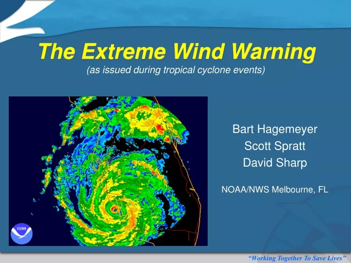
The Extreme Wind Warning(as issued during tropical cyclone events) Bart Hagemeyer Scott Spratt David Sharp NOAA/NWS Melbourne, FL
The NWS HAS ISSUED… FCMP Radar Display 10:48 PM EDT Extreme Wind Warning
What Are The Objectives? Upon successful completion, you should be able to… • Explain the value of operationally addressing tropical cyclones as mesoscale convective systems. • Know when to issue the Extreme Wind Warning (EWW) product during tropical cyclone events (e.g., definition). • Demonstrate a functional understanding of the EWW product toward improving public preparation and response relative to the onset of extreme hurricane winds. • Recall useful strategies for preparing effective EWW polygons.
What More Can Be Done? • As dangerous tropical cyclone winds begin to impact an area, is there anything more that can be done to help protect communities given that longer-fused warnings are already in place? • Who will actually experience the very dangerous core winds? • Where will they strike and when will they arrive? • What should people do now that they haven’t done already? • As warning meteorologists possessing critical insight, how will you convey this information to the people? Hurricane Charley Category 4 2004
Tropical Cyclone Wind Hazard - Conceptual Model WFO Knowledge of Expected Impact The Time We Know The Most 100 WFO Knowledge I Long-term HWO, PNS, EM Briefings, Media Interviews Long-term Hurricane Watch, Hurricane Warning, HLS, EM Briefings, Media Interviews Short-term HLS, SPS, NOW Very Short-term EWW, TOR, SVR, SVS, SPS Very Long-term Seasonal Outlooks, Preparedness Talks Local Short-term Warnings: The time we know the most is also our last chance to save lives !!! I ????? I I I 0 3 1 Day 7 Day 5 Day 3 H48 H36 H24 H12 H6 IMPACT User Needs – Plan/Prepare Implement According to Plan Last Chance Recovery
MCS: “A complex of thunderstorms which becomes organized on a scale larger than the individual thunderstorms, and normally persists for several hours or more. MCSs may be round or linear in shape, and include systems such as tropical cyclones, squall lines, and MCCs (among others). MCS often is used to describe a cluster of thunderstorms that does not satisfy the size, shape, or duration criteria of an MCC.” (NOAA/NWS Glossary) Mesoscale Convective Systems WFO Operations Paradigm Provide products and services that are: Short-fused Feature-based Radar-analyzed Frequently updated Of Limited Duration (~ 1 hr) County/Parish-specific
Hurricane Operations Paradigm For WFOs to consider tropical cyclone landfalls the same as any non-tropical severe weather outbreak. • NHC provides the synoptic scale wind depictions, along with the Maximum Sustained Wind (MSW) information that is representative of the system. • WFO localizes that wind information by further addressing the mesoscale and local scale implications (even any storm scale implications of transient features), and promptly conveys the impact. NHC WFO
Hurricane Charley Statement Example AT 840 PM...THE CIRCULATION CENTER OF HURRICANE CHARLEY WAS LOCATED OVER CAMPBELL IN NORTHWEST OSCEOLA COUNTY...MOVING NORTHEAST AT 23 MPH DIRECTLY TOWARD ORLANDO...UNION PARK...AND OVIEDO. DESTRUCTIVE WINDS OF 90 TO 100 MPH WILL OCCUR AS THE EYEWALL OF THE HURRICANE MOVES FROM OSCEOLA INTO ORANGE AND SEMINOLE COUNTIES THROUGH 10 PM. MOVE TO THE SAFEST LOCATION WITHIN YOUR HOME OR SHELTER. THIS IS A LIFE THREATENING SITUATION. Rapid-fire Statements Hurricane Jeanne Statement Example AT 130 AM...OBSERVATIONS FROM THE FLORIDA COASTAL MONITORING PROGRAM REPORT WINDS NEAR SEBASTIAN OF 75 MPH WITH GUSTS TO 110 MPH. WINDS NEAR VERO BEACH WERE 64 MPH WITH GUSTS TO 104 MPH. THE BACK EDGE OF THE EYEWALL WAS MOVING ONSHORE MARTIN AND SAINT LUCIE COUNTIES BRINGING THE RETURN OF DESTRUCTIVE WINDS. WINDS IN THIS PART OF THE EYEWALL WILL BE OUT OF THE SOUTH AND INCREASE TO HURRICANE FORCE…WITH GUSTS OVER 100 MPH BY 230 AM. THE RELATIVE CALM OF THE EYE ITSELF WILL CONTINUE TO SHIFT WEST INTO THE INTERIOR OF SAINT LUCIE COUNTY. IF YOU ARE IN THE EYE…YOU SHOULD REMAIN IN YOUR HOME OR SHELTER AS WINDS WILL DRAMATICALLY INCREASE FROM THE OPPOSITE DIRECTION AS JEANNE MOVES INLAND.
What’s The Value? • It makes effective use of the preceding few hours and moments leading up to landfall. • WFO Forecasters remain focused on the most impacting aspects during the event. • Users also remain focused and receive frequently updated wind information of relevance. • The flow of detailed wind information helps to manage the safety of a sheltered population whose lives are at risk throughout the event. • It heightens public awareness and readiness for the possible issuance of Extreme Wind Warnings.
Extreme Wind Warning (EWW) • Product Purpose:To inform the public of the urgent need to take immediate protective action within an interior room of a well-built structure due to the imminent onset of extreme tropical cyclone winds. • Issuance Criteria:An EWW is issued when both of the following criteria are met: • The tropical cyclone is a CAT 3 or greater. • Sustained winds of 100 kt (115 mph) or greater are expected to occur in a WFO’s county warning area within 1 hour; product valid time is not to exceed 2 hours.
Blunt Force Trauma TOR Warning Wind-Related Blunt Force Trauma/Violent Deaths Occur in Two Well-Defined Areas of a Hurricane. Primary Outer Rainband Tornadoes EWW Warning Inner Rainbands & Eye Wall Extreme Winds Hurricane Charley 2352 UTC 8/13/04
Surviving Extreme Winds Six adults huddled within an interior closet of this home. They all survived!
Here’s What We Don’t Want! “Hiding from the Wind” EWW – Trigger to go to that final safe place – in your PLAN!
Narrow Corridor Composite wind swath analysis; NOAA/HRD H*WND
Punta Gorda, FL Overemphasis on ‘skinny black line’; four deaths from flying debris and inadequate sheltering. Exactness in actual track and intensity can make a big difference in the magnitude of wind realized at any given location; the EWW can cut through the information barrage to elevate urgency.
Photo of enhanced wind damage within area transited by Hurricane Charley’s core winds. Significant Tree Blow-Downs S W Significant tree “blow-downs” NWS air survey; Highway 192, Osceola County
Frequent Gusts X Vero Beach Sustained (kt) NHC Gusts (mph)
EF-Scale for Tornado Damage EWW EF2 – The General Threshold for Serious Injury and Loss of Life
The Most Relevant Damage Indicators at EF-2 (115 mph Gust) Threshold Relevant Damage Indicators Hurricane Rita (2005) It is at about the 115 mph gust threshold that structure compromise and wind borne debris become a very serious life-threatening issue.
“Hunker Down” Hurricane Ike “We are still saying: Please shelter in place, or to use the Texas expression, hunker down…” Harris County Judge Ed Emmett (Source: AP) Information on the EWW early on can help form the message to avoid over-evacuation for wind. A warning will be issued if extreme winds do develop in time to go to that Safe Room. Hurricane Ike (2008)
Public Response & Preparedness EWW Concept Helps People Focus Planning for Proper Shelter Not in Storm Surge Threat Not a Good Plan! Thousands of people leave perfectly good single family homes to concentrate in “inland” shelters at motels and public shelters at schools and large open-span public buildings which can be seriously damaged starting at EF2 - or gusts from a high CAT 2 Hurricane.
A Worst Case Scenario There is a worst-case extreme wind scenario that is hard to imagine! Turner Agri-Civic Center Arcadia, FL
The Turner Agri-Center Hurricane Charley
Outside Into The Storm “Bits of paneling and insulation were swirling around the building. Many people started running outside into the storm.” Scott Moe Photo Courtesy of Scott Moe
Widespread Panic “All we could hear was yelling and screaming as widespread panic set in” “I never felt so helpless and small in all my life.” David Gaylord St. Petersburg, FL ~1,400 people were in this auditorium! Close call with tragedy! Photo Courtesy of Scott Moe
Shelter Within Shelter Concept of final shelter for extremehurricane winds needs to be included in all plans - from heads of families to public shelter managers – the ultimate goal is to preserve life! Long-Established Tornado Warning Procedures Should be followed for EWW
Remembering Hurricane Bob Hurricane Bob - 1991 Rare occurrence for NE US (very long return periods). Most have never experienced major hurricane conditions. Infrastructure/population impacts.
EWW Decision-Making Andrew 8/92 Hugo 9/89 Iniki 9/92 Extreme Wind; a rare TC impact – Potential of death from blunt force trauma/asphyxia increases dramatically at high end CAT 3 and above! Pongsona 12/02 Charley 8/04 Paka 12/97
Effective EWW Polygons Hurricane Jeanne: CAT 3; MSW = 115 to 120 mph; WNW @ 12 mph; RMW ~23 miles Chance for frequent gusts of 115+ mph ??? Chance for sustained winds of 115+ mph
Reference List REFERENCES: Florida Division of Emergency Management, 2006: PERFORMANCE OF PUBLIC SHELTERS DURING THE 2004 AND 2005 HURRICANE SEASONS. http://www.floridadisaster.org/Response/engineers/documents/2006SRR/2006-SRR-Chapt5.pdf Hagemeyer, B.C., 2009: The extreme wind warning and its role in improving public preparation and response to extreme landfalling hurricane winds in the urban environment. Preprints, Symposium on Urban High Impact Weather, Amer. Meteor. Soc., Phoenix, AZ, CD-ROM J8.5. Sharp, D.W., S.M. Spratt, B.C. Hagemeyer, and D.L. Jacobs, 2006:Major land-falling hurricanes as mesoscale convective systems: a paradigm shift for WFO operations. Preprints, 23rd Conference on Severe Local Storms, Amer. Meteor. Soc., St. Louis, MO, CD-ROM 11.4. Spratt, S.M., B.C. Hagemeyer and D.L. Jacobs, 2006: Providing short-fused warnings for the onset of extreme hurricane winds - a final opportunity to minimize casualties. Preprints, 27th Conference on Hurricanes and Tropical Meteorology, Amer. Meteor. Soc., Monterey, CA, CD-ROM 5A.5. Spratt, S.M., B.C. Hagemeyer and D.W. Sharp, 2008: Treating hurricanes as mesoscale convective systems - A paradigm shift for WFO landfall operations. Preprints, 28th Conference on Hurricanes and Tropical Meteorology, Amer. Meteor. Soc., Orlando, FL, CD-ROM 11C.7.