Download
1 / 20
200 likes | 340 Views
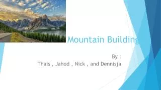
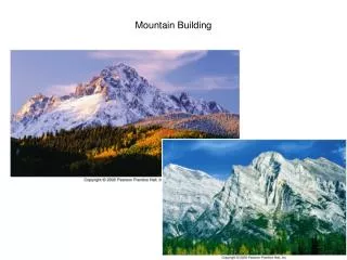
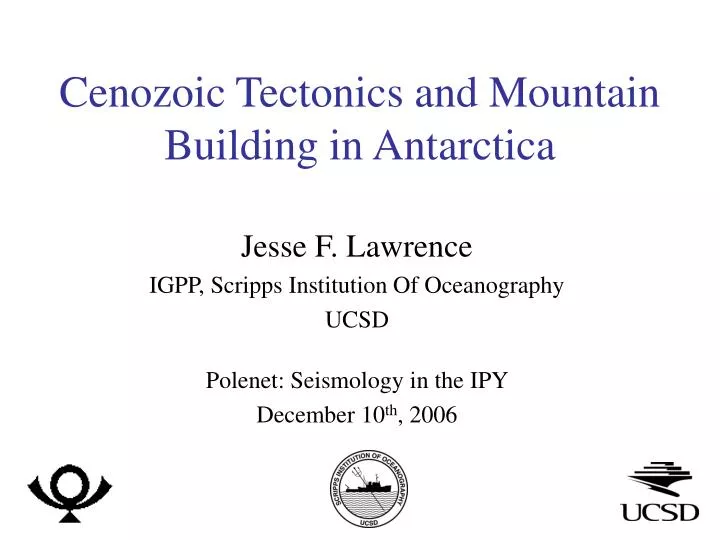
Cenozoic Tectonics and Mountain Building in Antarctica. Jesse F. Lawrence IGPP, Scripps Institution Of Oceanography UCSD Polenet: Seismology in the IPY December 10 th , 2006. East Antarctica. West Antarctica. Transantarctic Mountains. TAMSEIS: Transantarctic Mountain Seismic Experiment.

E N D
Cenozoic Tectonics and Mountain Building in Antarctica Jesse F. Lawrence IGPP, Scripps Institution Of Oceanography UCSD Polenet: Seismology in the IPY December 10th, 2006
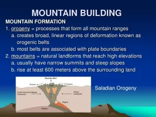
East Antarctica West Antarctica Transantarctic Mountains TAMSEIS: Transantarctic Mountain Seismic Experiment • Transantarctic Mountains • ~4000 km long • Peaks 4 km above Sea Level • 200-300 km wide • East Antarctica • Thick Precambrian block that held central position in Gondwana • West Antarctica • Thin group of younger crustal blocks • 42 Broadband Seismic Stations from 2000-2003 [Bedmap: Lythe et al., 2001]
Participants: • Washington University: • Doug Wiens, Rigobert Tibi, Patrick Shore, Brian Shiro, Moira Pyle, Sara Pozgay, Bob Osburn, James Conder, Mitch Barklage • Penn State: • Paul Winberry, Tim Watson, Don Voigt, Andy Nyblade, Audrey Huerta, Juliette Florentin, Sridhar Anandakrishnan, Maggie Benoit • IRIS PASSCAL: • Tim Parker, Bruce Beaudoin • SOAR: • John Holt, Don Blankenship • Others: • John Pollack, Bruce Long, Jennifer Curtis, Jerry Bowling, Ted Voigt • USAP/NSF
The Seismic Stations: • Seismometer & Data Acquisition System • 100 Ahr batteries charged by ~180W solar panels • 4Gb Disks (solid state: low energy & more stable) • Heating element: excess energy warms system • Low temp & energy shutdown
TAMSEIS: Seismic Studies • Receiver functions: Crustal thickness • Surface Wave Dispersion: Velocity variation Anisotropy • Body Wave Tomography: Seismic Velocity • SKS Splitting: Anisotropy • Differential Attenuation: Anelasticity • Airborne Geophysics: Gravity (SOAR) Topography Magnetic Ice Thickness Geophysical Modeling: ConsistentStory
Surface Moho Surface Waves and Receiver Functions • Surface Waves • Travel horizontally at depth ~ period • Sensitive to average velocities • Obtain velocity for each period • Receiver Functions • P-waves reflect nearly vertically off interfaces • Sensitive to velocity contrasts, velocity
Phase Velocities • 16-25 Seconds (20-35 km) • East Antarctica - slow • West Antarctica - fast • Transition beneath the Transantarctic Mountains • 120-170 Seconds (160-260 km) • East Antarctica - fast • West Antarctica - slow • Transition beneath the Transantarctic Mountains [Lawrence et al., 2006: JGR]
Receiver Function and Phase Velocity Surface Moho Surface Moho [Lawrence et al., 2006: G-cubed]
West Antarctica • West Antarctica: • Thin Crust: 20 km • Slow mantle seismic velocities [Lawrence et al., 2006: G-cubed]
East Antarctica • West Antarctica: • Thin Crust: 20 km • Slow mantle seismic velocities • East Antarctica: • Thick Crust: 35 • Fast mantle seismic velocities [Lawrence et al., 2006: G-cubed]
Across the The Transantarctic Mountains • West Antarctica: • Thin Crust: 20 km • Slow mantle seismic velocities • East Antarctica: • Thick Crust: 35 • Fast mantle seismic velocities • Transantarctic Mountains: • 5 2 km crustal root • Thins toward WA [Lawrence et al., 2006: G-cubed]
Seismic Tomography [Watson et al., 2006: G-cubed]
Differential Attenuation: • Attenuation: energy-loss per cycle of a wave. • Inverse correlation suggests thermal anomaly • 250C difference between East and West Antarctica inferred from both velocity & attenuation • Thermal expansion indicates ~1% more dense beneath East Antarctica [Lawrence et al., 2006: GRL]
Modeling Attenuation • East Antarctica: • Little asthenosphere (~0 km) • Thick lithosphere (>300 km) • West Antarctica: • Thick or very “mushy” asthenosphere • Little lithosphere (< 80 km) • Transantarctic Mountains • Transition between the two • Thickening of lithosphere • Thinning of asthenosphere [Lawrence et al., 2006: GRL]
The Geophysical Model • Bedrock Topography: • Ice-penetrating radar • Moho: • Receiver Functions • Mantle Density: • Tomography & Attenuation • Compare with Gravity: - Good fit to gravity, especially when mantle density anomaly is accounted for. [Lawrence et al., 2006: G-Cubed]
Conductive Heating Model Conductive Heating Model • East Antarctica is an old craton. • Likely has a cold, deep lithospheric root. • West Antarctica experienced extension during the Cenozoic. • Stretching factor: ~2 • Thinned the lithosphere • Increase mantle temperatures • East Antarctica’s deep keel will heat up at its edge. • This will reduce seismic velocities • Thin the lithosphere • Decrease density
Thermal History Shear Velocity at 100 km • East Antarctica is an old craton. • Likely has a cold, deep lithospheric root. • West Antarctica experienced extension during the Cenozoic. • Increase mantle temperatures • East Antarctica’s deep keel will heat up at its edge. • This will reduce seismic velocities • Thin the lithosphere • Decrease density [Lawrence et al., 2006: G-cubed]
Flexure Model • Constrained Parameters: • Surface & bedrock topography • Moho topography • Mantle Density Anomaly • Thinning lithosphere • Up to 6 km erosion • Flexure model • agrees with ten Brink and Stern model • accounts for current topography that is not currently compensated isostatically • Requires thinning of lithosphere toward the Ross Sea • Seismic, gravity, & Topography data agree!!! [Lawrence et al., 2006: G-cubed]
0 50 100 Depth (km) 150 200 0.0 1.0 2.0 % anisotropy Anisotropy SKS Splitting Surface Waves [Courtesy of Mitch Barklage] [Lawrence et al., 2006: JGR]
Conclusions • TAMSEIS was a success! • Stations located on the ice operate well with low noise • Reasonable data recovery given the harsh environment • TAMSEIS taught us a great deal about large-scale broadband seismic deployments in polar regions • We can use this knowledge for future broadband deployments • There is a great deal to be learned from broadband seismic studies in Antarctica!