Download
1 / 47
480 likes | 726 Views
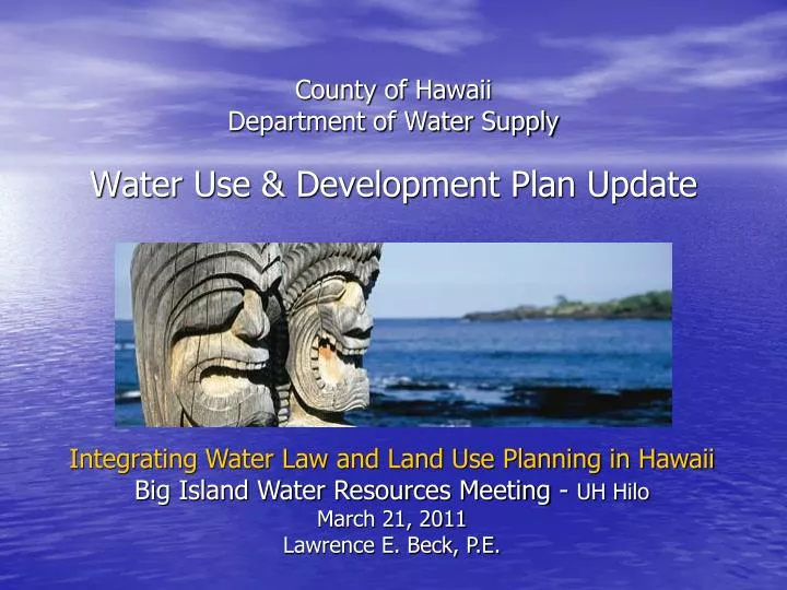
County of Hawaii Department of Water Supply Water Use & Development Plan Update. Integrating Water Law and Land Use Planning in Hawaii Big Island Water Resources Meeting - UH Hilo March 21, 2011 Lawrence E. Beck, P.E. HAWAII WATER PLAN Legislative Mandate.

E N D
County of HawaiiDepartment of Water SupplyWater Use & Development Plan Update Integrating Water Law and Land Use Planning in HawaiiBig Island Water Resources Meeting - UH HiloMarch 21, 2011Lawrence E. Beck, P.E.
HAWAII WATER PLANLegislative Mandate • 1987 – Hawaii Water Code (HRS Chapter 174C) • Protect Hawaii’s surface & ground water resources • Established the Commission on Water Resources Management (CWRM) • Development of the Hawaii Water Plan as… “a long range planning guide for CWRM”
State Needs Agricultural Needs Quantity Quality HAWAII WATER PLAN WRPP WQP SWPP AWUDP Resource Protection Policies County WUDP’s Water Use & Land Use Policies
HAWAII WATER PLANCounty WUDP’s Objective – “to set forth the allocation of water to land use through the development of policies & strategies to guide the County in its planning, management and development of water resources to meet projected demands” Hawai’i County decided to fund the update – recognized its importance as“a long range planning guide for DWS”
Statewide Framework (2000)Objective Created by CWRM to facilitate the coordination, integration & consistency of the components of the Hawaii Water Plan
Technical ApproachKey Tasks • Inventory of Existing Sources • Inventory of Existing Uses • Identification of Existing Water Systems • Assessment of Land Use Plans & Policies • Projection of Future Water Demands • Identification of Supply-side (Resource) & Demand-side (Uses/Control) Options • Public Participation – Stakeholder Input/Review
Technical ApproachInventory of Existing Sources • CWRM database • Registered Wells • Registered Diversions • Updated well pumpage information/records • Updated diversion records • Catchment systems are major sources • Reclaimed wastewater • Desalination systems
Instream Flow Standard Sustainable Yield
Technical ApproachKey Definitions • Sustainable Yield • “Sustainable yield” means the maximum rate at which water may be withdrawn from a water source without impairing the utility or quality of the water source as determined by the commission.” • Instream Flow Standards • “a quantity or flow of water or depth of water which is required to be present at a specific location in a stream system at certain specified times of the year to protect fishery, wildlife, recreational, aesthetic, scenic, and other beneficial instream uses.”
801 – KOHALA 802 – E MAUNA KEA 803 – W MAUNA KEA 807 – NW MAUNA LOA 809 – HUALALAI 804 – NE MAUNA LOA 808 - KILAUEA 806 – SW MAUNA LOA CWRM Aquifer Sectors & Systems 805 – SE MAUNA LOA 24 Systems
Summary – Island of HawaiiAquifer Sector – Sustainable Yield
Technical Approach (cont.)Inventory of Existing Uses • Domestic (individual households) • Industrial (fire protection, mining, thermoelectric cooling, geothermal) • Irrigation (golf course, landscaping) • Agriculture (crops, processing, livestock) • Military • Municipal (County, State, “Private” Public Water Systems)
Technical ApproachLand Use Plans & Policies • State Land Use Classifications • Generalized Land Use Policies • County General Plan • Ultimate Development “County Vision” • County Zoning • Allowable Development by Ordinance
Land Use Pattern Allocation Guide Map (LUPAG Map) 803 807 809 12 Classifications
County of Hawaii General Plan (LUPAG) 12 Classifications
County of Hawaii Zoning Map About 100 Zone Types
Technical ApproachProjected Water Demands • Full Build-out Scenarios • Sustainability of Land Use Policies • Application of Standard Unit Rates to GP/Z • Water Demand Projections • “Infill” of undeveloped or under-developed lands • Based on Population Growth Scenarios • Source Availability attenuates Development • Water System Infrastructure restricts Development • DWS treats State, County, DHHL, etc. same as other developers with respect to availability & infrastructure
GENERAL PLAN (LUPAG) FULL BUILD-OUT SCENARIO SUSTAINABLE YIELD (WRPP) EXISTING ZONING BUILD-OUT SCENARIO PROJECTED WATER DEMAND EXISTING DEMAND 2005 2010 2015 2020 2025 SUSTAINABILITY OF LAND USE POLICIES DEMAND/SUSTAINABLE YIELD (MGD)
GENERAL PLAN (LUPAG) FULL BUILDOUT SCENARIO EXISTING ZONING BUILD-OUT SCENARIO SUSTAINABLE YIELD (WRPP) SUSTAINABILITY OF LAND USE POLICIES DEMAND/SUSTAINABLE YIELD (MGD) 2005 2010 2015 2020 2025
GENERAL PLAN (LUPAG) FULL BUILDOUT SCENARIO EXISTING ZONING BUILD-OUT SCENARIO SUSTAINABLE YIELD (WRPP) SUSTAINABILITY OF LAND USE POLICIES DEMAND/SUSTAINABLE YIELD (MGD) 2005 2010 2015 2020 2025
GENERAL PLAN (LUPAG) FULL BUILD-OUT SCENARIO EXISTING ZONING BUILD-OUT SCENARIO PROJECTED WATER DEMAND POPULATION EXISTING DEMAND PROJECTED POPULATION GROWTH EXISTING POPULATION 2005 2010 2015 2020 2025 PROJECTED DEMAND DEMAND (MGD)
Technical ApproachIdentification of Resource Options • Conventional Water System Infrastructure • Alternative Water Resource Measures • Desalination • Reclaimed Water • Demand-side Measures • Conservation Programs – Affects Energy Usage • Xeriscape/Landscape management • Reduced Development Density - occurring • Water Availability Ceilings
ChallengesLimited Information • Based on the best available data • Source information from WRPP not available early in the process & WQP not yet updated • Agricultural Water Use - AWUDP projections not available – not island-wide • Requires reasonable judgment & assumptions
ChallengesOpportunity to Focus Future Efforts • Identification of Data Needs • Updated Source Capabilities • Agricultural Water Requirements • Identify areas requiring critical water resource management – current & future • Prioritize study and assessment efforts • Continue to monitor “non-problem” areas • Linking of Land Planning Policies with infrastructure & resource availability
Footnotes • Full Build-out conditions (General Plan & Zoning) represent “worst case scenarios” for the study areas • Used for “order of magnitude”-type assessment of the region • Helpful in prioritizing focus of efforts • Total Demand includes both potable & non-potable uses • More evaluation of non-potable use, i.e. Agricultural use of water is required • Focus on existing conditions & projected demands to prioritize efforts
Summary – Island of HawaiiSustainable Yield – Existing & Potential Demand
803 – W MAUNA KEA 807 – NW MAUNA LOA 809 – HUALALAI CWRM Aquifer Sectors & Systems
Summary – Island of Hawaii Sustainable Yield – Initial and Revised Potential Demand
EXISTING WATER USE PROFILE SECTOR AREA 801 – KOHALA (MAHUKONA, HAWI, WAIMANU) 801
801 PROJECTED TOTAL DEMANDS SECTOR AREA 801 – KOHALA (MAHUKONA, HAWI, WAIMANU) LUPAG = 208 MGD ZONING = 174 MGD SY = 154 MGD EXISTING USE PROJECTED DEMAND
PROJECTED DEMANDS EXCLUDING AG DEMANDS SECTOR AREA 801 – KOHALA (MAHUKONA, HAWI, WAIMANU) 801 SY = 154 MGD LUPAG = 40 MGD ZONING = 9 MGD EXISTING USE PROJECTED DEMAND
EXISTING WATER USE PROFILE SECTOR AREA 802 – EAST MAUNA KEA (HONOKAA, PAAUILO, HAKALAU, ONOMEA) 802
PROJECTED TOTAL DEMANDS SECTOR AREA 802 – EAST MAUNA KEA (HONOKAA, PAAUILO, HAKALAU, ONOMEA) 802 LUPAG = 405 MGD SY = 388 MGD ZONING = 378 MGD EXISTING USE PROJECTED DEMAND
PROJECTED DEMANDS EXCLUDING AG DEMANDS SECTOR AREA 802 – EAST MAUNA KEA (HONOKAA, PAAUILO, HAKALAU, ONOMEA) 802 SY = 388 MGD LUPAG = 25 MGD EXISTING USE ZONING = 8 MGD PROJECTED DEMAND
EXISTING WATER USE PROFILE SECTOR AREA 803 – WEST MAUNA KEA (WAIMEA) 803
PROJECTED TOTAL DEMANDS SECTOR AREA 803 – WEST MAUNA KEA (WAIMEA) 803 LUPAG = 187 MGD ZONING = 151 MGD SY = 24 MGD PROJECTED DEMAND EXISTING USE
PROJECTED DEMANDS EXCLUDING AG DEMANDS SECTOR AREA 803 – WEST MAUNA KEA (WAIMEA) 803 LUPAG = 52 MGD SY = 24 MGD PROJECTED DEMAND ZONING = 14 MGD EXISTING USE
General Recommendations • Promote water conservation • Use Highest Quality Water for Highest Uses • Plan for use of Non-potable Sources & Reclaimed Water for landscape irrigation & agriculture • More monitoring & studies to determine “safe” sustainable yields for groundwater • Anticipate “status quo” use of stream diversions until determination of instream flow standards
RecommendationsSector 803 – West Mauna Kea • Develop basal groundwater for potable water sources with caution, considering the thin basal lens • Investigate alternative sources of potable water, including transfer of water from the Kohala Aquifer Sector Area, surface water sources, desalination of brackish basal water • Implement demand side conservation measures • Investigate the feasibility of non-potable water systems (reclaimed water) in areas with concentrated development, such as the resort complexes
Implementation Plan • DWS 20-year Water Master Plan (completed) • Implementation strategy for DWS systems • Development of 20-year CIP • Integration with Department of Planning Policies • Community Development Plans • Pursue Regional Assessment of Available Water Resources (West Hawaii) • Hualalai • West Mauna Kea • Northwest Mauna Loa
NEW USGS STUDY RECHARGE DIFFERENCE RELATIVE TO WRPP % CHANGES -30 +4 -38 -22 -22 -34 +7 +84 +24 +207 +3 +77 -8 +2 +60 +108 +166 +36 +73 +264 +140 +78 CWRM Aquifer Sectors & Systems +183 +49
Final WUDP Update Report is available on the DWS website:www.hawaiidws.orgAbout the WaterWater Use and Development Plan Update
Questions?email: lbeck@hawaiidws.orgor Mailing Address:Mr. Lawrence Beck, PECounty of Hawaii Department of Water Supply345 Kekuanaoa StreetHilo, Hawaii 96720