Download
1 / 34
350 likes | 377 Views
Discover the structure of ocean basins, from continental shelves to abyssal plains and deep-sea currents, including trenches, seamounts, and coral reefs. Learn about the fascinating features and topography that shape our underwater world.

E N D
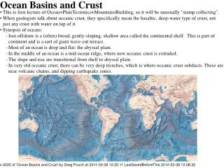
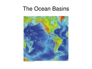
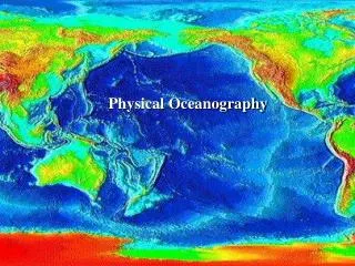
Structure of Ocean Basins Chapter 4
Continental shelves • Part of continents • Exposed or not exposed depending on sea level • Cut by submarine canyons • Vary in width depending on type of margin • Accumulate sediment from the continents (including rivers) • Fun fact: 25 % of global continental shelf is in the Bering Sea (very productive fisheries)
Continental Slope • Separated from the shelf at the shelf break (~ 130 m). • Continues to an average depth of about 4000 m (range is 3000-8000 m) • Most prominent topographic feature on earth • Marks the end of continents and the beginning of ocean crust • Average width of 20 – 100 km • Average slope of 4o (road grade) - 70 m/km or 370 feet/mile
Continental Rise • Sediments from the shelf move down the continental slope and accumulate on the continental rise. • Most are transported there by turbidity currents or through riverine-derived canyons. • Width of the rise varies and slope is gradual. • Deep sea currents shape the rises. • Slope is about 1/8 that of the Continental slope (about 0.5o or < 10 m/km or < 50 feet/mile) • Rise absent when slope terminates in a trench • Conspicuous features of passive (tectonically inactive) margins so rare in the Pacific
Trenches • Act as sediment traps! • Peru-Chile trench – oldest at the S end (shallower because its full of sediments) and vice versa • Feature of active margin/subduction zone
Deep Ocean Basins • Mainly, abyssal plains and ocean ridges • Also, trenches, seamounts and guyots • Include more than half the earth’s surface
Abyssal plain • True sea floor • Flat, sediment-covered ocean floor • Sediments often more than 1000 m thick (not so featureless underneath sediments) • Begins at the base of the continental rise • Very flat except for abyssal hills (which are low, < 1 km high, origin unclear), seamounts and guyots and islands • 25% of the earth’s surface and 42% of the ocean bottom is plain • Most common in the Atlantic and rare in the Pacific where trenches trap sediments • Average of about 4000 – 5500 m depth
Abyssal hills • Not very high and steep • Protruding ocean floor topography?
Abyssal plain sediments bury old mountains (image generated by Echo sounding)
Important features of the sea floor • Trenches • Extremely deep • Found in association with plate margins (converging); mainly in the Pacific because of plates there • Seamounts and guyots • Guyots are flat-topped seamounts (eroded) • Islands are seamounts that break the sea surface • Coral reefs • Most common in Pacific with range 40oN and 40oS • Require warm water, light (deepest living corals at 100 m), salinity (no freshwater forms) and low sediment load. • Fragile ecosystems
Trenches • Convergence zones • Cold at the bottom • 3 to 6 km deeper than adjacent seafloor • Trenches curved because of geometry of plate interactions on a sphere • Trench steeper on the island/continent side than the seaward side • Tectonically active • Big sediment traps
Island arcs • Parallel to trenches • Chain of islands behind a trench
Seamounts and guyots • Circular or eliptical • More than 1 km in relief • Alone or in groups • Old hot spots or extinct volcanoes formed at spreading centers • Guyots have flat tops
Coral reef formation • Atolls – around volcanoes • Fringe reefs • Corals grow up to keep in the sunlight • Evidence of old reefs at 1400 m
Oceanic Ridges 15 cm/yr at Iceland Includes diverging and converging boundaries.
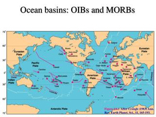
Ocean ridge system • Describe plate boundaries • Largest and longest mountain range on earth • Made up of young, basaltic rock at active spreading centers • Ridges devoid of sediment • Oceanic ridges and associated structures account for 22% of the world’s surface (compare to all land which is 29%!) • < 60% of their length is at the center of basins • Youngest rocks at spreading centers • Steeper ridges at slower spreading centers
Lavas • Lava cooling underwater forms pillow lavas • Solidifies rapidly because of contact with cold seawater; this also slows flow • Water pressure keeps gases in magma “solution” during cooling • Lave extruded on land • Cools more slowly; flows longer • Releases gases (sometimes explosively)
Transform faults • Fractures in the lithosphere along which movement has occurred • Characterized by shallow earthquakes • A result of the earth being a sphere • Transform faults are the active parts of fracture zones • Fracture zones extend further away from ridge axis and are evidence of past transform faulting. • Lithospheric plate on either side of transform faults move in opposite directions • Outward sections of fracture zones move in the same direction
Structure of the mid-Atlantic Ridge between FL and W. Africa Depressed central rift valley is in blue
Further North and West Seismic profile of ridge being buried
Hydrothermal vents • Discovered only in 1977 along the East Pacific Rise (now found on mid-Atlantic Ridge, in the Sea of Cortez and on the Juan de Fuca Ridge) • Really hot (~ 350oC), mineral-rich water (black smokers). Can form chimneys, deposit minerals, affects ocean chemistry, etc. • Seawater descends through fissures to meet hot rock. Superheated seawater dissolves minerals and escapes upward. • Found in Lake Baikal – future ocean? • Average water temperature is 8 – 16oC (bottom ocean water is 4oC)
Broad continental shelves Trenches Ridges GBR Red Sea Galapagos Iceland
Take home points • Continental shelf, break, slope and rise (relative slopes) • Abyssal plains • Mid-ocean ridge system (describes plate boundaries) • Hydrothermal vents, coral reefs, seamounts and guyots