Download
1 / 12
120 likes | 227 Views
WQX and the Arkansas Ambient Groundwater Quality Database. Roger Miller, P.G . Outline. ADEQ Groundwater Protection Program information N eed for database upgrade/modernization Project objectives and principal components End uses and specific applications Advantages.

E N D
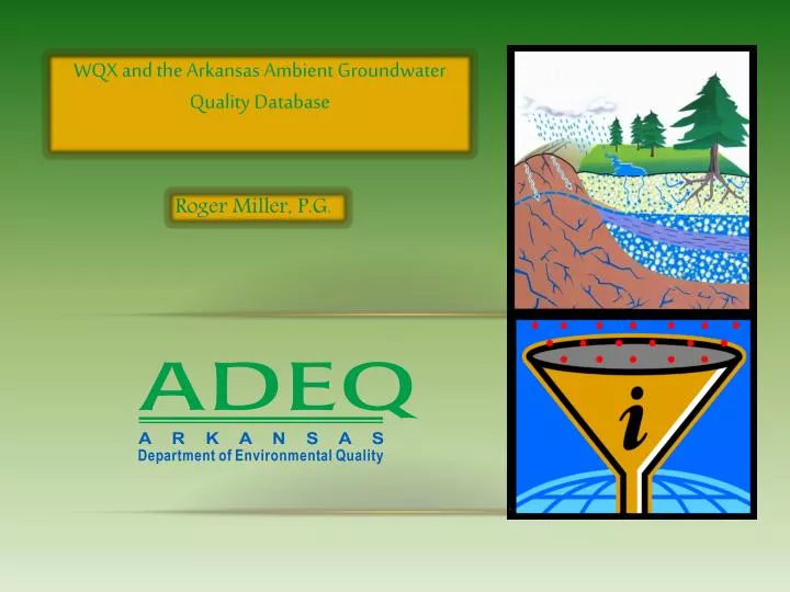
WQX and the Arkansas Ambient Groundwater Quality Database Roger Miller, P.G.
Outline • ADEQ Groundwater Protection Program information • Need for database upgrade/modernization • Project objectives and principal components • End uses and specific applications • Advantages
ADEQ Groundwater Protection program History and Structure • Housed in Planning Branch of Water Division (non-regulatory) • Normal staff: 2 geologists; one supervisory/program manager • Funding: Percentage of EPA Clean Water Act Section 106 Grant • Initial “prototype” ambient monitoring areas established in late 1980s
ADEQ Groundwater Protection program cont’d. Principal responsibilities: • Manage Ambient Groundwater Quality monitoring program • Administer funding provided to other state GW Protection Programs, e.g. Wellhead Protection Program at AR Dept. of Health • Technical support to ADEQ staff, other agencies and organizations • Collaboration with University researchers • Remediation oversight - contamination events not covered by existing regulations
Ambient Groundwater Monitoring Program • Currently 11 monitoring areas established, 1 in development • Approximately 295 active sites, of 431 sites sampled since inception • Monitoring schedule: each site sampled every 3rd year on average • Types of monitoring sites: • Domestic wells • Public water supply wells • Springs • Monitoring wells • Research sites
Types of data • General chemistry: Major ions, trace metals, nutrients, Total Organic Carbon (TOC) • Volatile Organic Compounds (VOCs) and/or Semi-volatiles (SVOCs) where warranted • Field parameters – pH, specific conductance, temperature, dissolved oxygen (DO), and oxidation-reduction potential (ORP) • Site attributes – locational coordinates, well type (use), date drilled, well depth, casing depth, geologic unit name, water-producing zones, etc.
Existing Database disadvantages Need for upgrade/modernization • Not available online • Data not aggregated into single database • Lab results are not available in single worksheet; manually compiled • Data management process is time-consuming and error prone • Older data not available electronically
Project origination and application process • Discussions with USGS and other agencies that maintain GW data • Conceptual design • Develop and finalize proposal • Establish time lines of separate goals • Develop budget for each goal and various phases • Agency review/approval process • Application, follow-up revisions and other submissions
Project Objectives • Goal 1 (ADEQ): • Collect and standardize existing “legacy” data from disparate sources (ADEQ and other agencies and organizations) • Upload legacy data to EPA STORET database • Goal 2 (ADEQ): • Establish automatic flow of ambient groundwater data from ADEQ Laboratory Information Management System (LIMS) to STORET • Goal 3 (USGS) Develop and deploy a map-based web page to: • Provide simultaneous online access to USGS NWIS and STORET data • Allow depiction and selection of sites on interactive map • Download selected data in various formats • Provide built-in visualization of data via hydrochemical plots for analysis and comparison of analytical results
Project features • Digitization of historic “legacy” data from various sources • Consistent flow of current ambient ADEQ groundwater data to STORET • Interactive map to select data types and locations • Simultaneous access to USGS and ADEQ databases • Various export formats (WQX-XML, MS-Excel, CSV/tab delimited) • Visualization techniques for analysis and comparison
Uses of ambient Groundwater Data • Assess background conditions • Support groundwater research • Support ADEQ permitting decisions • Guide public water supply well siting and development • Support groundwater management decisions (protection, conservation, standards-setting) • Evaluate spatial and temporal trends
Advantages of improved process For ADEQ: • Groundwater data no longer distributed in separate tables • Built in error traps • Frequent uploads to STORET • Time savings For users: • Comprehensive database • Web accessible • Map display/selection • Integral graphical depictions for analysis and comparison