Download
1 / 10
120 likes | 306 Views
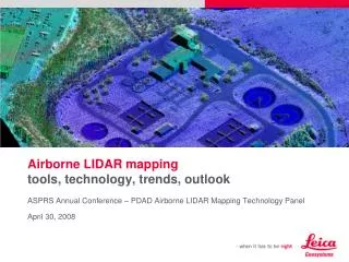
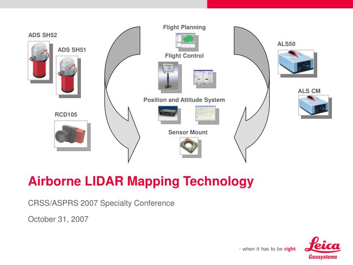
Flight Planning. ADS SH52. ALS50. ADS SH51. Flight Control. ALS CM. Position and Attitude System. RCD105. Sensor Mount. Airborne LIDAR Mapping Technology. CRSS/ASPRS 2007 Specialty Conference October 31, 2007. Leica focus Sensor performance and data acquisition productivity

E N D
Flight Planning ADS SH52 ALS50 ADS SH51 Flight Control ALS CM Position and Attitude System RCD105 Sensor Mount Airborne LIDAR Mapping Technology CRSS/ASPRS 2007 Specialty Conference October 31, 2007
Leica focus Sensor performance and data acquisition productivity GNSS/IMU workflow GrafNav IPAS Pro Point cloud generation ALS Post Processor Third party developer focus Editing and project management productivity Filtering/editing/QA: TerraScan/TerraModeler/TerraMatch VLS LIDAR Analyst QCoherent LP360 Merrick MARS Tiltan TLiD Applied Imagery Quick Time Modeler / Quick Time Reader LIDAR project management GeoCUE LIDAR workflowsfor DEM data production
Sample LIDAR-derived DEM data productssafety • Disaster prevention / disaster monitoring • Forest fire fuels assessment
Sample LIDAR-derived DEM data productssecurity • Defense • Supply route monitoring • Spot reconnaissance • Base mapping • Homeland security • Border monitoring • Urban event risk assessment • Law enforcement • Covert activity detection
Sample LIDAR-derived DEM data productsenvironment • Coastal survey • Watershed management • Flood zones • Erosion • Forest management • Tree health • Biometric data • Forest inventory • Development impact / change detection Image courtesy of Watershed Sciences
Sample LIDAR-derived DEM data productsfused data for multiple applications • Typical sensors co-collecting with ALS DEM data • Medium-format RGB • Medium-format CIR • Thermal imagery • Hyperspectral imagery • Auxiliary sensors collect: • Additional spectral regions • High definition planimetric data
Future development in LIDAR-derived DEM workflowsmarket requirements, paths for 3rd-party developers • Speed – but can be overcome with more CPUs • Black box – minimizing human interaction, especially during the filtering and editing stages; possible impact of Full Waveform Digitizing (FWD) LIDAR data on accuracy and ability to filter data • Multi-sensor automation - easier fusion from dissimilar sensors – airborne LIDAR + terrestrial LIDAR, LIDAR + airborne (Vis or NIR) imager, LIDAR + thermal imagery • Auto QC – automating the quantitative measurement of output data quality
What’s newadditional milestones since ASPRS annual meeting Image courtesy of North West Geomatics • Huge projects being undertaken w/ MPiA systems (Example – NWG has collected 315,000 km², 835 aircraft hours, 1 point / m², 0 sensor problems to date on 750,000 km² collection) • Number of new system deliveries/demos for high altitude use @ 4500 m – 6000 m AGL • Hexagon acquires NovAtel • Participation in large-scale defense exercises • Customer support staff increased to 30 staff 4500 m AGL, MPiA, 66º FOV, 1.5 m avg. post spcng
Please insert a picture(Insert, Picture, from file).Size according to grey field(10 cm x 25.4 cm). Scale picture: highlight, pull corner point Cut picture: highlight, choose the cutting icon from the picture tool bar, click on a side point and cut Thank you!visit us in our booth Doug Flint doug.flint@leicaus.com