Download
1 / 98
990 likes | 1.24k Views
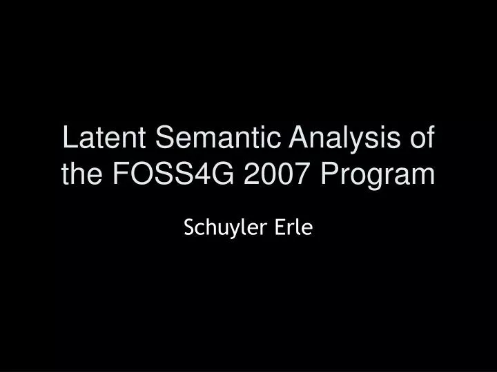
Latent Semantic Analysis of the FOSS4G 2007 Program. Schuyler Erle. The Seven Dimensions of OSGeo. 3 days. 120 presentations. what is the semantic structure of FOSS4G 2007?. 219 proposals. 364 reviewers. 364 dimensions. latent semantic analysis. singular value decomposition*.

E N D
Latent Semantic Analysis of the FOSS4G 2007 Program Schuyler Erle
singular value decomposition* *go look it up
Minerva: Integrating GIS, 3D, and Virtual Reality Thu 8:30-10:00 • Georeferencing Historical Maps over the Internet Wed 13:00-14:30 • Open Source Geospatial Software Integration at the United States Army Corps of Engineers (USACE) Tue 13:00-14:30 • Ship Tracking with MapServer for Fun and Profit Thu 8:30-10:00
Design and implementation of internet-based "Public Participation GIS" using a user-centered process and the open source model • Tue 15:00-16:30 • Open Source GIS and Sustainable Development • Thu 10:30-12:00 • Community Based Participatory GIS using Plone & PrimaGIS Tue 13:00-14:30 • Making Use of Open Source Geo-spatial software for supporting community based projects • Tue 15:00-16:30
GeoServer, past, present and future Wed 13:00-14:30 • Secrets of the JTS Topology Suite Wed 13:00-14:30 • Coordinate System Transformations in Geotools and uDig - Contribution of Google Summer of Code 2006 and 2007 Thu 10:30-12:00 • GeoServer and the GeoWeb: KML, GeoRSS, TileCaching and SuperOverlays Wed 13:00-14:30 • Bringing the Web Processing Service to a new stage – new 52°North WPS Features Wed 10:30-12:00
Automatic Generation of Web-Based GIS/Database Applications Thu 10:30-12:00 • Mapping with AJAX and SVG Tue 13:00-14:30 • Web based Vehicular tracking system. Wed 8:30-10:00 • Cartoweb4, a easy to use and extensible web GIS application built on top of OpenLayers. • Wed 15:00-16:30 • A full Web 3D GIS, using PostGIS and X3D output • Wed 13:00-14:30
A year in the life of OpenStreetMap: How OSM is mapping the world. Tue 15:00-16:30 • Free Software Business Thu 8:30-10:00 • The Gift Economy Ain't Free: Getting Help with Open Source Software Thu 8:30-10:00 • OSGeo: A community of communities Thu 10:30-12:00 • Free and Open Geospatial Content: Intellectual Property Rights and Cost Tue 15:00-16:30 • Towards a Public Geodata Repository Tue 15:00-16:30
gvSIG: towards 4D GIS Thu 8:30-10:00 • SEXTANTE: a gvSIG-based platform for geographical analysis Wed 10:30-12:00 • gvSIG Goes Mobile. gvSIG porting for mobile devices. Wed 8:30-10:00 • uDig Case Studies Wed 10:30-12:00 • JGrass and Udig, chronicles of a lovestory • Wed 10:30-12:00
Transitioning Low Earth Orbit Satellite Archive Data from Informix (Geodetic DataBlade) to PostgreSQL (PostGIS) Wed 13:00-14:30 • Processing and dissemination of satellite remote sensing data in an heterogeneous environment. • Tue 15:00-16:30 • High-Performance Image Processing and Cartography using the NASA Vision Workbench Wed 15:00-16:30 • Development of Geoprocessing Service with Realtime Data Using WPS and SOS Open Standard Wed 10:30-12:00 • TerraLib: an open source GIS library to build customizable geographical applications on spatio-temporal databases Thu 10:30-12:00
Putting the Pieces together: Combining different Open Source components toward developing a powerful, Open Source WebGIS application framework. Wed 13:00-14:30 • From Mapping to Metadata, From Simple to Enterprise Portals? - A one stop solution using portlet technology Wed 8:30-10:00 • GeoMOOSE - A client framework focusing on local government collaboration. Thu 8:30-10:00 • Exploring the Synergies between Commercial and Open Source Software Wed 8:30-10:00 • Best Business Practices for Implementing Open Source Web Mapping Technology Thu 10:30-12:00 • Trends of the Geo Web Tue 13:00-14:30
Analyzing Building Damages of a Major Earthquake Using GRASS and R Wed 15:00-16:30 • RiskBox: Natural Hazards and Risks Analysis within the GIS GRASS Wed 15:00-16:30 • Development and Implementation of Cut and Fill Problem in GRASS With 3D Representation Wed 10:30-12:00 • The use of QGIS and Grass to deliver GIS applications to a wider audience. Wed 10:30-12:00 • Quantum GIS -- Five Years and Counting • Tue 15:00-16:30
Adding Analytic Muscle to Spinning Globes: Bulking Up Google Earth and Virtual Earth With PostGIS. • Thu 8:30-10:00 • Developing Web 2.0 Applications Using FDO and Open Source RDBMS Data Providers Wed 15:00-16:30 • PostGIS Spatial Database: Introduction and Case Studies Wed 10:30-12:00 • Database Shootout: PostGIS and MySQL Wed 8:30-10:00 • How robust is your spatial query? A formal taxonomy to express spatial intersections Wed 13:00-14:30 • GDAL/OGR Project Status Report Tue 15:00-16:30
Delivering Tropical Medicine Solutions with Integrated Open Source GIS and Statistics. Tue 13:00-14:30 • The Amazon Deforestation Monitoring System: a large environmental geographic database developed on TerraLib and PostgreSQL Thu 10:30-12:00 • Using Open Source to analyze Canada's National Forest Inventory Wed 15:00-16:30 • Yukon Planning Atlas - Decision Support tools for regional land use planning. Wed 10:30-12:00 • Species Distribution Modeling Using An Open Source Geospatial Software Stack Wed 10:30-12:00
GOWS Project: Towards Web Services Dedicated to Thematic Mapping Wed 8:30-10:00 • Rock and a Hard Place Wed 8:30-10:00 • How to blow away $AU3.5m ($US2.97m) with GeoFOSS in eight weeks and still make friends Thu 8:30-10:00 • ossimPlanet - a collaborative open source virtual Earth Thu 10:30-12:00 • Avian influenza RSS web mapping exploring geographic and temporal aspects of outbreak events • Tue 13:00-14:30 • Using the Atom Publishing Protocol for Web GIS • Tue 15:00-16:30
A Survey of Open Source GIS • Tue 13:00-14:30 • OpenLayers - Agile Geography in a Browser • Wed 15:00-16:30 • WMS Performance: Mapserver vs. Geoserver • Wed 8:30-10:00 • Tips for the PostGIS Power User • Wed 10:30-12:00 • GeoServer, past, present and future • Wed 13:00-14:30 • GeoServer and the GeoWeb: KML, GeoRSS, TileCaching and SuperOverlays • Wed 13:00-14:30
Lifemapper: Using and Creating Geospatial Data and Open Source Tools for the Biological Community Wed 10:30-12:00 • Analyzing Building Damages of a Major Earthquake Using GRASS and R Wed 15:00-16:30 • How to blow away $AU3.5m ($US2.97m) with GeoFOSS in eight weeks and still make friends Thu 8:30-10:00 • Delivering Tropical Medicine Solutions with Integrated Open Source GIS and Statistics. Tue 13:00-14:30 • Operational, Timely Fire Data on an Open Source Stack. • Thu 8:30-10:00 • Yukon Planning Atlas - Decision Support tools for regional land use planning. Wed 10:30-12:00