Download
1 / 9
90 likes | 107 Views
Discover the interconnectedness of land, water, and living organisms in our watershed. Join our group assignments to explore different sections of the watershed and understand the impacts on water quality. Enhance your knowledge with Google maps and Google Earth. Get ready for an enlightening class presentation!

E N D
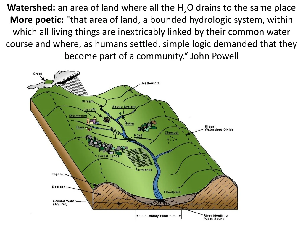
Watershed: an area of land where all the H2O drains to the same place More poetic:"that area of land, a bounded hydrologic system, within which all living things are inextricably linked by their common water course and where, as humans settled, simple logic demanded that they become part of a community.“ John Powell
Know your HUC • Before states, cities, counties… you were known by your watershed! • Hydrological unit code HUC! • More digits, more “specific” • HUC-2 (17) is the pacific northwest • HUC-4 (1706): Lower Snake River • HUC-8 (17060108): Palouse • HUC-12 (170601080202) is our specific drainage
Group Assignments 5 3 4 2 1
Assignment In your group (From Friday), take a watershed tour • Follow the river to its headwaters on Moscow Mountain, What impacts the water quality? • Farming, roads, straightening, livestock, houses, industrial, parking lots, parks, fields, playing fields/grass, etc… • Google maps, Google earth, personal knowledge, etc… Class Presentation: Group 1: South of Troy Highway to Buffalo Hump Group 2: In town to Mtn View Park (City limit to North) Group 3: Mtn View park to headwaters Group 4: Downstream of our site to WA State Line Group 5: Stateline to the Snake