Download
1 / 17
170 likes | 212 Views
Explore the groundbreaking 3D visualization of Canada's geological data, providing advanced insights for research, mining, groundwater, and natural hazard analysis. The project aims to revolutionize geology mapping and collaboration through an integrated, multi-resolution approach. Experience in-depth models from surficial to mantle layers, benefiting environmental studies, mining, and more. Find out about the collaborative efforts between national and international geological organizations to enhance data visualization and accessibility. Discover the next generation of 3D modeling technology and its significant impacts on understanding Canada's geology. Visit the link for more information and progress updates.

E N D
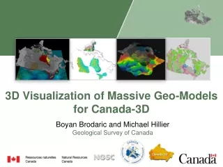
3D Visualization of Massive Geo-Models for Canada-3D Boyan Brodaric and Michael Hillier Geological Survey of Canada NGSC
C3D Objectives authoritative evergreen synthesisof CAN geology one-stop webaccess to CAN geology 2015-2017 proof-of-concept MAPS ANALYSES 3D/2D EXPERTISE DATABASES REPORTS
Expected Impacts Environment (e.g. C02 Storage, CC) Mining & Exploration Groundwater Natural Hazards … Research, Education, and others
Approach principles: collaborative, evergreen, integrated, multi-resolution container: surficial, bedrock, mantle layers / surfaces fill:models within and between layers topo surface surficial depth-to-bedrock surface bedrock MOHO surface mantle
National and International Collaboration CAN Fed-Prov-Terr NGSC formal agreement: nat’l geological framework CAN-UK-FR-AU OneGeology research: Loop next gen. 3D modelling
Results: 2016-2018 highlights Surficial Bedrock depth-to-bedrock surface Prec/Phan boundary surficial geology compilation bedrock geology compilation 3D viewer – desktop, web MOHO surface 2D viewer - web Mantle Modelling
Problems model & data availability modelling methods (data poor, know rich) storage, access, exchange visualization (e.g. CAN topo)
Solution distinctstorage, modelling, access, viz data / model management system extensive geometry types web / desktop 3D tiling open source Modelling Visualization Storage data model
Technologies > 30 geo-modelling software evaluated Subsurface untested Simple geometry OGC i3S 3D Tiles OGC CDB
Spatial Decomposition Octree hierarchical partitions Spatial index for search and retrieval
Generalization Geo-model inserted in db at octree root (id, gen_model, raw_model, spatial_index, feature_type) Generalization algorithm 1. Generalize node if > threshold (~1M objects) 2. Subdivide node if generalized 3. Go to (1) for each subdivided node
Retrieval and Streaming Determine scale-appropriate blocks Retrieve blocks from db
Results Success!... efficient and effective 4 nat’l surfaces, 2 dense geo-models
Evaluation Storage costs post-generalization
Evaluation Total render time < 1s for any level Data loading time (pre-render):
Summary Progress on new national 2D and 3D compilations for geology of Canada Progress on technological infrastructure for massive geo-models Investigating viz alternatives …Video
Thank you! https://xp-dev.com/trac/canadain3d/ NGSC