Download
1 / 60
610 likes | 764 Views
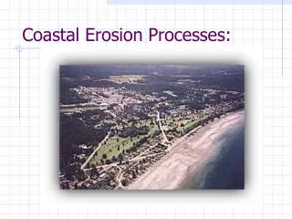
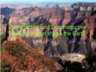
SLOW Processes that Shape the Earth PART 2. EROSION. Mrs. Wright Hugh B. Bain Middle School Cranston, RI. Earth - developed over long periods of time through continual change processes. STUDENTS: Evaluate slow processes of 1) weathering 2) erosion and 3) mountain building.

E N D
SLOW Processes that Shape the EarthPART 2. EROSION Mrs. Wright Hugh B. Bain Middle School Cranston, RI
Earth - developed over long periods of time through continual change processes. STUDENTS: • Evaluate slow processes of 1) weathering 2) erosion and 3) mountain building. The following slides are on erosion. • Determine how the earth has changed and will continue to change over time.
EROSIONProcess by which natural forces or agents (wind, water, ice, or gravity) move weathered rock and soil from one place to another Sediment Deposition Material moved by erosion (pieces of rock, soil, plant, & animal) Occurs where agents of erosion deposit sediment & changes shape of land cover0116‑sediment.jpg creek edge showing tiers of sediment deposition & gravel northcoastjournal.com
Causes of Erosion 1. Gravity 2. Running Water 3. Glaciers 4. Waves 5. Wind
1. Gravity What is gravity ? Force that moves rock and other materials downhill causing mass movement
Types of Mass Movement Caused by Gravity A. Landslides B. Mudflows C. Slump D. Creep
A .a FAST Process Landslides Occurs when rock & soil slide quickly down a steep slope Most destructive landslide.jpg In my earlier post, we discussed the causes of landslides. kshitija.wordpress.com
B. a FAST Process Mudflows • Rapid downhill movement of a mixture of water, rock, & soil ueol_02_img0070.jpg scienceclarified.com
C. a FAST Process Slump Mass of rock & soil suddenly slips down a slope in one large mass (often when water soaks bottom of clay soil) slump1.jpgSlump at Double Ditch - April, 1988 (Burleigh County, N.D.) more mass ... umt.edu
D. Creep Very slow downhill movement of rock & soil (often from freezing & thawing of water in cracked layers of rock beneath soil creep_kathryn1.jpg shoop2010.weebly.com
2. Running Water Major agent of erosion that shaped Earth’s land surface Raindrops loosen soil & carry particles. splash_eriosion.jpgRaindrop
Runoff Water that runs over the Earth’s surface runoff.jpg Surface runoff absoluteastronomy.com
Forms of Runoff (smallest to largest): Rills →Gullies→Streams → Rivers → Lake
Running Water - Runoff Rill → rill.jpg
Gully → • A channel with water only after it rains runoff‑670291.jpg
Stream → 9907_05_15‑‑‑Stream_web.jpgStream freefoto.com
River→ falls‑river‑towards‑sheep‑falls.jpgrivers flyfishingfrenzy.com
Lake → Vg‑025.jpglarge lake shannontech.com
Rivers Through erosion, rivers can create a variety of features falls‑river‑towards‑sheep‑falls.jpg rivers flyfishingfrenzy.com
River Features A. Valleys B. Waterfalls C. Floodplains D. Meanders E. Oxbow lakes
A. Valley Elongated low area between hills formed by a stream 258530373_87b9bf351d.jpg KulluValley's Beas River formed... flickr.com
B. Waterfall Occur where a river meets rock that erodes slowly & flows over softer rock downstream waterfallLG.jpg Largest waterfall in Lesotho, Africa todayscampus.com
C. Floodplain Flat, wide area of land along river. Lower down on its course where land slopes gently, river spreads out forming a river valley Floodplains here floodplain.jpgfloodplain belmont.sd62.bc.ca
D. Meander Loop-like bend in the river (S shape - Mississippi) meander_word_picture.jpgMeandering csahf.blogspot.com
E. Oxbow Lake Meander that has been cut off from the river Horseshoe shape Oxbow_lake,Yamal_Peninsula,Russia.JPG dic.academic.ru agilogy.com
Oxbow Lake During a flood, high water finds a straighter pass downstream As water falls, sediments dam up ends of meander Forming an Oxbow 111232009.jpg Oxbow Lakes Kentucky, United States ... geocaching.com
3. Glaciers What are glaciers? Any large mass of ice that moves slowly over land
Types of Glaciers A. Continental Glaciers B. Valley Glaciers
A. Continental Glacier Covers much of a continent Flow in all directions as they move (like pancake batter in frying pan) In distant past – covered one third of Earth’s land Have advanced, then retreated (last time - 10,000 yrs ago), or melted back, several times ContinentalIce.jpg The Continental Ice Sheet is the most significant of all the glacial agents ... homepage.montana.edu
B. Valley Glacier Long & narrow glacier Forms when snow & ice build up high in a mountain valley Sides of mountain keep them from spreading out in all directions Usually move down valleys already cut by rivers Much smaller than continental glaciers Tidewater‑Glacier.jpg There are an estimated 100000 valley glaciers travelwithachallenge.com
Processes of Glacial Erosion A. Plucking B. Abrasion
A. Plucking Glacierpicks up rocks as it flows over land; Rock fragments & boulders freeze to glacier bottom & are carried. 030515_75mhadaidh.jpg PLUCKING – a type of erosion. geogars.wordpress.com
B. Abrasion Many rocks remain on bottom & get dragged along Gouges & scratches bedrock striations.jpgAbrasion sometimes results in striations (scratches on the bedrock)… geogars.wordpress.com
Landforms from Glacial Deposition A. Till B. Moraine C. Kettle
A. Till Mixture of sediments (sand, silt, clay, boulders) deposited directly on surface till2.gif Area adjacent to Sherman glacier is covered with a coarse glacial till. pubs.usgs.gov
B. Moraine Till deposited at edges of glacier form ridge (Long Island, NY) 03 river‑thumb‑608x456.jpg Much of New York's Long Island was once the ... blogs.nationalgeographic.com
C. Kettle Depression formed when ice is left in glacial till When ice melts, kettle remains forming ponds or kettle lakes kettle1.gif The largest kettle shown is ~ 150 feet in diameter. Bering Glacier flows ... pubs.usgs.gov
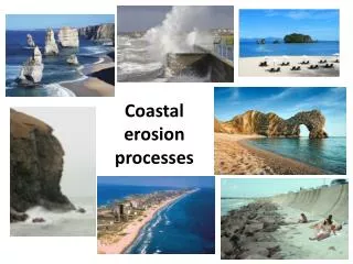
4. Waves Form from wind that blows across water’s surface Shape coast through erosion by breaking down rock & transporting sand & other sediment.
Landforms Created by Wave Erosion A. Headland B. Sea Arch C. Sea Cave D. Sea Stack E. Wave Cut Cliff
A. Headland Part of shore sticks out into ocean Made of hard rock that resists erosion longer headland_soldiers_rock.jpg Headland right of Soldier's Rock islaygallery.com
sea‑arch‑volcanoes‑national.jpg Sea arch - Volcanoes National Park tripadvisor.com B. Sea Arch 070906‑045.jpg Ilena in her kayak going through a sea arch(cave) on ...bryanhansel.com the_other_way.1212007260.sea‑arch.jpg Sea arch, Tutukaka, New Zealand. Poor Knights Islands travelpod.com
Folga Skerry.jpg Sea Caves landforms.eu → C. Sea Cave Sand Island Sea Caves.jpg Madeline Island Sea Caves. Top Canoe destination in the world, ... en.petitchef.com ↓ Sea+Cave.jpg Just one of many sea caves seen on the trip. ↓kauai-artist.blogspot.com
D. Sea Stack IMG_3180.jpgSea Stacks ideaphore.org Climbers_on_the_450ft_Sea_Stack_Old_Man_Of_Hoy,_Orkney.jpg Climbers on the 450ft sea stack Old Man Of Hoy, Orkney heason.net
E. Wave Cut Cliff calif_wavecutcliff.jpgwave cut cliff www2.pvc.maricopa.edu
Deposits by Waves A. Beach B. Longshore Drift C. Sandbar D. Barrier Beach
A. Beach EastBeach2.JPG East Beach... riparks.com
B. Long Shore Drift Waves repeatedly hit beach, beach sediment moves down beach with current spit – beach that projects out like a finger result of longshore process CapeFear.jpglongshore drift. geolab.unc.edu dungeness‑spit.jpg Dungeness Spit, Straight of Juan de Fuca livingwilderness.com
C. Sand Bar Long ridges of sand parallel to shore Australia_Lakeland_Island_Sand_Bar.jpg 735 × 450 - Lakeland Island Sand Bar australiaadventures.com
D. Barrier Beach Form when storm waves pile up large amounts of sand forming long, narrow island parallel to coast 14.jpg Gravel barrier beach, Coombs Cove, Hermitage Peninsula. gsc.nrcan.gc.ca
Wave Terms A. Impact B. Abrasion