Download
1 / 63
640 likes | 829 Views
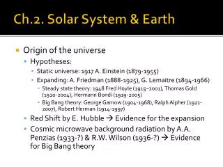
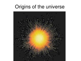
Topic 2 Origins--The Universe, Solar System, Earth. GEOL 2503 Introduction to Oceanography. Important Ages. Universe —about 15 billion years old Solar System —about 5 billion years old Earth —about 4.6 billion years old.

E N D
Topic 2Origins--The Universe, Solar System, Earth GEOL 2503 Introduction to Oceanography
Important Ages • Universe—about 15 billion years old • Solar System—about 5 billion years old • Earth—about 4.6 billion years old
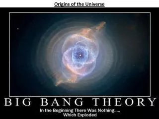
A supernova exploded 5 billion years ago. A shock wave sent a nearby nebula into a spin. The Nebula, a cloud of gas and dust, contracted and heated, forming the Sun. Outer dust particles collided, clumped together, and formed the planets
Early Planet Earth • Bombarded by particles of all sizes • Material accumulated • Interior temperature increased • Very hot, homogenous composition • Layers formed by differentiation--lightest material to the surface, heaviest material to the center
Differentiation give us a layered planet Early Earth heats up due to radioactive decay, asteroid impacts. Denser material sinks, lighter material rises. http://www.indiana.edu/~geol105/images/gaia_chapter_3/earth_differentiation.htm
Earth—A differentiated planet • Atmosphere, density less than 1g/cm3 • Hydrosphere, 1g/cm3 • Crust, 2.7-2.9 g/cm3 • Mantle, 3.3-5.6 g/cm3 • Core, 10-14 g/cm3
Density • Mass per unit volume • D = M/V • grams per cubic centimeter (g/cm3) • kilograms per cubic meter (kg/m3) • pounds per cubic foot (lb/ft3)
Mantle—the layer between the core and the crust Core—the center of the Earth is molten on the outside and solid on the inside We’ll see more in plate tectonics
How did the oceans form? • Water vapor came to the surface during heating of the interior • The vapor condensed at the cooler surface to form the oceans • Perhaps most important was water brought to Earth as ice in comets
Natural Time Periods • Year • Month • Day • Seasons • Many oceanographic and biologic processes are controlled by these time periods
Year • Time it takes for Earth to complete one orbit around the Sun • 365 ¼ days • Adapted to 365 days for convenience • Add an extra day every 4 years—leap year
Earth’s Orbit SUN Earth’s orbit is an ellipse, not a circle. Average distance to Sun is 93 million miles (1 Astronomical Unit).
What causes the seasons? The 23 ½° tilt of Earth on its axis
Important Seasonal Dates (see previous slide) First day of summer (summer solstice)—June 22—Sun is directly above the Tropic of Cancer (23.5 degrees north) First day of autumn (autumnal equinox)—September 23—Sun is directly above the equator First day of winter (winter solstice)—December 21—Sun is directly above the Tropic of Capricorn (23.5 degrees south) First day of spring (vernal equinox)—March 21—Sun is directly above the equator
Lunar Month • The time for the moon to pass through all 4 phases: • new moon, first quarter, full moon, last quarter • 29 ½ days • 4 phases approximately match the 4 weeks of the month
Solar Day • Time for the Earth to make 1 rotation on its axis • 24 hours
The Shape of the Earth • Nearly spherical • Slight bulge at the equator • Mount Everest is the highest mountain—29,000 ft • Challenger Deep is the deepest ocean depth—36,000 ft
Latitude & Longitude • Location system • Grid superimposed on the Earth’s surface • Use crossing of latitude and longitude lines to identify locations • Each latitude/longitude intersection is unique
Latitude -Measured north and south from the equator -Lines of latitude are always parallel -Circumference decreases to zero at poles
Latitude • Also called parallels • Begin at the equator—O° latitude • All lines of latitude are parallel (what is the definition of parallel lines?) • North Pole—90° N • South Pole—90° S • Lines (circles) of latitude become smaller as the poles are approached
Latitude (parallels) can be used for measurement—Why? • 1 degree of latitude equals 60 nautical miles • Each degree divided into 60 minutes • 1 minute of latitude equals 1 nautical mile • Each minute divided into 60 seconds • Why can’t longitude be used for measurement?
Longitude -Measured east and west from the Prime Meridian -All meridians are the same size -Meridians converge at the poles
Longitude • Also called meridians • Begins at the prime meridian—0° longitude • International date line—180° longitude • Lines run from North Pole to South Pole • Think of orange segments • Identified by degrees east and west of the prime meridian
A great circle is created by a plane crossing a sphere at its center A great circle divides the sphere in two equal hemispheres A small circle is created by a plane crossing a sphere not at its center Great Circles great circle small circle All lines of longitude are great circles. The equator is the only line of latitude that is a great circle.
The prime meridian, set by international agreement, runs through the Old Royal Observatory in Greenwich, England
Degrees Minutes Seconds: Latitude: 33° 34′ 48″ N Longitude: 085° 04′ 36″ W Decimal Degrees: Latitude: 33.58 Longitude: -85.07667 http://www.lat-long.com/ Location of Carrollton, Georgia
Geographic Coordinates (Globe)(earth is divided into 360º) Label on globe: Equator Prime Meridian Tropic of Cancer Tropic of Capricorn Arctic Circle Antarctic Circle 30 N 30 S 30 W 60 W 90W
Longitude and Time Circle or sphere has 360 degrees Earth rotates once in 24 hours Thus, Earth turns 15 degrees per hour Local “noon” is when the sun is directly overhead
Longitude and Time • Earth turns 15 degrees per hour • With an accurate clock we can measure Earth’s rotation • The prime meridian is zero longitude • The universal clock is set to noon when the sun is directly above the prime meridian • Greenwich Mean Time, Universal Time, Zulu Time
Longitude and Time • Forget about time zones, think about universal time • If it’s noon in Greenwich, England, what time is it in Carrollton? • In other words, how many times zones are we from Greenwich, and in what direction? • Five, to the west, our noon (EST) = 1700 GMT • Except during DST when our noon = 1600 GMT
Longitude and Time • A position west of the prime meridian that is directly under the Sun at 1:00 P.M. GMT is 15° W. • A position east of the prime meridian that is directly under the Sun at 11:00 A.M. GMT is 15° E.
John Harrison (1693-1776) • British clockmaker • Solved the “longitude problem” • Built first chronometer in 1735 • Fourth model (1761) lost only 51 seconds on 81-day voyage • Captain Cook used Harrison’s chronometer to help produce accurate charts
John Harrison’s fourth marine chronometer—portable and accurate enough for determining longitude.
Navigation • Radar • Loran • Global Positioning System
Radar • Radio detecting and ranging • Image is displayed on a radar screen when radio pulses are sent out, reflected from an object, and returned to the antenna
Loran • Long-range navigation • Measures the difference in arrival time of radio signals from pairs of land stations
Global Positioning System • GPS • Navigational satellites transmit digital codes through radio signals to ground receivers • Receivers generate identical codes at the same time
Types of Maps • Contour map—areas of equal value • Topographic map—elevation on land • Bathymetric map—water depth • Physiographic map—uses color and shading to show perspective • Nautical charts—details for navigation, especially nearshore hazards
Contours connect points of equal value Contour Map