Download
1 / 24
240 likes | 250 Views
Enhance water management efficiency with WaterWare, a powerful system offering data management, monitoring of time series, rainfall-runoff modeling, irrigation water demand insights, and water quality analysis. Utilize this tool for water budget modeling, multi-criteria optimization, and decision support system (DSS) for floods. WaterWare provides user support and system maintenance, ensuring seamless operation for various applications.

E N D
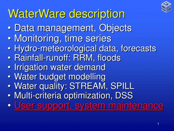
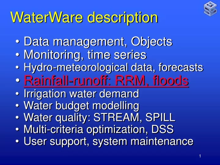
WaterWare description • Data management, Objects • Monitoring, time series • Hydro-meteorological data, forecasts • Rainfall-runoff: RRM, floods • Irrigation water demand • Water budget modelling • Water quality: STREAM, SPILL • Multi-criteria optimization, DSS • User support, system maintenance
Rainfall-Runoff: Translates rainfall (and snow) over a catchment into outflow (including snowmelt). RRM is a lumped (homogeneous HRU) vertically distributed, dynamic (daily or hourly) mass budget model, using cascading non-linear reservoirs. Multiple HRUs can be linked into a semi-distributed representation.
RRM processes: Interception storage (vegetation) Snowpack, snowmelt Surface runoff (Hortonian) Evapotranspiration Soil moisture/storage Infiltration, interflow, (deep) percolation Groundwater recharge (deep, shallow) Surface runoff, Exfiltration (soil, groundwater baseflow), channel flow routing.
RRM functionality: Provides outflow estimates from ungauged catchments Uses an automatic, heuristic multi-criteria calibration scheme based on Gestalttheory, ranges and inequalities, evolutionary programming concepts (satisfyzing) derived from scarce observations and experience.
RRM input data: Basin morphology Meteorology (observed or modeled) • Air temperature • Precipitation Observed runoff for calibration (optional)
Weather forecast: precipitation MM5/WRF meteo model results (5*24 hrs), Storm fronts around October 20 (Turkey, regional)
Weather forecast: precipitation MM5/WRF meteo model results (5*24 hrs), Storm fronts around October 20 (Izmir, local) Driving water resources and flood forecasting models
Weather forecast: validation Validation against real-time data from on-line monitoring network hourly data, comparison criteria from EU 2008/50/EC
Rainfall-runoff model: • Hourly or daily time step • Lumped or semi-distributed • Automatic calibration • Watershed erosion, non-point source pollution
Flooding:risk assessment needs Precipitation forecast High resolution DEM (30-1 m from stereo satellite ASTER, LIDAR Land use maps Soils, vegetation Drainage network (natural, sewers).
SWMM:storm water management drainage network representation: