Download
1 / 67
670 likes | 858 Views
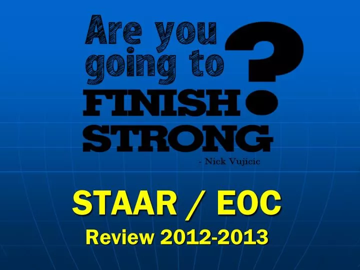
STAAR / EOC Review 2012-2013. Types of Maps. Physical landforms, bodies of water, etc. Political Man made borders/boundaries Historical Thematic Population Density Maps Resource or product maps. Latitude and Longitude. Latitude -Horizontal, run parallel and measure north and south

E N D
Types of Maps • Physical • landforms, bodies of water, etc. • Political • Man made borders/boundaries • Historical • Thematic • Population Density Maps • Resource or product maps
Latitude and Longitude Latitude -Horizontal, run parallel and measure north and south Equator -Zero degrees latitude Longitude –meet at the poles and measure east and west Prime Meridian –zero degrees longitude
Using Latitude and Longitude -Find the Latitude 30°N -Find the Longitude 95°W -What city is this point close to?
Earth’s Seven Continents Antarctica North America South America Africa Europe Asia Australia
Oceans Atlantic Pacific Indian Arctic *Southern
Major Seas & Gulfs Mediterranean Black Sea Red Sea Persian Gulf Gulf of Mexico
Major Mountain Ranges Himalayas Rockies Andes Alps Urals Atlas Appalachians
Major Rivers Danube Tigris Euphrates Volga Ganges Yangtze • Mississippi • Rio Grande • St. Lawrence • Amazon • Nile • Rhine The Nile’s periodic flooding provided invaluable silt for the ancient Egyptians
Layers of the Earth Hydrosphere Atmosphere Biosphere Lithosphere or crust Mantle Outer Core Inner Core
Plate Tectonics Plate Tectonic Theory: the Earth’s lithosphere is divided into large slabs of rock known as tectonic plates Moved by convection in the mantle
Weathering • Mechanical • Breaking rock into smaller rock • Chemical • Actually forming a new substance (like rust)
Tides and Currents • Tides • Bulges in the ocean caused by gravitational pull • Currents • Circulate warm and cold water that regulate the Earth’s temp.
LAMECOWS • Latitude • Affects amount of sun radiation • Zones of latitude (high, mid, low) • Air Pressure • Caused by unequal heating of earth’s surface • High=cold • Low=warm • Mountain Barriers • Rain shadow Effect: Mountains block wind and rain • Elevation • Increase in elevation = Decrease in temperature
LAMECOWS • Continental Location • Coastline has a stable temperature • Interior of continent has extreme temperatures (hotter & colder) • Ocean Currents • Wind Belts • Storms • Occur during low pressure conditions • Front = two air masses with different temps meet Wind Video
Seasons The earth’s tilt and revolution cause different parts of the Earth, to receive different amounts of sunlight
GIS and Disasters Systems that merge info from satellites & land based sources Helps pinpoint hazards & warn citizens/officials of danger GIS software commercial
What is Culture? A peoples way of life… Customs Roles Institutions Religions Gender Roles Family Structure Language Technology
Institutions Organizations developed to make social roles clear
World Religions Religion Video
Southwest Asia Monotheistic Religions • Judaism • Oldest monotheistic • Founded by Abraham • Holy book is the Torah (1st 5 books of the old testament) • Christianity • Christians believe that Jesus was God’s son on Earth & died for our sins • Holy book is the Bible (old & new testament) • Islam • Founded by the prophet Muhammad • Holy book is the Koran • Follow the 5 pillars of faith
South Asian Religions • Hinduism • Oldest major religion • Follows the caste system • Buddhism • No god is worshiped • The goal is to reach nirvana through the 8 fold path • Founded by Siddhartha Gautama (Buddha) • Sikhism • Monotheistic • Combine Hindu and Muslim beliefs (believe in reincarnation, but also in one god)
Animism Belief that many things in nature have their own spirit Native Americans Japanese – Shinto Central Africa
Social Structure US Society Caste System Social mobility –how easy is it to improve your social class?
Multicultural Societies The former Yugoslavia • Ethnic Group • Group sharing common ancestry & common culture • Homogeneous societies • Almost everyone belongs to the same ethnic group • Multicultural or heterogeneous • Mix of people and cultures • Minority • A group other than the dominate group • Ethnic prejudice • Genocide or ethnic cleansing
Regions • Cultural • Characteristics of the people living there • Ex. The “middle east” • Formal • Clear boundaries/borders • Ex. The USA • Functional • An area that works together • Ex. Greater Houston area • Perceptual • Based on people’s attitudes & emotions • Ex. “deep south” or “the midwest”
Demography • The study of populations, where and why they settle • Factors • Landforms • Climate • Nearness to water • Natural resources • Economies • Technology
Industrialization & Urbanization • Pre-industrial • Nomads • Agriculture • Rise in urban-type cultures • After the industrial revolution • Rapid urbanization • Cities became more business oriented
Current Population Trends • Massive population growth after the start of the industrial revolution (1700- 1800’s) • Spread of new and better medical practices
Population Density Maps Always make sure you DOUBLE check you key! Dot Population Map
Population Pyramids Shows age and sex distribution
Migration - Push & Pull Factors • Social • Religious persecution • Closer to family • Political • Wars • Citizens’ rights • Economic • New job • Factory shuts down • Environmental • Famine
Cultural Diffusion & Convergence • Spatial exchange • Ideas, products, customs, etc. Spread from place to another. • Convergence • Different cultures become more similar
Silk Road Ancient trade route between east Asia and Europe
Columbian Exchange Diffusion that resulted from European voyages to the Americas
Pandemics Widespread exchange of diseases Plague Video
Recent examples of diffusion and convergence • Democratic ideas • A large number of countries began to switch in the mid 1980’s • English • Many countries learn English as a second language • More than a billion people understand English • New Technology • With the internet, more and more people have access to technology • Sports • The Olympics and World cup soccer are just a few worldwide sporting events
Cultural Divergence • Different parts of a cultural region are exposed to different influences & become dissimilar • Ex. The split of the Roman empire with exposure to the Germanic tribes • Ex. Rwanda with the Belgium colonization
Innovations through technology • Transportation • In the 1700’s the steam engine powered ships and trains and drastically changed travel • The transcontinental railroad gave safer, faster access to the west • Cars and airplanes used the combustion engine which was developed in the early 1900’s
Types of Governments • Monarchy • Royal family • Constitutional Monarchy (Great Britain) • Republic • No king/queen or dictator • Democracy – people make decisions • Direct & representative Democracies • Dictatorships • Ruled by one person • Totalitarian – total control • Theocracy • Ruled by religious leaders
Nations • Political Power • Each government establishes clear boundaries over which it asserts its authority • Borders can change with conflict p.243 • Ex. Poland • Ex. Israel and Palestine • Sovereign Government • A government has the final control over what happens within it’s borders
International Relations • Balance of Power • The idea that if a country becomes too strong, the other countries will band together against it • United Nations • The UN security council has the power to send forces to areas of conflict • European Union • Created for ease of trade • Common currency & support