Download
1 / 48
490 likes | 661 Views
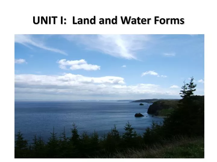
UNIT I: Land and Water Forms. UNIT I: Land and Water Forms. Earth's Interior In this lesson you will learn: About the interior of the earth. It is impetrative to understand the earth's structure before you can understand tectonic forces. . Earth's Interior . .

E N D
UNIT I: Land and Water Forms • Earth's Interior • In this lesson you will learn: • About the interior of the earth. • It is impetrative to understand the earth's structure before you can understand tectonic forces.
Earth's Interior . • Is neither all solid nor is it all molten. • It is made up of layers with different : • density, • thickness • and composition
Earth's Crust • is not one continuous layer. • It is broken into many sections known as plates. • They all float and move on top of the molten asthenosphere. • When they push together and when they pull apart they create "tectonic forces". • Note; without this liquid layer called the asthenosphere we would not experience earthquakes or volcanoes.
Earth's InteriorZones within the earth:(5) • Inner Core: The deepest part of the earth (1512 miles deep) is a solid that contains both iron and nickel. It is because of this that the centre of the earth is a magnet, a compass. It generates a magnetic field that protects the earth from flying out of orbit.
Earth's InteriorZones within the earth:(5) 2.Outer Core: Outside of the inner core lays the outer core (1419 miles deep). This is much like the inner core with the exception that it is a liquid that contains sulphur and oxygen (which lowers the melting point).
Earth's InteriorZones within the earth 3. Mantle: Occupying 1789 miles of the earth is the magma (iron and magnesium) that makes up the mantle. It is mostly solid except the outer 200-300 Km which is extremely hot and goopy; very plastic-like. This outermost liquid layer of the mantle is referred to as the asthenosphere.
Earth's InteriorZones within the earth 4. Mohorovicic Discontinuity: Boundary between the mantle (asthenosphere) and the Lithosphere. • The Moho serves to separate both oceanic crust and continental crust from underlying mantle.
The Mohorovicic Discontinuity, or "Moho", is the boundary between the crust and the mantle. The red line in the drawing below shows its location.
Earth's InteriorZones within the earth • Lithosphere (crust): This is the top layer of the earth, which is basically hardened mantle (magma). • It contains two segments, • the oceanic • continental crusts. • (diagram in book or online)
The oceanic andcontinental crusts • Note: this is the same crust, it just depends how thick it is to determine if it is part of the Oceanic or Continental Crust. • For instance, if you drained all of the water from earth, then there would be one, giant Continental Crust. • Likewise, if you flooded everything, you'd have one, giant Oceanic Crust.
UNIT I: Land and Water Forms • In this lesson you will: • define the term topography (P. 6 and glossary); • differentiate among the terms hill and mountain as well as plateau, and plain, (P.7).
Topography • The term referring to the surface features of the earth like, hills, mountains, valleys, plains, plateaus and other relief features. • The book defines it as " the natural and human features of the earth's surface". • `The map that follows shows the topographical features of South America.
Elevation & Relief • Elevation • The elevation of a geographiclocation is its height above a fixed reference point, often the mean sea level.
Relief • The difference between the highest and lowest elevations in an area. A relief map shows the topography of the area. • View CDLI for diagrams
Hills are typically defined as areas of upward relief less than 300 -600M. • Mountainsare defined as areas of upward relief greater than 300-600M. It is important to note that books differ on the actual relief required for a hill to be a mountain but the difference is one of the degree of elevation.
Plainsare areas of flat land with very little relief. They are found at low elevations often along coasts and in the center of continents. • Plateausare areas of flat land with little relief. They occur at high elevations and are associated with mountains. Like hills and mountains plains and plateaus differ based on elevation. • Refer to computer diagram
Land Form Patterns • In this lesson you will: • 1.1.11 Describe global patterns in the location of landforms. (k) (P. 7 questions 4-7).
Can you identify the "Rockies in North America", the "Andes in South America", and the "Himalayas in Asia" on the map?
Land Form Patterns • Most mountains and high elevations are located on coasts of continents. • Large mountain ranges occur along the west coast of North and South America.
Plate Tectonics • In this lesson you will: • 1.1.1 Explain how compressional forces are caused. (k) • 1.1.2 Explain how tensional forces are caused. (k) • 1.1.3 Relate selected plate movements to compressional and tensional forces. (a)
Plate Tectonics • Tectonic plates move or float on top of the asthenosphere . • The plates are forced in specific directions by the flow of magma beneath. • The magma forms convectional currents. The magma closer to the core heats and then rises towards the surface as its density decreases. • Once the rising magma reaches the lithosphere it moves in opposite directions.
Compressional Forces • Occur where two tectonic plates come together. • They compress against each other. • Subduction Zones sometimes occur where compressional forces result from two plates colliding.
Tensional Forces • Occur where two tectonic plates are pushed apart. • The tension is created as the plates move away from each other. • Ridge Zones sometimes occur where two plates move apart. The magma rises between the plates and forms a ridge. Diagram on line CDLI
The Development of the "Theory of Continental Drift" • Alfred Wegener was one of the first to propose the theory of continental drift. • While pondering the similarities between the coastlines of South America and Africa, Wegener came up with an idea: • What if the continents were once all connected and just drifted over the years?
The Evidence • Ferns and Reptiles in many different continents • Glaciers that were then tropical forests • Same types of rocks on continents close to each other (yet separated by an ocean) • The coastlines of Africa and South America
The Flaw in Wegener's Theory • He thought that each of the continents were a separate plate--they were just drifting on a never-changing ocean.
The Canadian Correction • J. Tuzo Wilson was the 1960’s Canadian scientist who resurrected Wegner’s theory after years of disbelief by the science community. • The plates of the earth are not composed of just land; they're composed of ocean, too. In some cases, the plates are just land, in others they're just ocean, and, in still other cases, they consist of land and ocean. They each have different boundaries and move in all different directions.
Continental Drift • It refers to the movement of the more than 20 plates (9 major) due to convergent, divergent, and transform boundaries • The continents drift at a rate of 2 inches a year, or, as fast as a fingernail grows. • It is believed to have started 200 million years ago. • The original single continent was named Pangaea and the original ocean that surrounded the land was called Panthalasa.