Download
1 / 23
230 likes | 443 Views
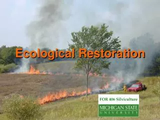
Comparing Pre-settlement, Pre-treatment and Post-treatment Stand Structure at Lonetree Restoration Site: Incorporating GIS into Restoration. By Christine Brown & Michael Jow Ecological Restoration Applications November 30, 2004. More Lonetree!.

E N D
Comparing Pre-settlement, Pre-treatment and Post-treatment Stand Structure at Lonetree Restoration Site:Incorporating GIS into Restoration By Christine Brown & Michael Jow Ecological Restoration Applications November 30, 2004
More Lonetree! • Data collected needs to be in a format where it can be analyzed displayed and stored • Including how it relates to the rest of the world • Future monitoring needs to be incorporated in a compatible format for comparison and analysis • Average tree density and basal area don’t provide the whole picture • Spatial arrangement is important to reconstructing proper structure • Presettlement site utilization by overstory is difficult to quantify and recreate
Objectives • Consolidate, store and organize project data • Spatially reference project area, treatment units and plot boundaries • Visually display and compare pre-settlement, pre-treatment and post-treatment stand structures • Visualize and analyze outcome of various prescriptions
Treatment Areas Project Boundary Treatment Units Plots
Methods Project layout • Boundaries and plot centers were plotted using a Tremble Geoexplorer 2 GPS unit • GPS data was and differentially corrected using USDA FS base station data from Cedar City, Utah and brought into an ESRI Arcmap project • Plots were created using center points and plot direction • Plot data was imported into Arcmap and linked to corresponding features • Pre- and post-treatment photos were hyperlinked to the point location they were taken • Features were overlaid on an aerial photo and topo map
Methods (Continued) Tree Data • Trees were plotted in Arcmap using x-y data collected on site and corresponding data attached to each tree • Crown diameter was estimated using allometric equations for ponderosa pine (McTague, 1988) • Crowns of trees were projected and canopy closure was estimated • Tree density and basal area was calculated using plot data
Formulas for Estimate Canopy from DBH • When D > 20 in: CST= (131.58 D - 1578.95) / {43.85exp (-333.54 / SD.99697)) +.012729 SD1.175 + 4.5} S = Site Index (60) D = Diameter in inches • When D < 4 in: CY = .426 + 1.317 D • When 4 < D > 20: C = (D – 4.0)[(CST, D=20) – 5.7] / 16.0 + 5.7 (McTague, 1988) CST=Crown Diameter of Saw timber CY=Crown Diameter of young trees
Assumptions • Area of each plot was slope corrected for estimating tree density and basal area • Pre-settlement date used was 1870(approximate time of fire exclusion) • Tree densities • Pre-settlement – assumed pole density by including living pre-settlement trees in total tree density calculation • Basal areas • Pre-settlement were calculated using the DSH of remnant stumps • Living pre-settlement trees and pole basal area not included • Crown closure • Canopy only estimated within plot using allometric equations • does not include canopy extending beyond plot boundaries or the canopy of trees rooted outside plot
Average Tree Density Average Basal Area 1400 /ha) 40 1200 2 1000 30 Pre-Settlement 800 Pre-settlement 20 600 Pre-treatment Tree Density (# trees/ha) Pre-treatment Basal Area (m 10 400 0 200 0 Lonetree Site Lonetree Site Need for Restoration Average tree density of all the measured plots. Average basal area of all the measured plots. Pre-treatment tree density and basal area are significantly different than pre-settlement tree density and basal area. Restoration is needed to return to a healthy forest similar to historical conditions.
Need for Restoration (cont.) Pre-settlement trees show a normal distribution around 40-50 cm DBH. The pre-treatment trees show a logarithmic (reverse J) distribution.
NAU-99-2 Tree Densities 450 400 350 300 Pre-settlement Tree Density (# trees/ha) 250 Pre-treatment 200 Post-treatment 150 100 50 0 NAU-99-2 NAU-99-2 Basal Areas 40 35 /ha) 30 2 25 Pre-settlement 20 Pre-treatment Basal Area (m 15 Post-treatment 10 5 0 NAU-99-2 NAU-99-2 Crown Closure 90.0% 80.0% 70.0% 60.0% Pre-settlement 50.0% Pre-treatment 40.0% Post-treatment 30.0% 20.0% 10.0% 0.0% Plot NAU-99-2 NAU-99-2 Pre-settlement, Pre and Post-treatment Canopy Covers
NAU-99-2: POST-TREATMENT PICTURES (P2) August 21, 2000 November 9, 2004
NAU-00-2 Tree Densities 3000 2500 2000 Pre-settlement Tree Density (# trees/ha) 1500 Pre-treatment 1000 500 0 NAU-00-2 NAU-00-2 Basal Areas 50 45 /ha) 40 2 35 30 Pre-settlement 25 Basal Area (m Pre-treatment 20 15 10 5 0 NAU-00-2 Crown Closure 80.0% 70.0% 60.0% 50.0% Pre-settlement 40.0% Pre-treatment 30.0% 20.0% 10.0% 0.0% Plot NAU-00-2 NAU-00-2 Pre-settlement and Pre-treatment Canopy Covers
NAU-00-2: PRE AND POST–TREATMENT PICTURES (0P) Pre-treatment. September 6, 2000. Post-treatment. November 9, 2004.
Additional Analyses • Location- find coordinates for any feature • Measurements- distance, area, perimeter • Spatial relationships- clumpiness, connectivity, proximity • Patterns- data visualization • Trends- changes in data over time • Modeling- predict outcomes of different restoration alternatives
GIS to Visualize Restoration Prescriptions 10 m recruitment radius Pre-settlement Evidence Pre-settlement Live tree Post-settlement Live Trees
Comparing Restoration Prescriptions Possible treatment using a 1.5 to 1 replacement for pre-settlement evidence Possible treatment using a 3 to 1 replacement for pre-settlement evidence
Conclusion • ALL project data (maps, photos, plot data) can be stored, organized and displayed in one GIS project • Project data can utilize other GIS data for additional analysis • Pre-settlement canopy closure and spatial distribution (i.e. “clumpiness”) can be reconstructed, analyzed and displayed • Spatial analysis can aid in selecting replacement/ leave trees in restoration treatments • Various prescriptions can be compared and visualized prior to implementation • Future monitoring information can easily be incorporated and compared to previous data