Download
1 / 29
290 likes | 380 Views
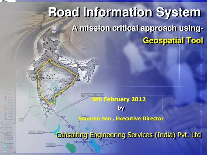
Road Information System A mission critical approach using- Geospatial Tool. 8th February 2012. by. Samiran Sen , Executive Director. Consulting Engineering Services (India) Pvt. Ltd. Introduction to RIS. National Highways Development Project (NHDP) comprises:

E N D
Road Information SystemA mission critical approach using- Geospatial Tool 8th February 2012 by Samiran Sen , Executive Director Consulting Engineering Services (India) Pvt. Ltd
Introduction to RIS • National Highways Development Project (NHDP) comprises: • Phase-I & II: Golden Quadrilateral & NSEW Corridor • Phase III: 4-Laning • Phase IV: 2-Laning • Phase V: 6-Laning of Selected Stretches • Phase VI: Expressway Development • Phase VII: Ring Road / Bypasses • Road Information System (RIS) developed for Golden Quadrilateral (GQ) as an Integrated System for collection and storage of Highway related data for • Management • Decision making.
RIS – Salient Features A Decision Support System for Transport Infrastructure Planning and Management A Web based GIS enabled application software dealing with Locational Referencing Traffic Management Pavement Management Asset Management Bridge & Structures Management Toll Management Accident Management Environment Management Contract Database Management Document Management
RIS – Salient Features An articulate tool for Asset Inventorisation, Project Monitoring and Maintenance of National Highways A query based graphical Information resource for commuters and public at large. Currently RIS deals with NHDP Corridors for Golden Quadrilateral (GQ) East–West & North-South (EWNS) Subsequent phases will cover all other National Highways in the country
A Bird’s Eye View of RIS Locational Referencing System System Administration Asset Management System HDM-4 Integration Module Pavement Management System Ad-Hoc Query Module Web based GIS enabled RIS Contract Database Management Module Traffic Management System Bridge Management System Accident Management System Document Management System Environment Management System Toll Management System
System Architecture of RIS RIS Core Modules HDM-4 Integration Module Traffic Management (TRMS) HDM-4 Analysis Locational Referencing (LRMS) Geographical Information System Network Matrix G F P Pavement Management (PVMS) H M L Asset Management (ASMS) Bridge Management (BRMS) Highway Network Toll Management (TOMS) MIS / GIS Reports Accident Management (ACMS) Environment Management (EVMS) HDM-IV Analysis Reports Contract Database Document Management (DOMS) System Support Modules System Administration [ Security & Access Control ] [ Database Backup & Recovery ] Ad-Hoc Query
Applied Technology • N-Tier Architecture – Data Layer, Logic Layer, Presentation Layer • Data Layer – Oracle 9i Enterprise (with Spatial) • Logic Layer – Web Services & Geospatial Tool • Presentation Layer – ASP.NET, VB.NET • Backend RDBMS • Oracle 9i Enterprise with Spatial • Front End • Visual Studio.NET • Autodesk Mapguide Enterprise Suite • Three layer security • IIS Security • .NET Framework Security • Database Security
RIS Geospatial Database • Road Information System covers: • 5846 kms of National Highways on GQ • 6000 Kms of National Highways on North – South & East – West Corridors • Database Development of RIS included: • Data compilation from DPRs • Data collected from PIUs • Primary & Secondary Surveys • Contains Data on approx 300 Road Attributes • Database comprises 10 different Modules.
Ad-Hoc Query Ad-Hoc Query Module :Providing broad & summarised information for National Highway’s Management for any National Highway section, to facilitate analysis and decision making. Data results are displayed to user in a tabular form for easy understanding.
Basic Concept of Geospatial Database of RIS Data Collection using Geo-Referencing System Data Processing Road Inventory & Condition Data Topo Sheets Road Network Traffic Data Data from DPRs Socio Economic Data Thematic Map Attribute data GIS Spatial Data Analysis Modules Planning & Monitoring Output
GIS Features…. GIS Features of Road Information System
GIS Features…. • RIS is a Web based System Coupled with GIS Features • GIS features available in the System Include • Multi layered Graphical/Map Representation of the Spatial Information and spatial attribute data pertaining to Corridor, National Highways, Links and Sections. • Spatial and spatial Queries and Display of the results in Map/Graphical form. • Spatial analysis like buffer operations and feature distance measurement • Feature based Information extraction
GIS Features…. Map Window of RIS The GIS Page of RIS has Map window, Query modules and Layer control Panel Layer Control Query Modules & Parameters
GIS Features…. • The GIS Features are designed so as to operate Module-wise queries and display results in a Map Form. • The GIS Map Window is powered with map handling tools such as Zoom and Pan • Advance Tools for User defined Map setting pertaining to Map Scale, Coordinates display, Units of Measurements and Map Printing.
GIS Features…. • GIS Features includes two Stage Querying Systems. • Location based Querying system • Location coupled Parameter based Querying system • Location Based queries are operated through LRS Module and Zoom GoTo feature of Popup menu • Parameter based queries are operated through Respective Sub-System/Modules after putting up Locational Query • The resultant of the query is displayed in the map window highlighting the sections which qualify the query
Outcome of Geospatial Tool • GIS query groups available are: • Pavement Condition &History • Traffic Volume • Traffic Analysis • Amenities • Cross-sectional Features • Contractor Details • Accident • Toll • Environment • Thematic Maps • Raster Images • HDM 4 Reports
Outcome of Geospatial Tool User Login Details Locational Query Tool Online Help Map Toolbar Module Menu Layer Control Map Window
Outcome of Geospatial Tool GIS queries made for identification of High Intensity Traffic Corridors
Outcome of Geospatial Tool One kilometer Buffer Zone on either side using Buffer Input Facility
Outcome of Geospatial Tool Vehicle Count
Outcome of Geospatial Tool Pavement Condition on GIS Maps
Outcome of Geospatial Tool Bridge & Stucture Details
Outcome of Geospatial Tool Climatologically Parameters
Outcome of Geospatial Tool Contract Database
Stakeholders • City Managers • Highway builders and Toll Companies • Consultancy Firms • Tour Operators • Equipment Manufacturers • Logistics Firms • Truck Operators • Real Estate Developers • General Public • NHAI & MORTH • Ministries of Central and State Governments • Planning Commission • Financial Institutions: WB, ADB, JBIC etc. • Corporate Houses (Public and Private Sector) • Investment Entrepreneurs • Academic and Research Institutes • State Police
Strategic Planning Outputs • Funding Requirements • Long term expenditure plans • Allocation between budget heads: • Maintenance, Improvement, Development, etc. • Allocation between Regions/sub-networks • Northern, Eastern, Southern, Regions, etc. • Primary, Secondary, Tertiary, etc. • Long term performance trends • Average network condition • Performance indicators
Reports for Decision Making Impact of available budget on NH Performance Sub network budget allocations Optimal budget - head Allocations Optimized multi-year work programme Budget allocation by work type Budget allocation by State/CMU NPV vs. Budget Roughness vs. Budget AnnualBudget Rs.100m Rs.150m Rs.200m Target = 3.5 IRI
Way Forward • Real-time Data Collection • Traffic Count through permanent Automatic Traffic Counter • GPS enabled Speed-Delay information • Speed – Flow condition at any time • Automatic Data Updation • Roughness using ROMDAS type of equipment • Accident incident through GPS • Seasonal Traffic Variation • Axle Load data from Fixed/Weigh-in-motion Stations