Download
1 / 15
150 likes | 168 Views
This study examines agroforestry practices in Saharanpur, India, using geospatial technologies and remote sensing data. It assesses changes in land use, particularly focused on eucalyptus and poplar-based systems. The research identifies dominant woody perennials and crops, highlighting a decline in agroforestry area over a decade. The methodology involves satellite imaging, spectral analysis, and classification techniques for accurate mapping. Results show the dominance of poplar-based systems and a decrease in overall agroforestry area. The study concludes with insights into market influences on agroforestry trends.

E N D
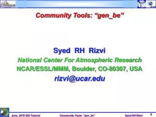
Analysis of Land Uses especially Agroforestry in Saharanpur district of North-western India using Geospatial Technologies R.H. Rizvi*, Deepak Maurya, R.S. Yadav, Ramesh Singh & S.K. Dhyani National Research Centre for Agroforestry, Jhansi-284003 * Email: rhrizvi72@icar.org.in, rhrizvi@mailcan.com
Introduction The prominent agroforestry systems practiced by farmers in Saharanpur district in western U.P., are agri-silviculture, agri-horticulture and agri-horti-silviculture. Dominant woody perennials prevailed in this district are Eucalyptus hybrid, E. tereticornis, Populus deltoides (Poplar), inter-sparse plantations of Sizygium cumini (Jamun), Dalbergia sissoo (Shisham). Mangifera indica (mango) is the dominanat fruit tree in agri-horticulture. Wheat, mustard, sugarcane, paddy are the dominant crops grown by the farmers (Sharma and Dadhwal, 1996). In Saharanpur district, majority of the farmers prefer to plant both eucalyptus and poplar trees on field boundary. Sources: Pathak et al. (2000); Sharma & Dadhwal (1996)
Introduction • GIS and remote sensing applications in agroforestry research include estimating areas for agroforestry, suitability assessment for agroforestry systems, monitoring of agroforestry parks. However these technologies have to be extensively utilized in agroforestry research. • Although FSI (2005) gave an estimate of trees outside forest cover, but that includes trees alongside roads, canals and in orchards, yet it does not give exact figures of area under agroforestry. • In order to estimate area under Saharnpur district, a DST sponsored project was initiated at NRCAF, Jhansi in 2007. Under this project, methodology for estimating areas under agroforestry has been standardized. • Sources: Unruh and Leferbvre, 1995; Rizvi et al., 2009; Bentrup and Leininger, 2002; Bernard and Depommier, 1997
Methodology • Satellite remote sensing images of Resourcesat-1 (IRS-P6/ LISS III) with spatial resolution of 23.5 m for the year 1998 and 2007 were procured from National Remote Sensing Centre, Hyderabad. • Spectral analysis for land uses/ land covers (LU/LC) and delineation of areas under agroforestry systems was done using Arc Info 9.3 and IDRISI Andes software. • Forest area in the district was digitized with the help of FCC and toposheets, used for masking this area from total district area. Land use/land cover classification was done by supervised techniques. • Remote sensing data of three spectral bands viz. green, red and near-infra red was subjected to PCA transformation before classification.
Methodology • Training sites for six classes viz. agriculture, builtups, fallow/wastelands, plantation, agroforestry, water/water bodies were created with the help of FCC and NDVI images. • Field data on agroforestry systems collected through GPS from the farmers’ fields was used as training sites for agroforestry class. • Maximum likelihood and minimum distance to mean classifiers were used in case of supervised classification. Accuracy of classification methods was done by error matrix analysis. • The area under agroforestry so obtained by different methods was extracted from the classified images of 1998 and 2007. Thereafter change detection analysis was done for assessing the change in area under agroforestry over this period.
Results/ Findings Area under land uses/ land covers in Saharanpur district for year 2007
Contd……. Error matrix of classification for maximum likelihood classifier (2007) AG- agriculture, BU- builtups, WB- water bodies, FW- fallow/wastelands, AF- agroforestry, PL- plantation, TOT- total, Er C- error of commission, Er O- error of omission Overall accuracy – 95.03 % Overall Kappa – 0.94
Contd……. Error matrix of classification for minimum distance to mean classifier (2007) AG- agriculture, BU- builtups, WB- water bodies, FW- fallow/wastelands, AF- agroforestry, PL- plantation, TOT- total, Er C- error of commission, Er O- error of omission Overall accuracy – 90.37 % Overall Kappa – 0.88
Agroforestry area in different climatic and edaphic conditions
Area under poplar and eucalyptus based agroforestry systems • The total agroforestry area was further classified into poplar and eucalyptus based systems with the help of ground truth data. • Poplar and eucalyptus based systems accounted for 49193.80 ha (63.7%) and 28066.30 ha (36.3%), respectively. • It clearly indicated that poplar based systems are more dominant than eucalyptus based systems in Saharanpur district.
Temporal change in agroforestry area in Saharanpur district Area under land uses/ land covers in Saharanpur district (1998) • Area under agroforestry decreased from 84918.80 ha in 1998 to 77260.10 ha in 2008. • There was decline in agroforestry area of about 7658.70 ha (9.0%). • This decline in area is attributed to decrease in poplar wood prices in the market since 2001 till 2005.
Conclusions Out of two methods applied, maximum likelihood classifier was found more accurate than minimum distance to mean classifier. Agroforestry is an important land use in Saharanpur district as it covers considerable area of the district. Poplar based agroforestry systems was predominant in Saharanpur district. Agroforestry area declined over a period of ten years due to decrease in wood prices in the market. Methodology standardized under this study may be replicated for estimating areas under agroforestry in other part of the country.