Download
1 / 20
200 likes | 378 Views
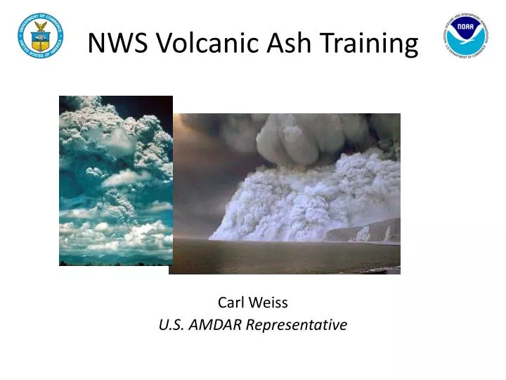
NWS Volcanic Ash Training . Carl Weiss U.S. AMDAR Representative. Background.

E N D
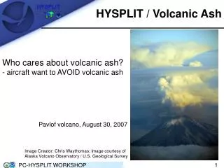
NWS Volcanic Ash Training Carl Weiss U.S. AMDAR Representative
Background • As a result of the Eyjafjallajökulleruption and its disruption to the aviation industry across Europe, the need for NWS operational meteorologists to better understand the environmental features and impacts of a volcanic eruption became apparent. • Operational forecasters must: • understand volcanic ash sources and physical processes, • predict the trajectory of volcanic ash using forecast products, • be aware of the impacts of volcanic ash on aviation, public health, climate, water quality and agriculture, • communicate effectively with the public. • An NWS directive recently has been implemented that addresses appropriate forecaster response to eruptions.
Background (Continued) • Target audience for thistrainingis current operational NWS and private sector meteorologists. • Secondary audiences for this course might vary widely, including: • federal agencies, • state and local government agencies, • non-governmental organizations, • universities, • international agencies. • Although some online sources and existing modules refer to volcanic ash and its impacts, this course is the first comprehensive training to treat this subject.
Course Development • A development team was assembled representing NWS, COMET and the climate community. • Team core members were: • Warren Rodie and Dr. Elizabeth Page - COMET Project Leads • Dr. Alan Bol - COMET Geologist • Tsvetomir Ross-Lazarov - COMET Instructional Designer • Paul Witsaman - NWS Project Lead, Regional Aviation Meteorologist, NWS SRH • Ken Venske - Meteorologist in Charge, CWSU Oakland, CA • Leslie Wanek – Impact Decision Support Services Manager, NWS WRH • Rich Mamrosh - Aviation Focal Point, WFO Green Bay, WI • Jeff Osiensky- Regional Aviation Meteorologist, NWS ARH • Scott Birch - Regional Aviation Meteorologist, NWS WRH • Dr. Alan Robock - Professor (Climate Change), Rutgers University
Course Description • Volcanic ash training focuses on providing forecasters: • an understanding of the source and characteristics of volcanic eruptions, • techniques for volcanic ash detection, • techniques for forecasting plume movement, • an understanding of impacts to aviation, climate, society, and water resources. • Course is comprised of 4 modules: • Introduction • Volcanism • Impacts • Observation Tools and Dispersion Models
Course Description (Continued) • Module format: • fully interactive, online module with text, animations, images and exercises, • embedded links allow students to selectively view topics in the module, • a print version is available so students can print sections related to their immediate needs, • each module contains references and a bibliography. • questions embedded in the training will evaluate student’s immediate retention of knowledge and will prepare them for the quiz at the end of each module.
Module 1: Introduction • Introduction • EyjafjallajökullVolcano (2010) • Mount Pinatubo (1991) • Mammoth Mountain, CA animation: Example of an Explosive Eruption • Course Description • Course Objectives
Module 2: Volcanism • Volcanoes: Understanding the Source • Eruption Dynamics • Volcanic Regions • Eruption Types • Classification of Volcanic Eruptions • Eruption Frequency and Size • Volcanic Hazards
Module 2: Volcanism (Continued) • Different volcanic eruptions can produce different hazards. These are some of the • more important hazards: • Tephra • Pyroclastic Flows • Lahars • Lava Flows • Volcanic Gases
Module 2: Volcanism (Continued) Visual representation of magnitude of historical volcanic eruptions based on volume of released molten rock, ash and pumice.
Module 3: Impacts to Aviation, Climate, Maritime Operations and Society • Aviation Impacts: Understanding the Impacts to the Aviation System • Maritime Impacts • Societal Impacts • Climate Impacts
Module 3: Impacts to Aviation, Climate, Maritime Operations and Society (Continued) • Seven-day (April 14-21, 2010) AMDAR animation illustrating impact of volcanic ash on air traffic over Europe. • One of several animations/videos included in the training.
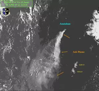
Module 4: Observation Tools andDispersion Models • Satellite Monitoring • Identify Presence of Ash • using visible, infrared, split-window and false-color imagery • principle component imagery, reflectance and sulfur dioxide products also covered • Monitor Plume Spread • determine plume height and drift • The HYSPLIT (Hybrid Single Particle Lagrangian Integrated Trajectory) trajectory and dispersion model can be a valuable tool • Issue Products • communicate with users
Accessing the Course • Go to the COMET web page • http://www.comet.ucar.edu/ • Click on the MetEd link
Accessing the Course (Continued) • If you have a COMET account, choose “Sign In”. • If you don’t have a COMET account, choose “Sign Up” and follow the instructions for creating one.
Accessing the Course (Continued) • Enter your account information and sign in
Accessing the Course (Continued) • To start the most recent Tools module, click on the image. • To start with any other module , choose the “See All” link.
Accessing the Course (Continued) • Scroll down past the other COMET modules until you reach your training of choice. In this case, Volcanic Ash Introduction. • Click on the image to begin the module.
Accessing the Course (Continued) • To start training, click “Begin Module” link. • Course Description, Objectives and Keywords tabs are found along the bottom of the page
What’s Next… • Just started work on a new course, Space Weather’s Impacts on Aviation, tentatively scheduled for delivery by June 30, 2012. • Future NWS aviation training will be steered by the aviation PDS effort.