Download
1 / 73
760 likes | 1.05k Views
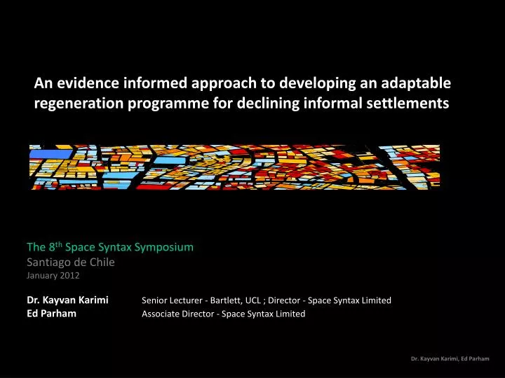
An evidence informed approach to developing an adaptable regeneration programme for declining informal settlements. The 8 th Space Syntax Symposium Santiago de Chile January 2012 Dr. Kayvan Karimi Senior Lecturer - Bartlett, UCL ; Director - Space Syntax Limited

E N D
An evidence informed approach to developing an adaptable regeneration programme for declining informal settlements The 8th Space Syntax Symposium Santiago de Chile January 2012 Dr. Kayvan Karimi Senior Lecturer - Bartlett, UCL ; Director - Space Syntax Limited Ed Parham Associate Director - Space Syntax Limited
Deteriorated unplanned settlements/Slumsa disturbing reality • According to UN-Habitat’s ground breaking report, The Challenge of Slums, in 2003, 924 million people, or 31.6 per cent of the world’s urban population, lived in slums or squatter settlements. • The majority of these settlements were in the developing regions, accounting for 43 per cent of the urban population (UN-HABITAT, 2003).” • These figures are unfortunately in continuous rise according to internationally verified statistics (UN-HABITAT, 2006). • Due to complexities of defining a slum area, these figures don’t necessarily include the ‘slum-like’ conditions of many other deteriorated urban areas, such as historic centres, which would not automatically qualify as a slum.
Unplanned/informal settlementsand slums Not always is an informal settlement a slum, or is a slum created in unplanned areas, but it is fair to say that in most cases slums happen to be informal or unplanned areas that are suffering from multiple physical or socio-economic problems.
Regenerating urban slumsa huge challenge In many developing countries, the governments that don’t have the resources, or are highly influenced by economic, social and political agendas, resort to a variety of harsh solutions to transform the slums. “urban segregation is not a frozen status quo, but rather a ceaseless social war in which the state intervenes regularly in the name of ‘progress’, ‘beautification’, and even ‘social justice for the poor’ to redraw spatial boundaries .. (Mike Davis, Planet of Slums).” . In other words, the whole effort is sometimes about eliminating the question through removing human encumberments, urban evictions, city beautification, slums de-criminalisation, and so on, rather than finding a solution to create a condition that informal settlements could self-correct themselves.
Physical segregation andsocial segregation Image: Sau Paolo - Luiz Arthur Leirão Vieira (Tuca Vieira)
Forces of change: Rapid growth, urbanisation, changing economies, migration, poverty … Spatial conditions: Segregation, Degradation, Encroachment, densification, … Socio-economic conditions: Deprivation, Impoverishment, low income, … Urban Slumsthe vicious circle of depravation
Slum ClearanceThe UK case Much of this effort was associated with slum clearance, as encouraged by the 1930 Act, which made the local authorities responsible for slum clearance and providing alternative accommodation.
The social approachillusion of ‘self help’ At the other end of the regeneration spectrum, it is argued that the slums have to be fixed by themselves. By helping people to help themselves, the life conditions will improve and the slums will be saved. Being much less costly, interruptive, and authority-dependent, this approach is favoured by institutions such as the World Bank, international aid agencies, NGOs and philanthropists. On the face of it, it looks like a good approach, but when it comes to the realities of the vast slums and deteriorated areas, the solutions do not seem to work. Mike Davis goes as far as calling it the ‘illusion of self-help’ and scholars such as Jeremy Seabrook, call it a misrepresentation: “it would be foolish to pass from the distortion – that the slums are places of crime, disease and despair – to the opposite; that they can be safely left to look after themselves (Seabrook, 1996, p. 197).” So, what should be done?
Conservative surgeryGeddesian approach Patrick Geddes (1854-1932).
Physical transformationConservative Surgery The Indian Town of Barlampur (1917)
Forces of change: Intervention, Regeneration, Investment, Redevelopment, … Spatial conditions: Access, Integration infrastructure, development, … Socio-economic conditions: Improvement, cohesion viability, investment, … Urban Slumsthe virtuous circle of regeneration
Jeddah Unplanned Settlements How did the Growth of Jeddah lead to the formation of unplanned settlements and what conditions exist within them today?
Jeddah Saudi Arabia Saudi Arabia Biggest port on Red Sea Gateway to the holy cities of Makkah and Madinah - 2.5m pilgrims in 2009 2010 Population 3.4 million 2030 Population 5.6 million
Urban growth 60 km 1800 200 bc 0 200 800 1000 400 bc 400 600 1200 1400 1600 2000 Jeddah established as fishing village by Quda’a tribe 1500s City walls built 1947 City wall removed 1964 - 71 Oil boom 646 Jeddah main port for holy cities 1980s – Present day
Planning HistoryModern masterplans Proposed Masterplan for Jeddah, Sirt Jackson and Saudi Consultants (1978 AD) Source: Historical Area: yesterday, today and tomorrow, King Abdul Aziz Project for Protection and Development Jeddah Historical Area Proposed Masterplan for Jeddah, Dr. Abdul Rahman Makhloof (1963 AD), Source: Historical Area: yesterday, today and tomorrow, King Abdul Aziz Project for Protection and Development Jeddah Historical Area
“Planned” areas 1.5 km
Unplanned areas 2.7 km
Unplanned areas 1.8 km
Unplanned areas 1.6 km
Unplanned areas 1.0 km
Unplanned settlements Over 50 unplanned settlements across Jeddah Settlement populations range from 3,000 to 120,000 Current estimation of 1m unplanned settlement inhabitants in total Worked with Municipality of Jeddah and public private partnership since 2006 to address Unplanned Settlements
Current conditions • Conditions across settlements vary but all of them combine at least 3 of the 5 characteristics the UN uses to define a slum: • Inadequate access to safe water • Inadequate access to sanitation and other infrastructure • Poor structural quality of housing • Overcrowding • Residential status
Spatial analysis Local scale Jeddah Spatial accessibility Unplanned settlements High Low Spatial Accessibility
Spatial analysis City wide scale Jeddah Spatial accessibility Unplanned settlements High Low Spatial Accessibility
Spatial analysis Local scale Agra Spatial accessibility Unplanned settlements High Low Spatial Accessibility
Spatial analysis City wide scale Agra Spatial accessibility Unplanned settlements High Low Spatial Accessibility
Current conditions • Problems • Isolated communities • Poor physical quality • Inadequate access to utilities • Under provision of social infrastructure • High proportion of illegal immigrants • High (perceived) levels of crime • Benefits • Cheap accommodation • Established family/social networks • Established local economies • Contribution to wider city economy • Least reliance on cars
Reversing the cycle of decline How can an intervention be developed to address the fundamental spatial problems at the heart of the unplanned settlement condition, and which can respond to potential changes in the economic, social and political conditions?
27 .5 to 40 25 to 27 .5 22 .5 to 25 20 to 22 .5 15 to 20 10 to 15 5 to 10 0 to 5 Vacant land Settlement profile Analytic indices Utilities Realm index Transformability index Public Realm index Number of utilities Access to public realm components 3 to 4 3 to 4 2 to 3 2 to 3 1 to 2 1 to 2 0 to 1 0 to 1
Settlement profile Fulfils three roles: Provides settlement-specific profile which can be used to categorise areas Identifies areas to target improvements in each settlement Provides design tool for later in process
Settlement classification Ranking formed the basis for the JDURC classification of settlements: 1. Settlements attractive to developers 2. Settlements partially attractive to developers 3. Areas with potential for self improvement 4. Settlements in need of immediate partial intervention Attractiveness to developers High Low
Approach Spatial intervention If the heart of the unplanned settlement condition is spatial, how can changes be made to spatial structure which minimise disruption to existing residents and stakeholders? If each of these approaches has its own strengths which are suited to a particular set of economic, social and political conditions, what can be done to combine the benefits of all of them and switch between them?
Principles of design Adapt existing spatial network to reverse cycle
Principles of design Adapt existing spatial network to reverse cycle
Land use/FAR Higher FARs Predominantly Commercial Route hierarchy Block type Special blocks Primary blocks Primary routes Secondary blocks Secondary routes Lower FARs Predominantly Residential and Social infrastructure Tertiary routes Principles of design Distribution of functional components Distribute land use and density in mixed use areas according to route hierarchy and exposure to movement (accessibility) Exposure to movement
Design Scenarios Flexibility Private lead Superblock-based redevelopment (Scenario A) Maximum intervention Maximum investment Maximum rehousing Minimum program Private-lead Route-based regeneration (Scenario B) Private lead land Route-based plot assembly (Scenario C) Public-lead Route based road widening (Scenario D) Public-lead Community assisted improvement (Scenario E) Minimum intervention Minimum investment Minimal rehousing Maximum time for transformation
Design Scenarios Flexibility Private lead Superblock-based redevelopment (Scenario A) Maximum intervention Maximum investment Maximum rehousing Minimum program Private-lead Route-based regeneration (Scenario B) Private lead land Route-based plot assembly (Scenario C) Public-lead Route based road widening (Scenario D) Public-lead Community assisted improvement (Scenario E) Minimum intervention Minimum investment Minimal rehousing Maximum time for transformation Scenario A Private sector, super–block based redevelopment
Design Scenarios Flexibility Private lead Superblock-based redevelopment (Scenario A) Maximum intervention Maximum investment Maximum rehousing Minimum program Private-lead Route-based regeneration (Scenario B) Private lead land Route-based plot assembly (Scenario C) Public-lead Route based road widening (Scenario D) Public-lead Community assisted improvement (Scenario E) Minimum intervention Minimum investment Minimal rehousing Maximum time for transformation Scenario B Private sector, route-based regeneration
Design Scenarios Flexibility Private lead Superblock-based redevelopment (Scenario A) Maximum intervention Maximum investment Maximum rehousing Minimum program Private-lead Route-based regeneration (Scenario B) Private lead land Route-based plot assembly (Scenario C) Public-lead Route based road widening (Scenario D) Public-lead Community assisted improvement (Scenario E) Minimum intervention Minimum investment Minimal rehousing Maximum time for transformation Scenario C Public/Private, route-based regeneration