Download
1 / 34
340 likes | 370 Views
Discover the diverse landscapes and economic activities in Texas' North Central Plains and Mountains & Basins regions - from Fort Worth to El Paso, including ranching, oil, farming, and the Guadalupe Peak. Learn about the region's unique geography, including the Caprock escarpment and rivers flowing east to the Gulf. Explore the varied elevations and natural resources like aquifers in these dynamic areas.

E N D
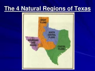
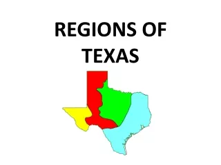
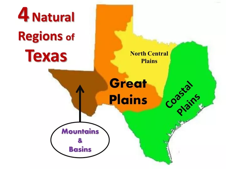
North Central Plains 4Natural Regions ofTexas Great Plains Coastal Plains Mountains & Basins
Caprock escarpment Red River 35 Products- Population- Landscape- Cattle and sheep ranching, oil, farming (wheat and cotton). Medium. Less than the GCP. Largest city is Fort Worth. Mostly flat. Some hills.
Central Plains • Size: 3rd largest • Location: North central Texas • Climate: Cold in winter; hot in summer. Less rainfall than Coastal Plains. • Landforms: plains, rivers • Products: ranching & agribusiness • Major Cities: Fort Worth, Abilene, Killeen, Wichita Falls, San Angelo
Fort Worth: Population- 534,000 Abilene: Population- 116,000 San Angelo: Population- 89,000
Wichita Falls: Population- 104,000 Killeen: Population- 112,000
Label Your Map Wichita Falls Fort Worth Abilene Killeen San Angelo
Mountains & Basins Guadalupe Peak 8,749 ft. – Tallest mountain in Texas
Mountains & Basins • Size: smallest • Location: far west Texas • Climate: dry, hot, desert • Landforms: Basins, rivers, Davis Mountains, canyon, plateau, mesa, butte, escarpments *All mountains located west of the Pecos River • Products: farming, oil & natural gas, trade & maquiladoras factories • Major Cities: El Paso
8 Products- Population- Landscape- Some cattle ranching. A little farming along the Rio Grande. Oil. El Paso Very low. Very few towns. Deserts and mountains. Rio Grande Mexico
Balcones Escarpment Central Plains Gulf Coastal Plains Kingdom of the Sharks
Caprock Escarpment Balcones Escarpment Great Plains Central Plains Gulf Coastal Plains
Caprock Escarpment Balcones Escarpment Mountains and Basins Great Plains Central Plains Gulf Coastal Plains
Guadalupe Peak Caprock Escarpment Balcones Escarpment Mountains and Basins Central Plains Gulf Coastal Plains Kingdom of the Sharks Great Plains
Label Your Map El Paso
Elevation- How high above sea level is the land? Notice how the elevation of Texas keeps going up as you travel WEST. Why does the elevation of Texas change as you head west? Because the land is higher in the northwest, almost all rivers in Texas run to the southeast and flow into the Gulf of Mexico.
Natural Resources- Rivers • Texas rivers are called ‘wrong way’ rivers because they carry water from the west (driest) to the east (wettest) parts of Texas. • Most flow into the Gulf of Mexico.
Natural Resources- Aquifers • Aquifer – underground water reservoirs or underground lakes • 2 major Aquifers: Edwards & Ogallala Edwards Aquifer
Answer: The Balcones Escarpment. Balcon means balcony in Spanish. The Balcones Escarpment
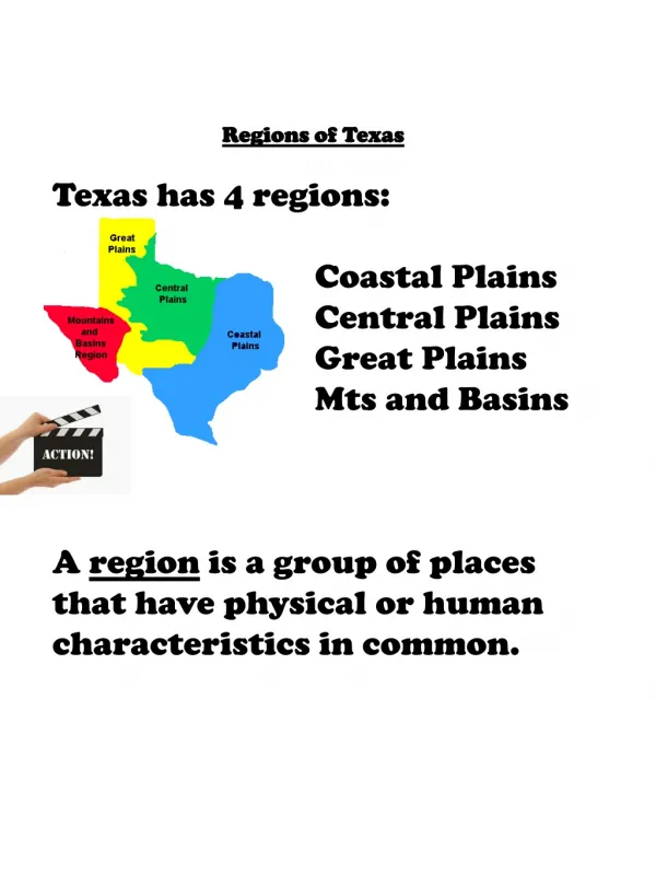
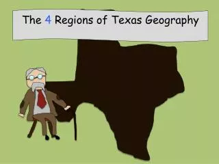
The 4 Regions of Texas Texas has 4 natural regions. A region is an area of land that shares common characteristics like elevation, climate, soil and precipitation. 3 2 1 Balcones Escarpment 4
Natural Resources- Lakes • Texas has many man-made lakes and reservoirs. • Only 1 natural lake- Caddo Lake. All others are created by damming up rivers. Example ‘Lake Houston’ wasn’t created until 1953 when the city of Houston built a dam to supply the needs of a growing city.
Escarpment A steep cliff
Plain Area of level land, at a low elevation, covered with grass.
Urban • Relating to the city
Rural • Relating to the country