Download
1 / 14
140 likes | 223 Views
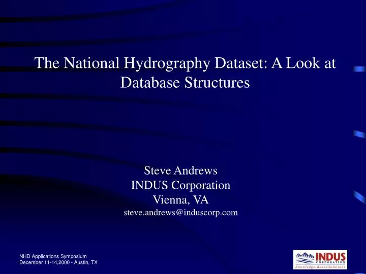
The National Hydrography Dataset: A Look at Database Structures. Steve Andrews INDUS Corporation Vienna, VA steve.andrews@induscorp.com. “An expert is a man who has made all the mistakes, which can be made, in a very narrow field.” Niels Bohr. Overview. Data Formats

E N D
The National Hydrography Dataset: A Look at Database Structures Steve Andrews INDUS Corporation Vienna, VA steve.andrews@induscorp.com
“An expert is a man who has made all the mistakes, which can be made, in a very narrow field.” Niels Bohr
Overview • Data Formats • FOD, NHDinARC, NHDinSHP, NHDinSDE, NHDinArcHydro? • NHD RAD Overview • Events as Shapes • Data Access • ArcIMS, Data Download, etc.
Format Overview • The FOD (Feature Operational Database) • NHDinARC • NHDinSHP • NHDinSDE • NHDinArcHydro
The FOD • Master copy of the NHD • Features and relationships • No measures • Primarily designed for maintenance
NHDinARC • Available only in cataloging unit (CU) “Cans” • Features can appear in more than one “can” • GIS route system • Measures • Includes (ArcInfo generated) topology • Has ArcInfo specific structures • Can be difficult to put together (appendNHD.aml)
NHDinSHP • Can be created from NHDinARC using NHDARC2SHP • Carries ArcInfo constructs, but they are not required* • Routes become measured shapes • INFO files are DBFs • Can be difficult to put together
NHDinSDE (RAD) • Appended together* • Carries all ArcInfo constructs, but they are not required* • Routes are measured shapes • INFO files are Oracle tables
NHD RAD Design Overview • Oracle 8i RDBMS, ArcSDE 8.0.2 spatial indexing system • 13 NHD SDE layers; 8 related NHD attribute tables • 2 event tables and 1 event SDE layer per system of events* • NHD metadata stored outside of Oracle; Event metadata stored in Oracle
NHDinSDE Version 1.04a 04/07/2000 LINEARRCH.DBF (M_SHP) RCH_:N(11) RCH-ID:N(11) COM_ID:N(11) RCH_CODE:C(14) RCH_DATE:date LEVEL:N(5) METERS:N(12) GNIS_ID:C(8) NAME:C(99) SECRCH.DBF RFLOW.DBF ROUTELINK_:N(11) ARCLINK_:N(11) F-MEAS:N(12,3) T-MEAS:N(12,3) F-POS:N(12,3) T-POS:N(12,3) RCH_:N(11) RCH-ID:N(11) REL_COM_ID:N(11) COM_ID_1:N(11) COM_ID_2:N(11) SEQUENCE:N(3) DIRECTION:N(5) DIR_TEXT:C(24) DELTA_LVL:N(5) NODE.DBF (SHP) FCODE.DBF NHD Shapes ARC_:N(11) NHD_:N(11) NHD-ID:N(11) COM_ID:N(11) FTYPE:C(24) ABOVE_ID:N(11) BELOW_ID:N(11) DRAIN.DBF (SHP) FCODE:N(5) FTYPE:C(24) DESCRIPT:C(130) ABW:C(32) ANT:C(32) CDY:C(32) CGC:C(32) COM:C(32) COS:C(32) FLO:C(32) GTT:C(32) HYC:C(32) HZT:C(32) IAT:C(32) ICS:C(32) IMC:C(32) OPS:C(32) PIT:C(32) POA:C(32) POT:C(32) PRD:C(32) RET:C(32) RTS:C(32) SOC:C(32) STT:C(32) SZT:C(32) WAC:C(32) WAT:C(32) WIT:C(32) NHD Point Shapes DRAIN_:N(11) DRAIN-ID:N(11) COM_ID:N(11) RCH_COM_ID:N(11) WB_COM_ID:N(11) FTYPE:C(24) FCODE:N(5) METERS:N(12) SECDRAIN.DBF ROUTELINK_:N(11) ARCLINK_:N(11) F-MEAS: N(12,3) T-MEAS:N(12,3) F-POS: N(12,3) T-POS: N(12,3) DRAIN_:N(11) DRAIN-ID:N(11) NHD Digital Update Unit (DUU) Shapes Point Event Table Linear Event Table Waterbody Event Table (SHP) EVENT_ID:C(19) DUU_ID:N(10) RCH_CODE:C(14) RCH_DATE:DATE ATTR_PRG:C(30) ATTR_VAL:C(20) ENTITY_ID:C(60) STATE:C(2) META-ID:C(18) EVENT_ID:C(19) P_MEAS(6,2) EOFFSET:N(12,8) DUU_ID:N(10) RCH_CODE:C(14) RCH_DATE:DATE ATTR_PRG:C(30) ATTR_VAL:C(20) ENTITY_ID:C(60) STATE:C(2) META-ID:C(18) EVENT_ID:C(19) F_MEAS(6,2) T_MEAS:N(6,2) EOFFSET:N(12,8) DUU_ID:N(10) RCH_CODE:C(14) RCH_DATE:DATE ATTR_PRG:C(30) ATTR_VAL:C(20) ENTITY_ID:C(60) STATE:C(2) META-ID:C(18) NHD Digital Update Unit (DUU) Table Extensions LINEARLM.DBF (M_SHP) ARC.DBF (SHP) LM_:N(11) LM-ID:N(11) COM_ID:N(11) FTYPE:C(24) FCODE:N(5) METERS:N(12) GNIS_ID:C(8) NAME:C(99) FNODE_:N(11) TNODE_:N(11) LPOLY_:N(11) RPOLY_:N(11) LENGTH:N(18,5) NHD_:N(11) NHD-ID:N(11) SECLM.DBF RAD Event Tables ROUTELINK_:N(11) ARCLINK_: N(11) F-MEAS:N(12,3) T-MEAS: N(12,3) F-POS: N(12,3) T-POS: N(12,3) LM_: N(11) LM-ID: N(11) Event Metadata Table NHD Table Extensions NHD Metadata System Files DUU2FEA.DBF DUU_ID:N(11) COM_ID:N(11) AREARCH.DBF (SHP) AREA:N(18,5) PERIMETER:N(18,5) RCH_:N(11) RCH-ID:N(11) COM_ID:N(11) RCH_CODE:C(14) RCH_DATE:date SQ_KM:N(18,3) GNIS_ID:C(8) NAME:C(99) POINT.DBF (SHP) Cardinality = 0 or 1 to Many POLY.DBF (SHP) DUUDOM.DBF (SHP) AREA:N(18,5) PERIMETER:N(18,5) NHDPT_:N(11) NHDPT-ID:N(11) COM_ID:N(11) FTYPE:C(24) FCODE:F(5) GNIS_ID:C(8) NAME:C(99) AREA:N(18,5) PERIMETER: N(18,5) NHD_:N(11) NHD-ID:N(11) AREA:N(18,5) PERIMETER:N(18,5) DOM_:N(11) DOM-ID:N(11) DUU_ID:N(11) DUU_NAME:C(40) DUU_DATE:date AREALM.DBF (SHP) AREA:N(18,5) PERIMETER:N(18,5) LM_:N(11) LM-ID:N(11) COM_ID:N(11) FTYPE:C(24) FCODE:N(5) ELEV:N(12,1) STAGE:C(24) SQ_KM:N(18,3) GNIS_ID:C(8) NAME:C(99) Added Relationship WB.DBF (SHP) Duel Added Relationship AREA:N(18,5) PERIMETER: N(18,5) WB_:N(11) WB-ID: N(11) COM_ID:N(11) (alternateWB_COM_ID) RCH_COM_ID:N(11) FTYPE:C(24) FCODE:N(5) ELEV:N(12,1) STAGE:C(24) SQ_KM:N(18,3) GNIS_ID:C(8) NAME:C(99) NHD Metadata Files System File Reference CU_METADATA QUAD_METADATA NHD.met DUUARC.DBF (SHP) FNODE_:N(11) TNODE_:N(11) LPOLY_:N(11) RPOLY_:N(11) LENGTH:N(18,5) NHDDUU_:N(11) NHDDUU-ID:N(11) DUUPOLY.DBF (SHP) AREA:N(18,5) PERIMETER:N(18,5) NHDDUU_:N(11) NHDDUU-ID:N(11) Cardinality = 1 RXP.DBF FREL.DBF Event Metadata SUBCLASS:C(13) SUBCLASS_:N(11) POLY_:N(11) REL_COM_ID:N(11) COM_ID_1:N(11) COM_ID_2:N(11) REL_TYPE:C(99) Structure Under Revision
Events as Shapes • Arc8 – seems to be moving away from dynamic segmentation • Geodatabase options – might be able to use geodatabase tools to maintain spatial coincidence for reaches and shape events • Display speed – shapes MUCH faster • Increased spatial selection options with shapes
RAD Data Access • Current Access • EnviroMapper • Tod Dabolt assigns you an ID • Future; ArcIMS server • Allow data downloads • Hide some NHD complexity • Increase ease of external application use
Contact Information • Steve Andrews • INDUS Corporation • steve.andrews@induscorp.com
NHD Application Data Access • Where are the names? • Linear reaches • Area reaches (lake/pond) • Non-reachable features (gages, wells, etc.) • 2D reachable features - artificial path • Waterbodies don’t correspond to reaches/artificial paths running through them