Download
1 / 11
110 likes | 124 Views
Learn the historic survey types and steps involved in creating nautical charts. Explore astronomical observations, land survey triangulation, tide gauges, shoreline mapping, hydrography, and theodolite use. Discover how to determine latitude, longitude, azimuth, and more with precision instruments.

E N D
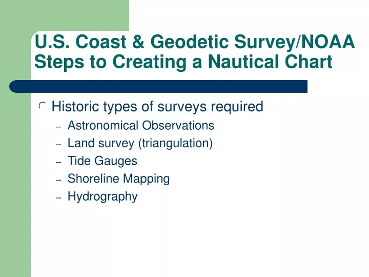
U.S. Coast & Geodetic Survey/NOAASteps to Creating a Nautical Chart • Historic types of surveys required • Astronomical Observations • Land survey (triangulation) • Tide Gauges • Shoreline Mapping • Hydrography
Theodolite instrument for precise astronomical observations to determine latitude, longitude, and azimuth Astronomical observations were necessary to determine the position and orientation of selected points in a survey network.
View through Telescope at desired star Star aligned with cross-hair
Survey Network Astromical Observations performed at this site to determine initial latitude, longitude, and azimuth.
Angle measured TRIANGULATION Angle measured = survey mark MEASURED BASELINE 1 Angle measured Angle measured MEASURED BASELINE 2 STEPS • Baselines (BL) 1 & 2 are measured • All angles of the triangles are measured • Sides of all triangles are computed • Computed length BL2 is compared to measured length of BL2
=Tide gauge TIDE GAUGES • Tide zone boundaries shown in red and orange • Within each zone tidal height and time correctors are equal • Tidal data required to correct depths and to determine horizontal position of shoreline
Plane table is set-up over known point • Paper map correctly oriented • Distant objects sighted upon and lines drawn from present position toward distant objects • Plane table moved to another location and procedure repeated • Points of intersection define position of distant objects • Shoreline is drawn through intersecting points; also range & bearing determine positions
9.1 8.8 8.5 8.3 8 7.9 7.6 7.2 7.2 Depths (soundings) are measured continuously along dotted lines. Sextant angle fixes are taken at locations indicated by green bars. 6 7.2 9.1 9.5 5.1 7 7.9 9.3 9.4 5.7 6.1 8 8.5 7 5 6.5 7.8 8 8.9 5.2 7 9 9.2 6 5.5 7.1 9.2 9.5 8
HYDROGRAPHY • Two sextant angles at periodic points along the launch’s path determine position of the launch
= tide gauge = survey mark GEODETIC SURVEY SHORELINE SURVEY TIDAL SURVEY HYDROGRAPHIC FIELD SHEET FINISHED NAUTICAL CHART