Download
1 / 40
400 likes | 424 Views
Explore the comprehensive water management plan for Gram Panchayat Kammuru, Ananthapuramu District, focusing on irrigation, infrastructure, population, and farming practices. Learn about existing resources, water deficit, and initiatives to achieve water sufficiency for sustainable development.

E N D
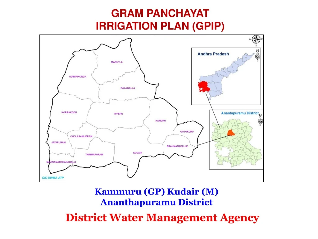
Gram panchayat irrigation plan (GPIP) Kammuru (GP) Kudair (M) Ananthapuramu District District Water Management Agency
GP Details Anganwadi Centre : 1 Primary School : 1 Panchyath building : 1 Post office : 1 Cooperative Society : 1 OHead tank : 1 RO Plant : 1 Tanks : 1 Borewells : 195 (Funct : 119 Non Fun : 76) Total Area : 1570.95 Cropped Area : 1180.55 Rainfed Area: 1081.95 Irrigated Area : 98.60 Common Land : 160.00 Grazing Land : 25.00 Uncultivable waste : 4.40 Forest : 201 Marginal & Small Farmers : 93 Big Farmers : 319 Land Less : 188 No.of HHs migrated : 2 Milch Animals : 438 Bullock : 129 Hebuffaloes : 127 Sheep : 2530 Goat : 607 Milk production : (liters) Cows : 2 ltr per animal /day Buffaloes : 3 ltr /animal /day House Holds : 600 Job cards issued : 600 Total : 1909 Male : 994 Female : 915 Literacy % (Male : Female) 54 : 40 SC : 441 ST : 07 BC : 1084 Others : 377 Farming & Live Stock details Land (Ha) Infrastructure Population KAMMURU GRAMPANCHYAT
Water Budget Water availability Water deficit 1 Water receipt KAMMURU GP 2 3
WATER Budget Rainfall receipt : Village area (Ha) = 1570.95 Average rainfall = 515 mm Annual rainfall = 1570.95 * 515 /1000 809.04 Ha-m Rainfall usage : 1. Ground water (9%) = 809.04*9/100 = 72.81 Ha-m 2. Run off (40%) = 809.04*40/100 = 323.62 Ha-m 3. Evapo transpiration (41%) = 809.04*41/100 = 331.71 Ha-m 4. Soil moisture (10%) = 809.04*10/100 = 80.90 Ha-m
Survey Methodology 1 Initial Gramasabha 2 9 Documentation Data Collection Final GramaSabha & GPIP approval 3 Team Formation 8 4 Group Discussion PRA Exercises 7 Transact Walk Identification of works 5 6
Categories of works ( Identified ) Ridge area treatment Staggered Contour Trenches Continuous Contour Trenches Barren Hill Afforestration Water Absorption Trenches Drainage Line Treatment MPT/PT, Check Dams/Check Walls identified ValleyArea Treatment Farm Ponds/Dugout Ponds Silt Application/Desilting of water bodies Repairs and restoration to existing WHS Repairs and restoration to M I tanks. Recharge pits Recharging dried up open wells/Bore wells Horticulture plantations Institution plantations
LABOR BUDGET NOTE: 10% INCREASE OF LABOUR BUDGET OVER EVERY YEAR
Format - I (Community works)
Format - I (Community works)
Format - II (Individual Beneficiary related works)