Download
1 / 56
590 likes | 1.35k Views
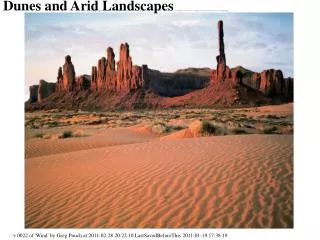
Chapter 4 Glacial and Arid Landscapes. Glaciers. Glaciers are parts of two basic cycles Hydrologic cycle Rock cycle Glacier — A thick mass of ice that originates on land from the accumulation, compaction, and recrystallization of snow. Glaciers. Types of glaciers Valley (alpine) glaciers

E N D
Glaciers • Glaciers are parts of two basic cycles • Hydrologic cycle • Rock cycle • Glacier—A thick mass of ice that originates on land from the accumulation, compaction, and recrystallization of snow
Glaciers • Types of glaciers • Valley (alpine) glaciers • Exist in mountainous areas • Flow down a valley from an accumulation center at its head • Ice sheets • Exist on a larger scale than valley glaciers • Two major ice sheets on Earth are over Greenland and Antarctica
Glaciers • Types of glaciers • Ice sheets • Often called continental ice sheets • Ice flows out in all directions from one or more snow accumulation centers • Other types of glaciers • Icecaps • Outlet glaciers • Piedmont glaciers
How Glaciers Move • Movement is referred to as flow • Two basic types • Plastic flow • Occurs within the ice • Basal slip • Entire ice mass slipping along the ground • Most glaciers are thought to move this way by this process
How Glaciers Move • Movement is referred to as flow • Zone of fracture • Occurs in the uppermost 50 meters • Tension causes crevasses to form in brittle ice • Rates of glacial movement • Average velocities vary considerably from one glacier to another
How Glaciers Move • Rates of glacial movement • Rates of up to several meters per day • Budget of a glacier • Zone of accumulation—The area where a glacier forms • Elevation of the snowline varies greatly
How Glaciers Move • Budget of a glacier • Zone of wastage—The area where there is a net loss to the glacier due to • Melting • Calving—The breaking off of large pieces of ice (icebergs where the glacier has reached the sea)
Movement of Glacial Ice • Budget of a glacier • Balance between accumulation at the upper end of the glacier, and loss at the lower end is referred to as the glacial budget • If accumulation exceeds loss (called ablation), the glacial front advances • If ablation increases and/or accumulation decreases, the ice front will retreat
Glacial Erosion • Glaciers are capable of great erosion and sediment transport • Glaciers erode the land primarily in two ways • Plucking—Lifting of rocks • Abrasion • Rocks within the ice acting like sandpaper to smooth and polish the surface below
Glacial Erosion • Glacial erosion • Glacial abrasion produces • Rock flour (pulverized rock) • Glacial striations (grooves in the bedrock)
Glacial Erosion • Landforms created by glacial erosion • Erosional features of glaciated valleys • Hanging valleys • Cirques • U-shaped valleys • Fiords • Arêtes • Horns
Glacial Deposits • Glacial drift—Refers to all sediments of glacial origin • Types of glacial drift • Till—Material that is deposited directly by the ice • Stratified drift—Sediments laid down by glacial meltwater
Glacial Till Is Typically Unstratified and Unsorted Figure 4.10
Glacial Deposits • Landforms made of till • Moraines • Layers or ridges of till • Moraines produced by alpine glaciers • Lateral moraine • Medial moraine
Glacial Deposits • Landforms made of till • Other types of moraines • Endmoraine—Terminal or recessional • Ground moraine
Glacial Depositional Features Figure 4.14
Glacial Deposits • Landforms made of till • Drumlins • Smooth, elongated, parallel hills • Steep side faces the direction from which the ice advanced • Occur in clusters called drumlin fields
Glacial Deposits • Landforms made of stratified drift • Outwash plains (with ice sheets) and valley trains (when in a valley) • Broad ramp-like surface composed of stratified drift deposited by meltwater leaving a glacier • Located adjacent to the downstream edge of most end moraines • Often pockmarked with depressions called kettles
Glacial Deposits • Landforms made of stratified drift • Ice-contact deposits • Deposited by meltwater flowing over, within, and at the base of motionless ice • Features include • Kames • Eskers
Glaciers of the Past • Ice Age • Ice covered 30% of Earth’s land area • Ice age began between 2–3 million years ago • Most of the major glacial episodes occurred during a division of geologic time called the Pleistocene epoch
Maximum Extent of Ice During the Ice Age Figure 4.15
Glaciers of the Past • Indirect effects of Ice Age glaciers • Forces migration of animals and plants • Changes in stream courses • Rebounding upward of the crust in former centers of ice accumulation • Worldwide change in sea level • Climatic changes
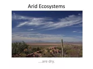
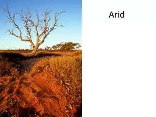
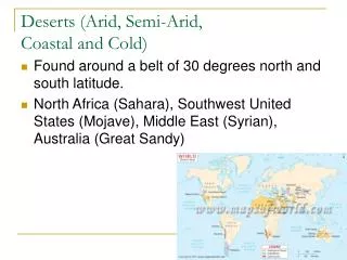
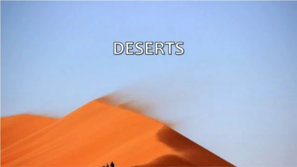
Deserts • Dry regions cover 30 percent of Earth’s land surface • Distribution and causes of dry lands • Two climatic types are commonly recognized • Desert or arid • Steppeor semiarid
Desert and Steppe Regions of the World Figure 4.19
Deserts • Dry lands are concentrated in two regions • Subtropics • Low-latitude deserts • Areas of high pressure and sinking air that is compressed and warmed
Deserts • Dry lands are concentrated in two regions • Middle-latitudes • Located in the deep interiors of continents • High mountains in the path of the prevailing winds produce a rainshadow desert
Rainshadow Desert Figure 4.21
Deserts • Role of water in arid climates • Most streambeds are dry most of the time • Desert streams are said to be ephemeral • Carry water only during periods of rainfall • Different names are used for desert streams in various region • Wash and arroyo (western United States) • Wadi (Arabia and North Africa)
Deserts • Role of water in arid climates • Ephemeral streams • Different names are used for desert streams in various regions • Donga(South America) • Nullah (India) • Desert rainfall • Rain often occurs as heavy showers
Deserts • Role of water in arid climates • Desert rainfall • Because desert vegetative cover is sparse, runoff is largely unhindered and flash floods are common • Poorly integrated drainage systems and streams lack an extensive system of tributaries • Most of the erosion work in a desert is done by running water
A Dry Channel Contains Water Only Following Heavy Rain Figure 4.22
Basin and Range: Evolution of a Desert Landscape • Characterized by interior drainage • Landscape evolution in the Basin and Range region • Uplift of mountains—Block faulting • Interior drainage into basins produces • Alluvial fans • Bajadas • Playas andplaya lakes
Basin and Range: Evolution of a Desert Landscape • Landscape evolution in the Basin and Range region • Ongoing erosion of the mountain mass • Produces sediment that fills the basin • Diminishes local relief • Produce isolated erosional remnants called inselbergs
Wind Erosion • Transportation of sediment by wind • Differs from that of running water in two ways • Wind is less capable of picking up and transporting coarse materials • Wind is not confined to channels and can spread sediment over large areas
Wind Erosion • Transportation of sediment by wind • Mechanisms of transport • Bedload • Saltation—skipping and bouncing along the surface • Particles larger than sand are usually not transported by wind • Suspended load