Download

1 / 40
400 likes | 409 Views
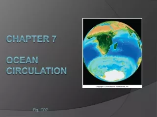
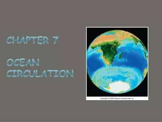
CHAPTER 7 Ocean Circulation Dr. C. Dong, ECC. Ocean currents. Moving seawater Surface ocean currents Transfer heat from warmer to cooler areas Similar to pattern of major wind belts Affect coastal climates Deep ocean currents Provide oxygen to deep sea Affect marine life.

E N D
Ocean currents • Moving seawater • Surface ocean currents • Transfer heat from warmer to cooler areas • Similar to pattern of major wind belts • Affect coastal climates • Deep ocean currents • Provide oxygen to deep sea • Affect marine life
Types of ocean currents • Surface currents • Wind-driven • Primarily horizontal motion • Deep currents • Driven by differences in density caused by differences in temperature and salinity • Vertical and horizontal motions
Measuring surface currents • Direct methods • Float meters • Intentional • Inadvertent • Propeller meters • Indirect methods • Pressure gradients • Satellites • High Frequency Radar Figure 7B
Measure Vertical Profile of Oceanic Current (1) ADCP: Acoustic Doppler Current Profiler ADCP measures the velocity of water using a physical principle called the Doppler shift. This states that if a source of sound is moving relative to the receiver, the frequency of the sound at the receiver is shifted from the transmit frequency.
Measuring deep currents • Floating devices tracked through time • Chemical tracers • Tritium • Chlorofluorocarbons • Characteristic temperature and salinity
Surface currents • Frictional drag between wind and ocean • Wind plus other factors such as • Distribution of continents • Gravity • Friction • Coriolis effect cause • Gyres or large circular loops of moving water
Ocean gyres • Subtropical gyres • Centered about 30o N or S • Equatorial current • Western Boundary currents • Northern or Southern Boundary currents • Eastern Boundary currents Fig. 7.4
Other surface currents • Equatorial countercurrents • Subpolar gyres Fig. 7.5
Exe. 08-01 • List the methods to measure surface oceanic currents and vertical profiles of currents • Draw general circulation gyres in Pacific Ocean
Ekman transport • Average movement of seawater under influence of wind • 90o to right of wind in Northern hemisphere • 90o to left of wind in Southern hemisphere Fig. 7.7
Western intensification • Western boundary currents intensified • Faster • Narrower • Deeper • Warm Due to the increase in the Coriolis Effect with latitudes
Eastern Boundary Currents • Eastern side of ocean basins • Tend to have the opposite properties of Western Currents • Cold • Slow • Shallow • Wide
Ocean currents and climate • Warm ocean currents warm air at coast • Warm, humid air • Humid climate on adjoining landmass • Cool ocean currents cool air at coast • Cool, dry air • Dry climate on adjoining landmass
Ocean currents and climate Fig. 7.9
Coastal upwelling and downwelling • Ekman transport moves surface seawater onshore (downwelling) or • Offshore (upwelling) Fig. 7.12a
Exe. 08-02 Three concepts: 1. Ekman Transport 2. Western Intensification: Western Boundary Current 3. Coastal Upwelling/downwelling
Atlantic Ocean circulation • North Atlantic Subtropical Gyre • North Equatorial Current • Gulf Stream • North Atlantic Current • Canary Current • South Equatorial Current • Atlantic Equatorial Counter Current
Atlantic Ocean circulation • South Atlantic Subtropical Gyre • Brazil Current • Antarctic Circumpolar Current • Benguela Current • South Equatorial Current Fig. 7.14
Exe 08-03 Circulation pattern in Atlantic Ocean, especially northern Atlantic Ocean
Pacific Ocean circulation • North Pacific subtropical gyre • Kuroshio • North Pacific Current • California Current • North Equatorial Current • Alaskan Current Fig. 7.18
Pacific Ocean circulation • South Pacific subtropical gyre • East Australian Current • Antarctic Circumpolar Current • Peru Current • South Equatorial Current • Equatorial Counter Current
Storms hit Southern California, in Jan., 2010 Question: What causes the series of abnormal storms in the area in some years?
Ocean gyres • Subtropical gyres • Centered about 30o N or S • Equatorial current • Western Boundary currents • Northern or Southern Boundary currents • Eastern Boundary currents Fig. 7.4
Normal conditions Fig. 7.20a
Abnormal Condition : El Niño-Southern Oscillation (ENSO): Warm (El Niño) and cold phases (La Niña) El Nino (warm) Decreased pressure difference across Equatorial Pacific Weaker trade winds Warm pool migrates eastward Thermocline deeper, water temperature warmer, more storms, flooding…. Lower biological productivity, less food fish…. (El Niño)
El Niño-Southern Oscillation (ENSO): Warm phase (El Niño) Fig. 7.20b
El Niño-Southern Oscillation (ENSO): cool phase (La Niña) Increased pressure difference across equatorial Pacific Stronger trade winds Stronger upwelling in eastern Pacific, Shallower thermocline, Cooler than normal seawater, Higher biological productivity (La Niña)
El Niño-Southern Oscillation (ENSO)Cool phase (La Niña) Fig. 7.20c
ENSO events • El Niño warm phase about every 2 to 10 years • Highly irregular • Phases usually last 12 to 18 months Fig. 7.22
ENSO events • Strong conditions influence global weather, e.g., 1982-1983 El Niño • Flooding, drought, erosion, fires, tropical storms, harmful effects on marine life Fig. 7.21
Exe. 08-04 1. Under what condition will El Niño take place? What are potential impacts of El Niño? 2. Under what condition will La Niño take place? What are potential impacts of La Niño?
Thermohaline circulation • Below the pycnocline • 90% of all ocean water • Slow velocity • Movement caused by differences in density (temperature and salinity) • Cooler seawater denser • Saltier seawater denser
Thermohaline circulation Fig. 7.26
Conveyor-belt circulation • Combination deep ocean currents and surface currents Fig. 7.27
Deep ocean currents • Cold, oxygen-rich surface water to deep ocean • Dissolved O2 important for life and mineral processes • Changes in thermohaline circulation can cause global climate change • Example, warmer surface waters less dense, not sink, less oxygen deep ocean
Exe. 08-05 What is thermohaline circulation? What is the difference between thermohaline circulation and surface circulation?