Download
1 / 18
180 likes | 299 Views
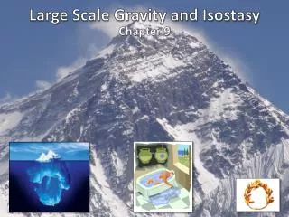
Gravity in the Fernley & Hazen Flat Areas. Geol 492/692 Spring 2005. Melissa Edwards, Harmony Farnsworth, and Rich Redd. Locations—Fernley. Locations—Hazen. Methods—Gravimeter. Used a LaCoste & Romberg Model G Gravimeter to measure gravity at each location

E N D
Gravity in the Fernley & Hazen Flat Areas Geol 492/692 Spring 2005 Melissa Edwards, Harmony Farnsworth, and Rich Redd
Methods—Gravimeter • Used a LaCoste & Romberg Model G Gravimeter to measure gravity at each location • Before each trip to the field a base station measurement was taken at UNR outside of SEM (Base 1) • At both the Fernley and Hazen sites a base station was established and a gravity measurement was taken the morning, afternoon, and the evening of each trip (Base 2 & Base 3) • The base station gravity measurements were all within 0.5 mGals of each other, indicating the gravimeter was working correctly • A calibration correction for the reading for the gravimeter was made using one of the following formulas (depending on what the gravity reading was): • For 3100 reading: ((Gravimeter reading-3100)*1.02258)+3170.62 • For 3200 reading: ((Gravimeter reading-3200)*1.0226)+3272.88
Methods—Trimble • Used a Trimble XT GPS to measure elevation and lat/long at every location • Instrument was placed 10 ft or less away from the spot where a gravity reading was taken, but at the same elevation level • Instrument was allowed to collect GPS points for 10 minutes or 120 points, which ever came first • Data • Downloaded using GPS Pathfinder Office 3.0 • Used the Reno airport as the reference for corrections to all the GPS data collected from the Trimble since it had data for all the days we recorded. • Horizontal error at least 6 cm. • 68% confident elevation is within 2 meters • Amounts to a 0.3 to 0.6 mGal error in the Bouguer calculations
Methods—Terrain Corrections • Estimations were made of the elevation difference b/w the place where the gravity reading was taken and the surrounding topography • For zone B (6.56’-54.6’), 4 directions • For zone C (54.6’-175’), 6 directions • With these values a chart was used to find the dgr values for each direction & all of these values were added to obtain the total terrain correction value
Methods—Bouguer Correction • Bouguer anomaly value calculations were made using the gravity readings from the gravimeter, the terrain corrections, the elevation/lat/long data downloaded from the Trimble, and the following formulas: • Free Air Correction = 0.3086 * elevation • Bouguer Correction = 0.0419*density (used 2.67) * elevation • Theoretical Gravity = 978.03185* (1 + (0.0053024 * sin2 (latitude)) – (0.0000058 * sin2 (2 * latitude)) • Bouguer Anomaly = (Observed Gravity + Free Air Correction – Bouguer Correction) – Theoretical Gravity
Methods & Results—Fernley Line 1 • Gravimeter points were spaced 100 meters apart • Points S1-S19 were surveyed (plus Base 1 & Base 2)
Methods & Results—Fernley Line 2 • Gravimeter points spaced 100 meters apart • Points S201-S221 were surveyed (plus Base 1 & Base 2) • Poor satellite coverage for S204 & S205 with the Trimble
Methods & Results—Hazen • Gravimeter points were spaced 100 meters apart • S128 was spaced 150 meters form S127 • S131 was spaced 330 meters from S130 • Points S100-S131 were surveyed • Poor satellite coverage for S121 & S122 with the Trimble
Modeling—Bouguer Slab Depths • Where Δg= The computed Ganom value from grav2d • Δρ= -.35 • The 0.0419 value is a constant Bouguer Slab Equation (Telford et. Al.1990)
Fernley 1 Blue lines indicate regional stresses. Red lines indicate shearing within the flower structure