Download
1 / 59
590 likes | 790 Views
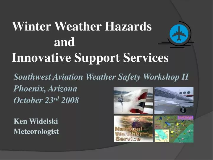
Winter Weather Hazards and Innovative Support Services. Southwest Aviation Weather Safety Workshop II Phoenix, Arizona October 23 rd 2008 Ken Widelski Meteorologist. Presentation Agenda. A few notes on icing accidents Icing hazards - Warm front

E N D
Winter Weather Hazards andInnovative Support Services Southwest Aviation Weather Safety Workshop II Phoenix, Arizona October 23rd 2008 Ken Widelski Meteorologist
Presentation Agenda • A few notes on icing accidents • Icing hazards -Warm front -Cold front • Instructional Sounding analysis • Wintry Precipitation Types • Tools and Innovative services • The graphical age • Questions
Interesting Icing StatsNWA Winter Weather and Flying: Terry Lankford-retired FAA controller • Icing affects aircraft in three ways: flight and engine instruments induction systems structurally. • An erroneous assumption is that icing only affects the IFR pilot.
Icing affects the VFR pilot as well as the IFR pilot. • Based on total numbers, VFR pilots are involved in more icing related accidents than IFR pilots.
Structural icing accidents accounted for only about 40% of total accidents involving icing. • The majority of icing accidents are attributed to carburetor or induction system icing, with less than 10% involving icy runways.
Icing hazard-Warm Front • Warm air gently slopes over cooler surface air (Veer).
Warm Front Hazards.Reference, Geoff Butler Flight School. • Warm air rising above the freezing level aiding in precipitation. • Rain falls through the freezing layer and freezes as super cooled water droplets. • Water droplets stick to the aircraft on contact.
What to do if caught in this situation? Options: • Climb above the freezing level. • Turn around and go back, underneath the cloud. • It is therefore important before flying to gain situational awareness by assessing pre-flight tools. • The ice can cause loss of lift.
Cold Front Characteristics • Some fronts can be slow moving. • Mild conditions ahead of the boundary with cold dense air directly behind the fro-pa. • Can lead to dense stratus, sub freezing temperatures, and in some cases frozen precipitation.
Some cold front passages can be very quick and produce rapid drying. However…a rapid moving front can also provide another aviation hazard… Strong winds and low level wind shear…
Basic Sounding Analysis • An incredibly helpful tool if you know how to use them. • Identify smooth air, wind shear, atmospheric stability • Icing hazards
http://www.rap.ucar.edu/weather/upper/ama.gif Radiosonde soundings Available twice daily At 00 Z and 12 Z Look for temperature inversions aloft – Stable air is typically smooth Temp Dewpoint Watch for horizontal wind shear - note speed AND direction
is the theoretical maximum amount of water vapor that air at a specific temperature and pressure can hold The maximum water vapor concentration in the atmosphere for a given air temperature. The higher the air temperature, the higher the saturation mixing ratio. Author: Larry D. Carey
Wintry Precipitation Types • Freezing rain • Freezing drizzle. • Sleet • Snow
Main question asked… How do you know which precipitation type will fall?
Sleet Cold air below warm nose deep enough to refreeze into ice pellet Warm nose
Another thing to remember about soundings… • Be sure to check weather conditions all across your flight path. • Checking one sounding will only provide conditions in the vicinity of that area and may not be uniform across the full flight path.
In addition to p-type • Soundings can help show inversions • Mixing heights • Diurnal mixing expectancies
Daytime heating leads to mixing of higher momentum air aloft down to the surface. Especially if mixing heights are deep. Temperature Inversion Thermal Turbulence
Tools and Innovative Services • Technological advancements over the years have led to a wide variety of briefing tools for pilots. • Individual briefing methods can be established well before a go-no go decision is made.
NWS: Aviation Weather Centerhttp://adds.aviationweather.gov/tafs/
Purpose for the Aviation AFDAirline Perspective • Briefly identify weather impacts which may affect the operations of an airport terminal. • Provide a reasoning behind the TAF in a non technical manner. • **Describe TAF uncertainties or items left out of the TAF but still possible**
Low clouds and fog KLBB 202325Z 210024 15010KT P6SM SKC FM0500 12007KT P6SM SKC FM0800 15005KT 5SM BR SKC FM1000 VRB03KT 2SM FEW010 FM1200 18010KT P6SM SKC • Discussion Moist soil conditions from recent rainfall combined with clear skies and light winds will produce an environment favorable for areas of radiation fog. Areas on the Caprock have the best potential for strong radiational cooling. There is a moderate to high confidence that VSBY will meet MVFR criteria with a lower confidence for IFR conditions. The fog event will be short lived as mixing of drier air develops around sunrise.
VFR TAF with uncertainties KLBB 202325Z 210024 05010KT P6SM SKC FM0500 12007KT P6SM SKC FM1200 18010KT P6SM SKC FM1700 21015G25KT P6SM FEW250 Discussion Low level moisture is expected to slowly increase tonight. Stratus is expected to develop across the Permian Basin and Concho Valley by 06z and slowly expand northward toward the South Plains region before sunrise. Right now…it appears that the bulk of the low cloud development is expected to remain just south of KLBB and a VFR TAF will be maintained for this issuance. There is still a possibility for SCT MVFR CIGS at KLBB and we will re-evaluate the potential for the 06z TAF.
TAFS are what is used for operational airline planning decisions. • The Aviation AFD is a communication mechanism that can benefit both the forecaster and the dispatcher if used correctly. (Liaison)
MOS: Model Output Statistichttp://www.nws.noaa.gov/mdl/synop/products.shtml
The Graphical Age • Many NWS offices are developing “Graphicast’s”. • “Graphicast’s” can provide a lot of detail without the use of technical jargon. • Can give the user a picture of expected weather conditions for a specific area.
For Example… • Standard Area Forecast Discussion looks like this… .DISCUSSION... LOW CLOUDS CONTINUE TO CLEAR FROM NORTH TO SOUTH THIS MORNING. CLOUDS SHOULD HOLD ON OVER SOUTHERN AND SOUTHEASTERN ZONES THROUGH MUCH OF THE MORNING AND SKY GRIDS WERE EDITED TO REFLECT THIS. OTHERWISE...GUIDANCE VALUES WERE FOLLOWED CLOSELY FOR THIS FORECAST. CONTINUED COLD ADVECTION TODAY PROGGED TO HOLD HIGH TEMPS DOWN IN THE UPPER 60S/LOW 70S DESPITE FULL SUNSHINE OVER MOST OF THE CWA. FRI MORNING EXPECT FROST IN A FEW LOW-LYING OR SHELTERED AREAS THAT CAN MANAGE TO DROP INTO THE 30S...BUT THESE AREAS SHOULD BE ISOLATED. WILL TOUCH UP THE SPS ISSUED ON THE DAY SHIFT YESTERDAY. ONCE A UPPER LEVEL SHORT WAVE MOVES THROUGH THE AREA FRI A RIDGE FOLLOWS BEHIND...WITH WARM AND DRY CONDITIONS EXPECTED THIS WEEKEND. FAIRLY GUSTY SOUTHERLY WINDS SHOULD DEVELOP BY SUN IN ADVANCE OF A COLD FRONT ON MONDAY. LITTLE CHANCE OF PRECIP WITH THIS FRONT...BUT EXPECT COOLER TEMPS NORTHERN ZONES. WINDS COME BACK AROUND TO THE SOUTH ON TUE IN ADVANCE OF THE NEXT UPPER LEVELTROUGH. OPERATIONAL GFS/ECMWF BOTH INDICATE A HIGH AMPLITUDETROUGH BRINGING A FAIRLY STRONG COLD FRONT SOUTHWARD ON WED. SLIGHT CHANCE/CHANCE POPS ARE IN THE FORECAST FOR TUE NIGHT/WED. NOT MUCH CONFIDENCE YET THOUGH AS SPREAD AMONG NCEPENSEMBLE MEMBERS IS LARGE.