Download
1 / 22
230 likes | 466 Views
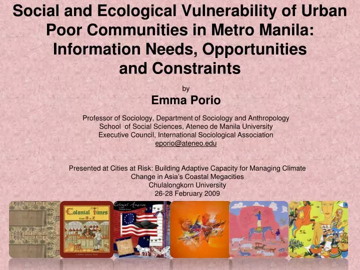
Social and Ecological Vulnerability of Urban Poor Communities in Metro Manila: Information Needs, Opportunities and Constraints. by Emma Porio Professor of Sociology, Department of Sociology and Anthropology School of Social Sciences, Ateneo de Manila University

E N D
Social and Ecological Vulnerability of Urban Poor Communities in Metro Manila: Information Needs, Opportunities and Constraints by Emma Porio Professor of Sociology, Department of Sociology and Anthropology School of Social Sciences, Ateneo de Manila University Executive Council, International Sociological Association eporio@ateneo.edu Presented at Cities at Risk: Building Adaptive Capacity for Managing Climate Change in Asia’s Coastal Megacities Chulalongkorn University 26-28 February 2009
Number of Informal Settlers in Metro Manila by City and Municipality, 2002 Poverty in Metro Manila
Poverty and Flood-prone areas in Metro Manila
Poverty and Climate-related Risksin Metro Manila Slum community next to a major river in Pasay City. Slum community next to a railroad track in Manila City.
Existing Data/Information Base: Response to the Needs of Vulnerable Population • Metro Manila:Heterogeneity,Specificity,Vulnerability Available data base, perceived needs, opportunities vary, one city to the other, within one city, barangay, vulnerable group: • Ecological, social-political-economic vulnerability: e.g.,Taguig, migrant Muslim community vs. old-time residents • GIS, Pag-Asa, Phivocs, National Disaster Coordinating Council, Civilian Defense System or Civilian Relations Service (CRS) • Metropolitan Gov’t/Local Government Units: Decentralization and Information Bases
The Most Vulnerable Populations in Metro Manila • Live in low-lying or swampy/wetlands, informal settlements • Low-income and/or no stable sources of income (less than US$ 1/day); high number of dependents • Majority (about 80 percent) have no security of tenure • About 75 percent have no adequate access to basic services (potable water, electricity, sanitation facilities get flooded, etc.) • About 75 percent regularly suffer income/job loss, sickness, and schooling of children as a result of floods/typhoons • About 75 percent suffer loss of HH appliances, garments or need house repair due to typhoons/floods • Single-headed/female-headed households (singles, widows, widowers and old)
Existing Data/Information Base: Response to the Needs of Vulnerable Population • Administrative Boundaries (LGU/MMDA) vs. Ecological Boundaries and Information Bases • LGU:Marikina, disaster mitigation program vs. other cities in the Kamanava area, e.g., Navotas officials in collaboration with urban poor affected by sea level rise (SLR), storms, floods. • Municipal data base system: List of barangays (or puroks/HHs) that are frequently flooded/evacuated during floods • List of schools and other buildings as evacuation centers • Barangay officials, teachers, tanods and their contact numbers in case of floods/typhoons and inventory of available resources • A Barangay-Level Disaster Mitigation Task Force
Constraints/Opportunities • Main issue: Access and Utilization of data (both formal data base system and insider knowledge system) for decision-making by the different stakeholders: - Analysis/Understanding vs. Policy, Programs for Disaster Mitigation, Adaptation, Resilience • Information data base/early warning devise system , e.g. water-gauge & siren/alarm system in Tumana, Marikina. • Barangays: no early warning device—the monitoring of water levels or flood levels by those in situ and communicating these to the appropriate disaster response system/officials. • Need to connect: Decision-makers (e.g., local/school officials) with information/resources to vulnerable populations who need/use it. Most decision-makers live in gated communities or areas that do not get flooded, so they cannot tell whether the residents in creeks and danger areas should be evacuated or not. • Barangay and local/national officials with the task force handling disaster-related activities like evacuation, food distribution, and medical services • Vulnerable Populations: Communicating information more efficiently/effectively to vulnerable populations in danger zones.
Constraints/Opportunities • Adaptation/Resilience: Flood Water-Based Lifestyle and Information Systems • Adaptation: Architecture/building/housing designs • Water-based transport systems (Styrofoam boats and bancas at HH level; pedi-cab; bombastic or water diversion for LGUs) • Household/Barangay organization adaptation for evacuation (plastic for wrapping garments, boots, raincoats, etc.) • Drainage/sanitation adjustments • Maximizing and Linking Insider Knowledge of Vulnerable Populations (from lunar calendar and experience) and the Formal Knowledge (GIS, Information Warning Systems) • Updated and linked information system: HH-based/neighborhood based information linked to LGU information system (e.g. residential, commercial development that fill up/obstruct natural waterways, etc.) • Linking ground-based information with those from ABOVE!!!
Information Needs:For Whom? For What? When? • Analysis/Understanding Policy, Planning, Implementation/Action • Variable/uneven data bases in different institutions, e.g. GIS mainly used by local gov’ts for tax mapping purposes • Access/utilization of vulnerability, hazard maps (e.g, suppress for fear of panic) • Disconnect between data base and potential users/non-users(MMDA,LGUs)
Information Needs, Available Data: For Whom?What? Available, Accessible, Consumable by the appropriate stakeholder (researcher, planner, decision-makers at national/local level, etc.) Need to connect data bases from the ground or from above to the level of decision-making/action
Threats to Sustainability:Climate Change and Disaster-Related Risks
Threats to Sustainability:Climate Change and Disaster-Related Risks