Download
1 / 12
150 likes | 955 Views
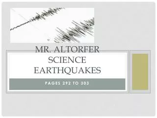
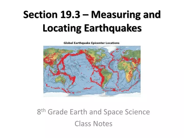
Section 19.3 – Measuring and Locating Earthquakes. 8 th Grade Earth and Space Science Class Notes. Earthquake Magnitude and Intensity. Richter scale – measures the magnitude (energy) of an earthquake. Determined by the amplitude (height) of the seismic wave

E N D
Section 19.3 – Measuring and Locating Earthquakes 8th Grade Earth and Space Science Class Notes
Earthquake Magnitude and Intensity • Richter scale – measures the magnitude (energy) of an earthquake. • Determined by the amplitude (height) of the seismic wave • Each number on the Richter scale corresponds to an amplitude increase of 10x • Each increase in magnitude corresponds to a 32x increase in energy
Earthquake Magnitude and Intensity • Moment magnitude – measures the energy released by an earthquake, taking into account the size of the fault rupture, the amount of movement along the fault, and the rocks’ stiffness • Used most often by seismologists • This is what is often reported by news outlets
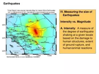
Earthquake Magnitude and Intensity • Modified Mercalli– measures the intensity of the earthquake by the type and amount of damage it causes
Earthquake Intensity • The intensity of an earthquake depends primarily on the amplitude of the surface waves generated. • Intensity is highest closest to the epicenter and decreases as you travel further from the epicenter.
Depth of Focus • Earthquakes are classified as shallow, intermediate, or deep, depending on the location of the focus. • Shallow-focus earthquakes are the most damaging.
Locating an Earthquake • An earthquake’s epicenter’s location, as well as the time of occurrence, can be determined using seismograms and travel-time curves.
Locating an Earthquake – Distance to an Earthquake • The distance to an earthquake’s epicenter can be determined by measuring the separation on any seismogram and identifying that same separation time on the travel-time graph.
Locating an Earthquake – Distance to an Earthquake • Scientists identify the seismic stations on a map, and draw a circle with the radius of distance to the epicenter from each station. • The point where all the circles intersect is the epicenter.
Locating an Earthquake – Time of an Earthquake • Seismologists can use a seismogram to gain information about the exact time that an earthquake occurred at the focus. • The time can be determined by using a table similar to a travel-time graph.
Seismic Belts • The majority of the world’s earthquakes occur along narrow seismic belts that separate large regions with little or no seismic activity. • The locations of most earthquakes correspond closely with tectonic plate boundaries.